Download
1 / 33
340 likes | 522 Views
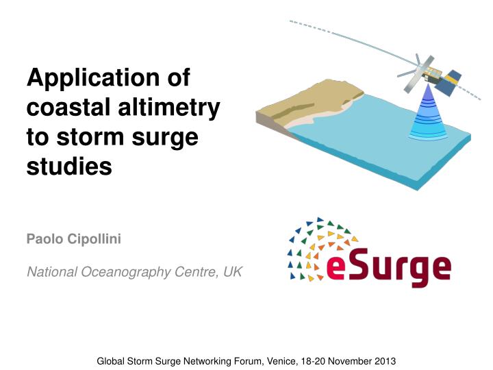
Application of coastal altimetry to storm surge studies. Paolo Cipollini National Oceanography Centre, UK. Global Storm Surge Networking Forum, Venice, 18-20 November 2013. Satellite Altimetry. N ine missions since early 90s, huge success measures sea surface height (precision ~ few cm)

E N D
Application of coastal altimetry to storm surge studies Paolo Cipollini National Oceanography Centre, UK Global Storm Surge Networking Forum, Venice, 18-20 November 2013
Satellite Altimetry Nine missions since early 90s, huge success • measures sea surface height (precision ~ few cm) • synoptic, sustained view of surface ocean dynamics (currents, eddies, planetary waves) • accurate, long-term global and regional sea level monitoring • measures wave field (precision ~10s of cm) • measures wind
SEA LEVEL RISE - global Remko Scharroo, Altimetrics LLC
SEA LEVEL TRENDS - regional Sea Level component on dedicated ESA programme, the “Climate Change Initiative”
Why do coastal altimetry? - 1 corrupted waveform 20+ years of data in the coastal strip can be recovered! We believe that most of those coastal data can be recovered! (and users are actually asking for them!) Traditionally, data in the coastal zone arenot used: problems with wavefoms problems with some corrections (coastal zone: in practice, any place where standard altimetry gets into trouble as radar waveforms are non-standard and/or corrections become inaccurate)
Why do coastal altimetry? - 2 • coastal dynamics • coastal management • link oceanic sea level to tide gauges • coastal wave field • global dataset, 20+years of data • new missions (SAR altimeter, Ka-band altimeter) have good coastal capabilities • better measurements at the coast are a requiremen of any future mission • storm surges now emerging as crucial application
For instance - can we recover these measurements? We believe so, with dedicated reprocessing and corrections.
How we recover more data 0-10 km 0-50 km • Specialized retracking • Use new waveform models, accounting for change of shape in coastal environment • Use specialized retracking techniques (for instance retrack groups of adjacent waveforms in one go) • Improved Corrections • Most crucial is the correction of path delay due to water vapour (“wet tropospheric” correction) • Some applications (NOT storm surges!) require correction of tidal and high-frequency signals, which are also difficult to model in the coastal zone • Both validation and applications require exploitation of coastal models & in situ measurements
“Retracking” of the waveforms = fitting the waveforms with a waveform model, therefore estimating the parameters Maximum amplitude: related to wind speed “Epoch”: gives range (therefore height) Slope of leading edge: related to significant wave height Figure from J Gomez-Enri et al. (2009)
Retracking – Coastal waveforms • waveforms in coastal zone and island passes have been extensively studied • we often see disturbances in the ‘tail ‘ of the waveform • Our suggested workaround: a retracker that only fits the ‘good’ portion of the waveform (the leading edge), neglects the rest • “OceanCS” retracker by Lee et al 2012, further developed at NOC by Passaro et al., 2013 ALES retracker This recovers more data over open ocean too!
Retracking – an example M. Passaro, NOC Jason-2 Example Jason-2 pass 096 over the coast of South Africa and example of coastalwaveformfor cycle 83 and its retracking with various models: BGP (Halimi et al., 2013), Brown (1977), OceanCS (Yang et al., 2012), ALES (Passaro et al., 2013)
With specialized retrackers we get much closer to the coast! Envisat example, 20 cycles of pass 0543 over Northern Adriatic proxy for noise proxy for noise Venice SSH SWH /ALES /ALES QUALITY HIGH RATE DATA UP TO 2.5 KM ! IMPROVEMENT IN COASTAL SWH RETRIEVAL PRECISION! New ALES retracker now implemented in NOC’s eSurge coastal altimetry processor see next talk Note: works well everywhere, not just at the coast!
The role of altimetry • Key quantity: Total Water Level Envelope (TWLE) • That’s the level you get – inclusive of tide, pressure, HF atmospheric effects, wave setup, etc… • altimetry measures TWLE • coastal altimetry extends TWLE measurements to the coastal strip, i.e. where they are most relevant to storm surge research, applications and services • The wave field in the coastal strip is also relevant • helps development of more realistic wave models • Of course there is a sampling issue – but altimetry is still useful, in combination with Tide Gauges, to ascertain the modes of variability of the coastal ocean • Let’s see some data!
Han 2011 – Hurricane Igor Jason-2: before, during, after Coast
eSurge AOI-120: Gulf of Mexico 28/29 Aug 2012 Hurricane Isaac
Jason-2 p026 28Aug 5 UTC Jason-1 p168 28Aug 5 UTC 5 3 ` 4 2 1
1 – Old Port Tampa 2 – Cedar Key 3 – Panama City 4 – Apalachicola 5 – Pensacola Predicted tide Observed WL Obs–Pred J1/J2
Isaac: Jason-1/-2 TWLE (RADS) Jason-1 Jason-2 How best to use these observations? validation in hindcasts? assimilation in forecasts? How best to use the fine-scale information at the coast? Coast Coast
Cryosat-2 p0660 29Aug 04:34 UTC Jason-2 p026 28Aug 5 UTC Jason-1 p168 28Aug 5 UTC 5 3 ` 4 Cryosat-2 p0703 30Aug 16:24 UTC 2 1 Cryosat-2 p0645 28Aug 16:27 UTC
1 – Old Port Tampa 2 – Cedar Key 3 – Panama City 4 – Apalachicola 5 – Pensacola C2 Predicted tide Observed WL Obs–Pred J1/J2
Cryosat LRM TWLE (from RADS) 0.7 m Note: not reprocessed with coastal altimetry techniques as yet!
Cryosat LRM TWLE (from RADS) 0.4 m Note: not reprocessed with coastal altimetry techniques as yet!
Cryosat LRM TWLE (from RADS) 0.55 m Note: not reprocessed with coastal altimetry techniques as yet!
Sandy 29 Oct 2012 Lillibridge et al - Hurricane Sandy storm surge HY-2A only altimeter to capture surge < 12 hr duration Measured Tides Montauk Predicted Tides HY-2A Surge: Measured - Predicted Hurricane Sandy storm surge flooding the World Trade Center construction site
Cryosat in SAR mode over Indian coast SAR mode: increased accuracy and along-track resolution In acquisition Mask 3.4 Since Oct 1, 2012 highly vulnerable coastline, surges are one of the deadliest phenomena in the area satellites can provide much needed information to improve the modelling+forecasting
How to use the altimetric data • Blended with Tide Gauges : most naturally used for assimilation into models, hindcasts/forecasts • Single altimetric profiles: • verification • Ensemble pruning • NRT: • challenging! (error on NRT orbit) • there may be cases where the relative height profile is still useful in an assimilation exercise (Example: Adriatic, to get the seiche phase right) • remains useful for verification in real time • is being pioneered over Indian Coast and North Sea in eSurge Live, from Summer 2013
Blending Altimetry with Tide Gauges TG2 TG1 Technique developed by DMI combine (‘blend’) long time series of altimeter(delayed) and TG to extract modes of variability along altimeter track then use Real-Time TG data to estimate ‘blended’ Real-Time level along altimeter track see Jacob Høyer’s talk
Conclusions • Storm surges natural application for coastal altimetry • in synergy with in situ measurements an model • ESA supporting further development of processor via eSurge • Specialized retrackers improve TWLE retrieval near coast SAR Altimetry (Cryosat-2) also very promising • Data need to be exploited in synergy with in situ & models to make up for inadequate sampling