1 / 22
220 likes | 261 Views
This Presentation explains the basics of petroleum production and exploration, also with its by products obtained by various separation process. Modern exploration method is also given.

E N D
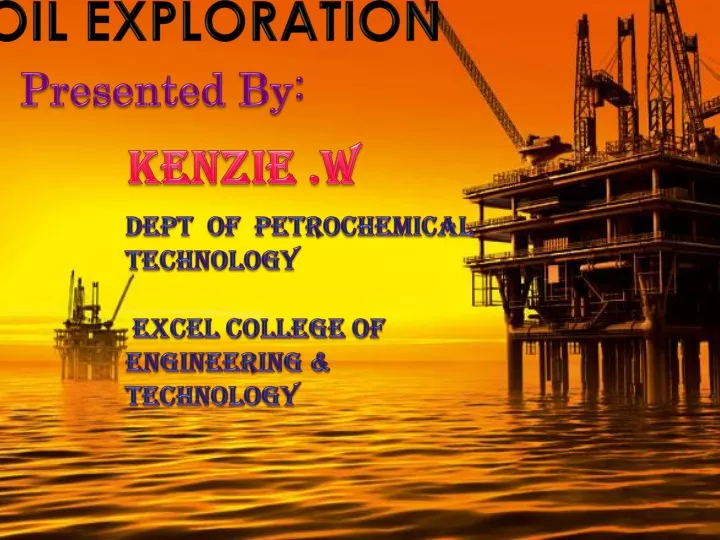
OIL EXPLORATION OIL EXPLORATION Presented By: Dept of petrochemical technology Excel College of Engineering & Technology Kenzie .W
CONTENTS: • Introduction: *Origin and formation of crude *Composition and types of crude *Petroleum and its products *Oil formations and conditions
CONTENTS: • Exploration techniques: *Geological methods *Geophysical methods *Geochemical methods • Modern method • Conclusion
Exploration: *The practice of locating or identifying the area of available sources of natural gas and petroleum is called exploration. *Hydrocarbon explorationis the search by petroleumgeologists and geophysicists for deposits of hydrocarbons, particularly petroleumand natural gas, in the Earth using petroleum geology.
Origin of oil: • Petroleum etymologically means rock oil. It is a natural organic compound mainly composed of HC occurs either in gaseous or liquid state. The liquid part obtained after the removal of dissolved gases commonly referred as crude oil. • Many theories have suggested to explain the origin and formation of petroleum/crude in nature. • They were listed as: *Carbide theory *Engler ’s theory *Modern theory
Theories of petroleum: • Carbide or inorganic theory: Petroleum is produced inside the earth by the action of water on metallic carbides.First lower HC were produced and by hydrogenation and polymerization higher HC were produced. • ENGLER’S Theory: (animal origin) It is produced by the decomposition of marine animals under high pressure and temperature. • Modern theory: (Vegetable origin) It is from biogenic origin, they are produced by a mother substance kerogen or shales.
OIL FORMATION: • Accumulation of organic material and its environmental conditions and good heating event and trapping mechanism give the capability of oil formation. • Three components were needed for oil formation: *Source rock *Reservoir rock *Cap rock And mainly kerogens are present in cap rocks (limestone, sandstone, shales) and so they are found in sedimentary rocks.
COMPOSITION AND TYPES OF CRUDE: • They contain HC and Non-HC compounds: *HC compounds includes paraffins, napthenes, aromatics, asphaltics, olefins. *Non- HC includes sulphur, nitrogen, oxygen, and some other metals. • Crudes are grouped into: (i) Paraffinic base (ii) Hybrid or naphthenic base (iii) Asphaltic base (iv) Intermediate base.
PETROLEUM AND ITS PRODUCTS: • Petroleum is a mixture of various hydrocarbons and varies in colors from light brown to dark brown or black. • Its products were classified on three basis: light, middle and heavy distillates. • LIGHT DISTILLATES: LPG (natural gas, associated and dissolved gas), Naphthas, Gasoline (petrol or motor sprit). • MIDDLE DISTILLATS: Kerosene, Diesel, ATF(Aviation Turbine Fuel), fuel oils, lube oils. • HEAVY DISTILLATES or RESIDUES: Petroleum wax, Bitumen, Petroleum coke.
Exploration techniques: 1. Geological methods: *Remote sensing *Subsurface mapping 2.Geophysical techniques: *Gravity : Respond to density *Electrical : Respond to resistivity *Magnetic : Respond to susceptibility *Seismic : Respond to velocity 3. Geochemical techniques: *Direct method *Indirect method
EXPLORATION: The hunt for the HC is focused at the favorable or promising areas based on geological consideration. 1.Geological Methods: Sub surface mapping: Selection and mapping of promising areas which satisfy the criteria of promising areas which satisfy the criteria of being sedimentary rocks of marine origin with the presence of anticline structure of Mesozoic, Cenozoic and Paleozoic periods. They are expressed in terms of known geographic locations, stratigraphic markers, and rock composition at the depth. It is given by GIS (Geographic Information system)technology. *Contour maps are widely used in this type.*
Remote sensing: The scanning of the earth by satellite or high-flying aircraft in order to obtain information about it. Remote-sensing data are highly useful for the oil and gas industry. Remote sensing has proven to be an integral tool for downstream and upstream oil and gas operations through evaluation of infrastructure for well-site planning and for exploration through large-scale regional reconnaissance. Spectral analysis is a key form of processing to evaluate for surface outcrops and surface hydrocarbon. • Benefits:
2. Geophysical techniques: • Gravimetric survey: It is done by gravimeter. It measures the gravitational field and this reading correlates with the density of the region. It measures gravity in the units of acceleration called Milligan. It provides the information regarding underlying formation of oil, salt domes, basin shape and sedimentary thickness. • Electrical Survey: The accuracy is mainly dependent on geological conditions. It is suitable for wells drilled with fresh mud. Types : *Electrical resistivity topography (ERT) * Self Potential method (SP) * Induced polarization (IP)
* Magnetic survey: It is done by air-borne magnetometer either in ground or air. Principle :magnetic attraction on the surface depends on the magnetic intensities of the rocks and their distance from the surface. Aim: To locate the sedimentary rocks. They have low magnetic properties than the other rocks. *Seismic survey: It is conducted by sound waves. It indicates the nature of the rock and angle of dip. It is used in onshore to detect the echoes returning from the ground sent to sea by geophones and hydrophones.
3. Geochemical techniques: • Direct method: It involves the presence of dispersed oil components in the form of HC or bitumen in the soils, waters and rocks in the vicinity of oil and gas accumulations. Types: *Gas logging * Bitumen survey * Hydro chemical techniques
Indirect method: It is based on the detection of any chemical, physical or microbiological changes in the soils, waters, or rocks associated with the oil and gas deposits. Types: * Soil-salt method * Oxidation and reduction potential method * Microbiological method * Hydro chemical technique
Modern method of exploration: • Modern method: hydro spectral Remote sensing. • This method gaining information by the use of sensors. • The resolving power of sensor is high. • It has good radiometric resolution and thus preferred more than multi spectral remote sensing. • Hyper spectral imaging samples a wide variety of bandwidths in the light spectrum to provide a rich dataset and detect objects of interest not visible to single-bandwidth imaging sensors.
Spectral remote sensing involves the collection, processing and interpretation of electromagnetic energy that is reflected or emitted from features on the Earth's surface. • The main difference between multispectral and hyper spectral is the number of bands and how narrow the bands are. Multispectral imagery generally refers to 3 to 10 bands. Ahyper spectral image could have hundreds or thousands of bands. • HYSIS (Hyper spectral Imaging Satellite) is an Earth observation satellite which will provide hyper spectral imaging services to India for a range of applications in agriculture, forestry and in the assessment of geography such as coastal zones and inland waterways
CONCLUSION: • Petroleum is found in sedimentary rocks under high pressure but at low temperatures. • If the hydrocarbon index (HI) is lesser than 0 the oil is present if HI>0 then no oil is present. • Long chain HC are bitumen & Short chain HC are gas & medium chain HC are paraffin. • Age of oil is indicated by CPI (Carbon Preference Index)