Download
1 / 26
260 likes | 267 Views
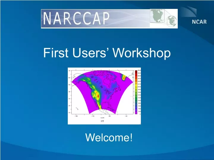
First Users’ Workshop. Welcome!. Workshop Goals. Introduce initial group of users to NCARCCAP Provide opportunity of interaction between modelers and users to: Better understand user needs Improve quality of products provided Build a user website that best responds to user needs

E N D
First Users’ Workshop Welcome!
Workshop Goals • Introduce initial group of users to NCARCCAP • Provide opportunity of interaction between modelers and users to: • Better understand user needs • Improve quality of products provided • Build a user website that best responds to user needs • Build NARCCAP User Community
Introduction to NARCCAP and the Use of High-resolution Modeling L. O. Mearns Institute for the Study of Society and Environment National Center for Atmospheric Research First NARCCAP Users’ Meeting February 14, 2008
Elevation (meters) 2500 2250 2000 1750 1500 1250 1000 750 RegCM Topography 0.5 deg. by 0.5 deg. 500 250 0 Elevation (meters) -250 3000 2750 NCAR CSM Topography 2.8 deg. by 2.8 deg. 2500 2250 2000 1750 1500 1250 1000 750 500 250 0
Regional Modeling Strategy Nested regional modeling technique • Global model provides: • initial conditions – soil moisture, sea surface temperatures, sea ice • lateral meteorological conditions (temperature, pressure, humidity) every 6-8 hours. • Large scale response to forcing (100s kms) • Regional model provides finer scale (10s km) response
Physical Contexts for Regional Modeling • Regions with small irregular land masses (e.g., the Caribbean) • Complex topography (mountains) • Complex coastlines (e.g., Italy) • Heterogeneous landscapes
Now that we can have more regional detail, what difference does it make in any given impacts assessment or adaptation study? What is the added value? Do we have more confidence in the more detailed results?
Global and Regional Simulations of SnowpackGCM under-predicted and misplaced snow Regional Simulation Global Simulation
Use of Regional Climate Model Results for Impacts Assessments • Agriculture: • Brown et al., 2000 (Great Plains – U.S.) • Guereña et al., 2001 (Spain) • Mearns et al., 1998, 1999, 2000, 2001, 2003, 2004, 2005 • (Great Plains, Southeast, and continental US, N. A.) • Carbone et al., Doherty et al., Tsvetsinskaya et al., • 2003 (Southeast US) • Easterling et al., 2001, 2003 (Great Plains, Southeast) • Thomson et al., 2001 (U.S. Pacific Northwest) • Olesen et al., 2007; Fronzek and Carter, 2007; • Mínguez et al., 2007 (Europe)
Use of RCM Results for Impacts Assessments 2 • Water Resources: Leung and Wigmosta, 1999 (US Pacific Northwest) Stone et al., 2001, 2003 (Missouri River Basin) Arnell et al., 2003 (Southern Africa) Miller et al., 2003 (California) Wood et al., 2004 (Pacific Northwest) Graham et al., 2007 (Europe) • Forest Fires: Wotton et al., 1998 (Canada – Boreal Forest) • Human Health: New York City Health Project (Hogrefe et al., 2005) Halsnæs et al., 2007 (Europe)
New York Climate and Health Project MM5 Tests with 12 and 4 km Resolution Hogrefe et al., 2005
Putting spatial resolution in the context of other uncertainties • Must consider the other major uncertainties regarding future climate in addition to the issue of spatial scale – what is the relative importance of uncertainty due to spatial scale? • These include: • Specifying alternative future emissions of ghgs and aerosols • Modeling the global climate response to the forcings (i.e., differences among GCMs)
Programs Exploring Multiple Uncertainties • PRUDENCE - over Europe • ENSEMBLES – over Europe • NARCCAP – over North America • CREAS: Cenários REgionais de Mudança de Clima para América do Sul (Regional Climate Change Scenarios for South America)
PRUDENCE • European domain • 8-10 RCMs • 2 AOGCMs (HadCM3, ECHAM4) but also time slice experiments • 2 emissions scenarios (A2, B2) • Most RCMs used only one driving model, HadAM3H, with A2 emissions scenario • 1961-90 and 2071-2100
The North American Regional Climate ChangeAssessment Program (NARCCAP) Initiated in FY06, it is an international program that will serve the climate scenario needs of the United States, Canada, and northern Mexico. • Exploration of multiple uncertainties in regional model • and global climate model regional projections. • Development of multiple high resolution regional • climate scenarios for use in impacts assessments. • Further evaluation of regional model performance over North America. • Exploration of some remaining uncertainties in regional climate modeling • (e.g., importance of compatibility of physics in nesting and nested models). • Program has been funded by NOAA-OGP, NSF, DOE – 3-4-year program www.narccap.ucar.edu
NARCCAP - Participants Linda O. Mearns, National Center for Atmospheric Research Ray Arritt, Iowa State, Dave Bader, LLNL; Sébastien Biner, Ouranos; Erasmo Buono, Hadley Centre; Daniel Caya, Ouranos; Phil Duffy, LLNL; Filippo Giorgi, Abdus Salam ICTP; William Gutowski, IowaState; Isaac Held, GFDL; Richard Jones, HadleyCentre; René Laprise, UQAM; Ruby Leung, PNNL; Don Middleton, NCAR; Ana Nuñes, Scripps; Doug Nychka, NCAR; John Roads, Scripps, Steve Sain, NCAR, Lisa Sloan, Mark Snyder, UC Santa Cruz; Ron Stouffer, GFDL; Gene Takle, Iowa State; Phil Rasch, Tom Wigley, NCAR
Organization of Program • Phase I: 25-year simulations using NCEP boundary conditions (1979—2004) • Phase IIa: RCM runs (50 km res.) nested in AOGCMs current and future • Phase IIb: Time-slice experiments at 50 km res. (GFDL AM2.1 and NCAR CAM3) – current and future • Opportunity for double nesting (over specific regions) to include participation of other RCM groups (e.g., for NOAA OGP RISAs, CEC, New York Climate and Health Project) • Scenario formation and provision to impacts community (led by NCAR)
Phase I • All RCMs have completed the reanalysis-driven runs. • Configuration: • common North America domain (some differences due to horizontal coordinates) • horizontal grid spacing 50 km • boundary data from NCEP/DOE Reanalysis 2 • boundaries, SST and sea ice updated every 6 hours
NARCCAP PLAN – Phase II A2 Emissions Scenario GFDL CGCM3 HADCM3 link to European Prudence CCSM CAM3 Time slice 50km GFDL Time slice 50 km Provide boundary conditions 2040-2070 future 1971-2000 current CRCM Quebec, Ouranos RegCM3 UC Santa Cruz ICTP HADRM3 Hadley Centre RSM Scripps WRF NCAR/ PNNL MM5 Iowa State/ PNNL
Global Time Slice / RCM Comparison at same resolution (50km) A2 Emissions Scenario GFDL AOGCM CCSM Six RCMS 50 km CAM3 Time slice 50km GFDL Time slice 50 km compare compare
NARCCAP Project Timeline Current 1 Future climate 1 Current and Future 2 Project Start AOGCM Boundaries available Phase 1 12/07 6/08 9/07 1/06 12/08 1/08 Time slices
The NARCCAP User Community • Three user groups: • Further dynamical or statistical downscaling • Regional analysis of NARCCAP results • Use results as scenarios for impacts studies • www.narccap.ucar.edu
Workshop Plan • User introductions • NARCCAP in broader context and AOGCMs • Time slice experiments (atmospheric models) • RCMs • Results of Phase I – overview • User discussions • Data Archiving, Practicum, GIS • Uncertainty Analysis • In depth user group discussions