Download
1 / 43
430 likes | 435 Views
Web GIS for Decentralized District Planning : A Case on Cuddalore & Nagapattinam Districts of Tamil Nadu. National Informatics Centre, Chennai. http://www.tngis.tn.gov.in. Introduction :.

E N D
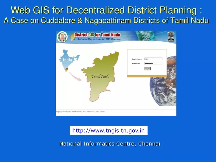
Web GIS for Decentralized District Planning : A Case on Cuddalore & NagapattinamDistricts of Tamil Nadu National Informatics Centre, Chennai http://www.tngis.tn.gov.in
Introduction : • Geographic Information System (GIS) has become an important tool for managing, analyzing and decision making, by seamlessly combining both spatial and non-spatial data. • In Tamil Nadu, a vast volume of spatial data sets have been generated through GIS projects undertaken by several departments and agencies. • The present challenge is to integrate and coordinate these varied and disparate efforts to build a GIS structure for the state as a whole. • The present project at Cuddalore and Nagapattinam is a first step towards this larger objective of building TNGIS.
Basic Issues : • Need for data/information in decision making • Huge volume of existing data sets in various departments are underutilized/unutilized • Sourcewise variation leads to spatial / location inaccuracy of information and mismatch in boundaries • Varied Data formats and its interoperability • Proprietary Vs. Opensource Tools in Managing the Spatial and Non-spatial Information • Data update over time • Capacity Building in District • Integration with the National Spatial Data Infrastructure (NSDI) • Intranet Vs Internet based solutions • Wider dissemination
Approach and Methodology : • The major challenge is to integrate and coordinate these varied and disparate efforts to build a GIS structure for the state as a whole. • The present project is a first step towards this larger objective. • To facilitate the district administration to realize the potential of GIS in their day-to-day affairs by providing the base layers on various themes and capacity building for necessary update over time. • Standardized SOI’s District boundary at 1:50 K scale in UTM & WGS 84 projection and datum as the common boundary to be in sync with TN-SSDI as proposed in TNGIS; and later with National Spatial Data Infrastructure (NSDI).
The methodology for establishment of Web GIS at Cuddalore and Nagapattinam district involves the following steps: 1) Collection and Preparation of Spatial and Attribute Datasets for the District from the nodal departments in district and State 2) Generic Database Design and uploading Data for the District 3) Generic Web GIS Interface Development 4) Deploy the web based software along with open source GIS software 5) Training and Handholding
Collection of Spatial and Attribute Datasets for the District • District boundary, as provided by Survey of India at 1:50 K scale in UTM & WGS 84 has been standardized keeping in mind the integration of all spatial layers under State Spatial Data Infrastructure proposed in TNGIS; and later with National Spatial Data Infrastructure (NSDI). • The Spatial and other Non-spatial information (digital and conventional) were collated from varied sources in the government domain and the discrepancies in the boundaries, scale and the co-ordinate systems were removed for establishing the required authentic layers for these districts. For instance, the Revenue and Panchayat Village Boundaries are retained as same for the villages where these boundaries are co-terminus. Further, the required bifurcation, merging of boundaries is carried-out for necessary revenue/panchayat village boundaries.
Collection of Spatial and Attribute Datasets for the District (Contd.) • Spatial layers for Cuddalore and Nagai have been collected from the nodal departments such as : • 1. Agriculture Engineering Department 2. Tamil Nadu Water And Drainage Board 3. Institute of Remote Sensing, Anna University 4. Bharathidasan University 5. Institute of Water Studies, PWD 6. Ground Water, PWD 7. NIC / National Spatial Database • The sources of major attribute datasets are : 1) Population Data (PCA) of Census 2001, DCO 2) Agriculture Department 3) Health Institutions Data - DPH 4) RD Panchayat Villagewise Infrastructure Data – DRD 5) Below Poverty Line Data (BPL) – DRD 6) Educational Institutions Data 7) Rainfall Data – AD, Statistics
Collection of Spatial and Attribute Datasets for the District (Contd.) • Necessary linking of these spatial layers with the major attribute data sets from the respective departments is carried out, so that the regular update of these data sets can be done without much effort. For instance, the following major data bases are linked; G-Return Agriculture Data Rural Infrastructure Data Census 2001 - Primary Census Abstract Data Census 2001 - Village Amenities Data 7th All India Education Survey Data PHC, HSC, Hospital Data from Public Health Department • In addition to the above, various spatial layers like location of fire-stations, police stations etc. are also provided with a scope to add the necessary attribute data sets. • Further, major efforts on building necessary spatial layers on various natural resources like soil, water resources, delineation of watershed, location of tanks, etc are also provided.
Generic Database Design and uploading Data • PostgreSQL – an ORDBMS as the Backend Database and PostGIS is • an extension of PostgreSQL to support the storage of Spatial Datasets. • The database has been designed to store the spatial or map data, the • attribute information with “Master Tables” to store the metadata – • data on spatial and attribute datasets. Master tables act as a directory. • The design has been made in such a way that any layer would be • dynamically linked to any kind of attribute dataset. For querying and • thematic mapping this gives more scope to add / link any kind of • attribute information in future also. • The database related activities comprise of - The corrected/reprojected Spatial Layers (more than 80 layers) in the form of ESRI Shape File format have been imported into PostgreSQL / PostGIS database. • Metadata on these layers/attribute datasets have been fed into • respective master tables to enable queries in different styles / kinds of • mapping etc.
Generic WebGIS Interface Development • Web GIS has been adopted as the technology to provide interface for the various datasets keeping in mind the large number of users • UMN MapServer is used as the Open Source Web GIS Server with PHP/MapScript as the scripting environment. This would enable us to host the data on any platform. • The following software modules have been currently created: • Dynamic thematic or choropleth mapping that supports following • classifications over web: Equal Interval Equal Count (Including zeros values). Equal Count (Excluding zeros values) Custom classification • Based on the metadata fed on the numeric attribute datasets, the • software decides the mapping layer which includes: Revenue villages, Panchayat villages, Taluks and Blocks
Generic WebGIS Interface Development (Contd.) • Simple Query module to enable query on the attribute datasets • and Complex Spatial or Administrative queries to query on GIS • and attribute datasets. • Alphanumeric based dynamic thematic/unique symbol map • creation module to enable mapping on spatial layers like Soil, • Geomorphology, etc. based on an attribute stored in the layer itself. • Search – Spatial Search on Administrative Units • Authentication to check the user credentials before showing maps • Master Entry pages to enable entry into important master tables / metadata • Update of attribute datasets through Excel sheets or any other • RDBMS is available for administrators
Deploy the web based software along with open source GIS software • The Web based software has been deployed on the Server at Cuddalore and Nagapattinam • Quantum GIS open source GIS software has been installed on Clients • Sensitization of the GIS program has been done at the district level • Key departments have been identified and nodal persons nominated for taking the project forward by the respective District Collector.
Remote User Remote User Remote User Web Server (Apache / IIS) Web Design Style Sheets Layouts Navigational Sequence Open Layers JavaScript MapServer API/CGI PHP Spatial Data Non-Spatial Data PostgreSQL SQL Server MS Access ESRISHP PostgreSQL/PostGIS DesignArchitecture :
PHP Scripts create the map object and access the database Web Browser Define PHP classes for GIS objects Web Server PHP/Map Script Provides function to manage geospatial data Map Server PostGIS Generate map images PostgreSQL Database Stores Geo spatial and business data InteractionamongtheComponents :
Metadata Design Meta data Taluk Layer Census Table
Training and Handholding • Initial sensitization with the user departments in the districts is done through a consultation process under the Chairmanship of District Collector. • The necessary training programme organized at Cuddalore and Nagapattinam in coordination with SPC and district administration for the key personnel's in various district departments • Necessary guidance to sustain the efforts made is being provided for additional requirements over time. • Handholding support at the District is also extended for some period to stabilize the system and ensure its sustenance.
Achievements: • The spatial queries / administrative queries will provide a good Decision Support System for the administrators. Since the queries can be directly made on the spatial datasets in an RDBMS environment, the results will ensure only the up-to-date output. Any change in the layer would reflect immediately on the result sets. • The application provide means for importing attribute datasets even from an Excel sheet and update the datasets periodically so that maps would reflect the latest information. In addition, one can also import datasets from other databases like SQL Server / MS Access etc. • The administrator has the complete control of the application through which he / she may add more parameters for thematic mapping / querying, etc by altering the metadata through the forms provided for this purpose. • The district environment does not restrict users with only the web based interface. Provision of Quantum GIS – a full fledged Open Source GIS software ensures a full functionality GIS tool for the authenticated users in various departments to leverage the full potential of the GIS prepared for the district.
Achievements(contd.): • Without any fresh digitization of maps and by collecting the spatial layers from different agencies, more than 80 layers of data have been brought under SOI’s common district boundary. Bringing these layers within one common boundary itself had been a major task accomplished in this project. • The deployment proposed is modeled on open source software mentioned below. This will enable easy replication at minimum cost for the Software tools for promoting GIS in Decentralized Planning and development in district. • Server OS : Suse Enterprise Linux 10 • Database : PostgreSQL / PostGIS for Attribute and • Spatial datasets • GIS Server : UMN MapServer with Open Layers for • AJAX based map rendering • Scripting : PHP with PHP/MapScript wrapper for • MapServer • Client OS : Suse Desktop Linux 10 • GIS Software : Quantum GIS with PostgreSQL / PostGIS • Support
Achievements(contd.): • Through State SDI initiatives (TNGIS) for the State, all the layers prepared have been collated from different departments in digital vector formats to avoid re-digitization activities. This could be possible only through the SPC’s active involvement in identifying and collecting the datasets from different the nodal departments. • The generic database model created will enable faster replication of the GIS application to other districts and easy integration with attribute datasets later by the District GIS Administrator. • Web based application interface ensures wider scope for the project and the number of users who can access the system. The user needs only internet connection and a browser to access the system. • Almost all the above maps are customizable for size, colour, fill style, titles, etc. so that the user is provided with a more flexible map making interface. • The application also provides a PDF output which can be used for presentations / reports, etc.
Water bodies in Cuddalore district with Overview window, Info Window, Legend Window
Spatial / Administrative Queries SKOCH SUMMIT 2009
Administrative queries Villages with more than 6000 population but without any Health facility
Administrative queries Villages from where people have to walk at least 1.5 km to access a health facility
Attribute Query and Map Output – Total Literates less than 3000
Overlay Layers Dynamically – Apply fill styles / colours / size, etc.