Download
1 / 39
420 likes | 515 Views
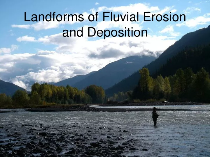
Landforms of Fluvial Erosion and Deposition. A River’s Story …. A river has a life cycle from source to mouth. The processes at work cause changes to the river valley and river features in the landscape that it passes over.

E N D
A River’s Story … • A river has a life cycle from source to mouth. The processes at work cause changes to the river valley and river features in the landscape that it passes over. • Traditionally this cycle has been described in 3 stages, the Upper (Torrent) section, the Middle (Valley) section and the Lower (Flood Plain) section. The terminologies Youthful, Mature and Old have also been used to describe the sections. • The stages are not clearly defined but merge from one to the other and individual rivers show varying characteristics.
A Typical Long Profile A typical long profile: Upper Middle Lower
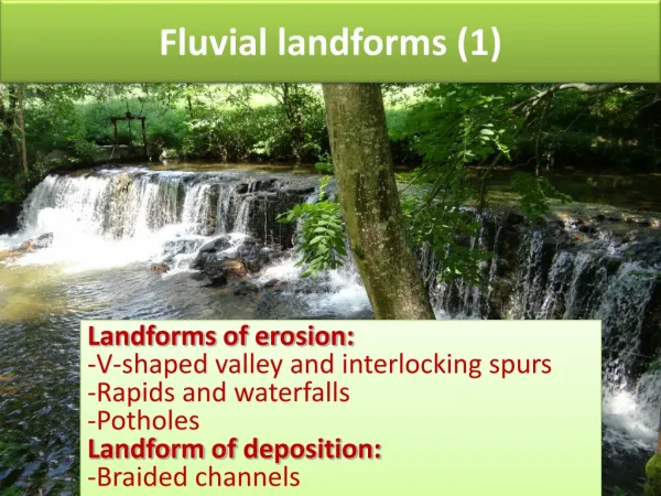
Deep, narrow valley (V shaped) Interlocking spurs Fast flowing river (erosion predominant) Pot holes in the river bed Rapids and Waterfalls The main process at work is the downward or vertical erosion of the stream bed. This cuts into the landscape deepening the valley sides. Upper Course - Characteristics:
From lower down the river, the interlocking of the spurs of land between the bends blocks the view up the valley. Interlocking spurs
Potholes are cylindrical holes drilled into the rocky bed of a river by turbulent, high velocity water loaded with pebbles. The pebbles become trapped in slight hollows and vertical eddies in the water are strong enough to allow the sediment to grind a hole into the rock through abrasion (corrasion). This picture shows pebbles resting in the bottom of bowl-shaped potholes of medium size. Notice how the pebbles are rounded - partly by the same action that scours the pothole. This is because the pebbles and the bedrock are of the same ‘hardness’, so they wear each other away. The pebbles only escape when they are so small that they can be carried away by the current. The pebbles are also smoothed and rounded through the process of attrition. Potholes
Bourke's Luck Potholes, Blyde River, South Africa Over time, the potholes may widen and join with others to form larger potholes – ultimately, the whole riverbed is deepened. However, not many are as dramatic as these potholes in South Africa!
Potholes on the Presque Isle River, Porcupine Mountains Wilderness State Park, Michigan. Potholes can vary in width from a few centimetres to several metres. They are usually found in the upper sections of the river where there is more potential energy for downcutting and the river bed is more likely to be rocky.
Rapids are stretches of fast-flowing water tumbling over a rocky and shallow riverbed. Different levels of resistance between rocks cause rapids. They are formed when the water goes from one area of hard rock that resists the water's erosion to a softer rock that is more easily eroded. Rapids
The Congo River Rapids Simulated rapids at the Alton Towers resort Recognise this?
Waterfalls … a similar story Waterfalls occur when a band of hard rock lies across the river with softer rock downstream which is more rapidly eroded. At first rapids would form but these would then later develop into a waterfall as the softer rock erodes further.
Basic waterfall formation And you should certainly recognise this picture! Name of waterfall? How high is it? Name of river? Names of rock types?
The Middle Course • As a river flows downstream, the gradient becomes less steep and lateral (sideways) erosion becomes more important. • The river then starts to meander. • The flow is always faster on the outside bend of a meander. This means that the water has more power to erode its bed and so it is also deeper here. • The water will also erode/undercut the river banks to form a steep-sided river cliff. • On the inside bend, the water flows more slowly; the water is shallower and deposition of material will lead to the build up of a river beach (sometimes called a slip-off slope or a point bar).
Formation of Meanders(How do they happen in the first place?) • In low flow conditions, straight channels are seen to have alternating bars of sediment on their beds and the moving water is forced to weave around these bars. • This creates alternating shallow sections (riffles) and deeper sections (pools). • The swing of the flow caused by these riffles and pools directs the maximum velocity towards one of the banks and results in erosion through undercutting (see previous slide).
Perpetuation of Meanders • Once they have been created, meanders are perpetuated by a surface flow of water across to the concave outer bank with a compensatory subsurface return flow back to the convex inner bank. • This corkscrew-like movement of water is called helicoidal flow.
Remember that meanders also migrate downstream (think what happens when you send a ‘wave’ along a skipping rope). As they do so, they become wider and wider due to erosion on the outer bends. This also has the effect of widening the valley floor. See Photo → (The red lines show the widening valley floor). Meander Migration
This diagram shows the formation of an ox-bow lake. The neck of the meander narrows gradually due to erosion on the outer bends. Eventually, the neck is broken through, often during a time of flood. Deposition of silt/alluvium seals off the meander from the mainstream. Gradually, the ox-bow lake will dry up to leave a meander scar. Can you add some more labels to this diagram? The Formation of an Ox-Bow Lake
Ox-bow lake along the Red River, near Morris, southern Manitoba, Canada
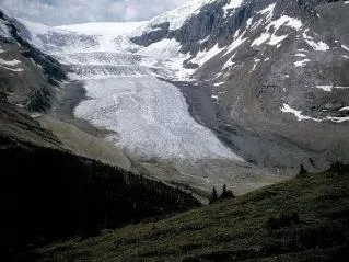
Braided Channels II • Braiding occurs when the river is forced to split into several channels separated by islands. • It is a feature of rivers that are supplied with large loads of sand and gravel as a result of unstable and easily eroded banks. • It is also likely to occur when a river has variable discharges such as in low-lying, semi-arid areas that ‘receive’ rivers from mountainous areas. Or, in glaciated areas where again, the river discharge can be highly variable – see next slide. • As a consequence, the channel becomes very wide in relation to depth and the river can become ‘choked’ with several sandbars and channels that are constantly changing their location.
The Lower Course of the River • This is associated with larger meanders, ox-bow lakes, levees and flood plains • Erosion is reduced although there will still be some lateral erosion on the outside bends of meanders • The bedload will be much smaller – pebbles, gravel and sand. Most will be transported in suspension • Deposition of (mostly) fine particles forms slip-off slopes, levees and flooplains
A flood plain is the wide, flat area of land on either side of a river. Each time a river floods, it deposits a new layer of silt/alluvium on the surrounding land. The heaviest, coarsest material is deposited first to form raised banks known as levées, such as those along the Mississippi River in the USA. These have been artificially heightened to help prevent flooding, which unfortunately is not always successful! Formation of Flood Plains A reinforced levée on the banks of the Mississippi. Levee strengthening began here in 1699! By the 1990s, the length of engineered levees was 3200kms.
As a river reaches the sea, it may flow into a delta or estuary. An estuary is the lower course of a river valley which has been ‘drowned’ by a rise in sea level (or a fall in land level). An estuary is very wide with mud flats and salt marshes. The valley at this point will be low-lying and relatively flat. What happens at the mouth of a River? Recognise this? It’s the Mersey estuary – most of you will have been down here on the ferry! Note the sandbanks and mudflats in the foreground.
Deposition occurs as the velocity and sediment carrying capacity of a river decrease on entering the sea or a lake. Bedload and suspended material are dumped as a result. Flocculation occurs as fresh water mixes with seawater and clay particles coagulate due to chemical reaction. Formation of Deltas Aerial View of the Mississippi ‘bird’s foot’ delta.
The rate of deposition must exceed the rate of sediment removal This is more likely when the sediment load of rivers is very large – such as in the case of the Mississippi and Nile Deltas are also more likely to form when the coastal area into which the river empties its load has a small tidal range and weak currents (such as the Gulf of Mexico and the Mediterranean). Ideal conditions for delta formation
Different types of Delta Your turn to do a bit of research: Find out about the following three types of delta. Support your research with relevant pictures and/or diagrams. • Cuspate deltas • Arcuate deltas • Bird’s foot deltas
Now … how carefully were you watching …? Stand By for the Big Picture Quiz!
a) Name the Waterfall b) How high is it? c) Name the River d) Name the Hard Rock e) Name the Soft Rock 2) An old friend …
And the proper geographical name for this feature would be …. ? 5) Nice bit of white water here …
Two features to name this time 6) What are these? 7) And what is this?
8) What are the main features here? 9) What do the red lines show? And some bendy bits …
And two deltas … 10: Where is this one? 11: Where is this one?
12) Name this Ride 13) And the theme park! And finally …
Actually, there is one more … 14) What was the ‘F’ word … Twenty marks available in all – how did you do