Download
1 / 32
320 likes | 378 Views
Making Every Raindrop Count in Our Watershed.

E N D
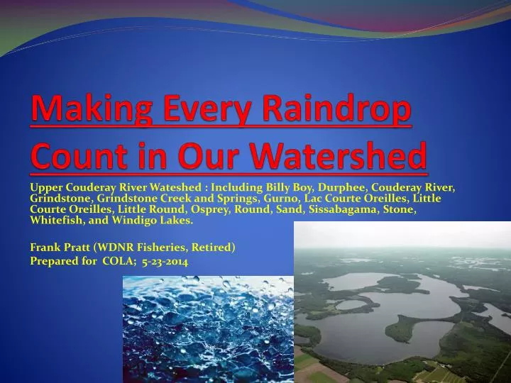
Making Every Raindrop Count in Our Watershed Upper Couderay River Wateshed : Including Billy Boy, Durphee, Couderay River, Grindstone, Grindstone Creek and Springs, Gurno, Lac Courte Oreilles, Little Courte Oreilles, Little Round, Osprey, Round, Sand, Sissabagama, Stone, Whitefish, and Windigo Lakes. Frank Pratt (WDNR Fisheries, Retired) Prepared for COLA; 5-23-2014
Special Emphasis This Report • Watershed Concept-Run-off vs. Groundwater • Climate Change- AIC • Impairment • Phosphorus • Two-Story Fisheries • Local Level Community Action/Cooperation
Frank 3:16 • “Habitat is everything” • “There is no such thing as enhancement- only attempted restoration” • “WATERSHED, WATERSHED, WATERSHED.. • “Every Raindrop Counts!!”
What is a Watershed • Definition- Area of land surrounding the water to which that land drains. • Includes all land mass, wetlands, lakes, human development, everything. • Includes soil surface and those soils and substrates underneath through which water drains. • Geographic scale of one water on up to Oceans • Water cycle- Dynamic precipitation- run-off-groundwater-evaporation-flow • Sum total of countless raindrops • Linked other chemical cycles- nutrients and sediment • Human Watershed
Some Basic Watershed Terms • Surface Water • Run-Off • Ground-water • Evaporation • Riparian • Upland • Intra-Lake • Inter-Lake • Watershed
Our Human Watershed • Landowners on- • Landowners off- • Outside users • Agencies • Lake and Land Groups • Future Generations- • “To Our Children’s, Children’s, Children” Watershed!
Regional Watershed Map • Insert Map here
Our Big Three Local Watersheds • Upper Namekagon- 200 square miles- some major lakes and 20 miles Wild River, many miles smaller, cold-water tributaries • Upper Couderay-125 square miles- many large lakes and lake chains.* • Lake Chippewa- 185 square miles-many large lakes and lake chains.* (* Linkage via groundwater inflow to Round Lake from Tiger Cat Chain.)
Local Watershed Map-Couderay 7 1.Sissabagama 2.Sand 3.Whitefish 4.LCO 5.Musky Bay 6.Grindstone 7.Round 8.Stone 9.Windigo Numerous smaller not shown 9 6 4 5 3 2 8 1
Sub-Watersheds and Lake Chains • Sand/Whitefish Creek System- Sissabagama, Sand Lake, Whitefish Lake, Whitefish Creek (outlet to LCO) • Grindstone Creek System- GrindstoneSprings, Grindstone Creek, Grindstone Lake, Little Grindstone (0utlet to LCO) • Osprey Creek System- Round, Little Round, Osprey, Osprey Creek • Couderay R. Headwaters System- LCO,Little LCO, Billy Boy, Couderay River • Perched Seepage- Gurno, Durphee, Stone, Windigo
Major Lakes-Upper Couderay Plus- Many other smaller, but still important waters. *-Indicates ORW or “nondegradation, State, category.
Near vs. Far Watershed Shoreline ~ 3-5% only Water, including other lakes~16-20% Upland ~ 80% !!
Rain • 31” per year x watershed area • Pattern is changing to summer episodes • X quadrillion raindrops per year! • Each resident owns hundreds of trillions • In sum total, each one counts!
Raindrops as Critical Mass • < 1-5% watershed land area =“riparian” • Other 95+% “back-watershed” drives the system, including other waters. • Land up to 5 miles distant from its surface water • Land use/habitat determine fate of raindrop • Sum raindrops = water quantity and water quality “downstream” • The entire land mass is the “Buffer Zone” • Nutrient transport-Especially Phosphorus • Climate Change is a Game Changer
Surface Water Comes From • RAIN…then • Typical (Couderay/Chippewa)- 35% groundwater and 65% run-off. • Namekagon is likely more groundwater • Watershed management functions in two ways- greater infiltration to ground-water, and slowing down run-off. • Determines both water quality (Temp, nutrients, clarity) and quantity (floods, drought, flows, level)
Forest Impervious Run-Off Erosion Agriculture
Raindrops Journey-Upper Couderay Evaporation 25% Sissabagama Sand 2 yrs. flow 4 yrs. Ground 3 yrs. flow Whitefish LCO 11 yrs. flow 10 yrs. flow
Different Approaches Stewarship Individual Water Watershed Level • Exclusive- “Me/Mine” • A surface water • Limited Resources • Narrow Buffer • Expediency-Here/now • Shoreline-Water linkage • End of Water Cycle • Intra-Lake • Social • Inclusive-Our • All water • Pooled Resources • Wide Buffer • Visionary-Long-term • Land-Water linkage • All of Water Cycle • Inter-Lake • Political
Watershed Fish-UC20 Lake Whitefish Cisco Muskellunge
Big Money +1 ppb TP = - 1 ft. = $25,ooo up in flames
TP- Total Phosphorus-UC20 Already impaired, threatened, impact others, or insufficient data-WATERSHED
Lakes Class-TP Standards • LCO- Site Specific- 10 ppb (Impaired) • Sissabagama- Headwater, Drainage, Stratified- 20 ppb (Impaired) • Sand- Drainage, Stratified- 30 ppb • Stone, Windigo- Seepage, 20 ppb • Whitefish, Grindstone, Round- Two Story- 15 ppb • Durphee, Gurno, others- Shallow, Seepage?? 40 ppb (No data) • Site Specific ORW- Core samples some historic baseline. • Problems: Insufficient data, standards are too high, methodology is too liberal, many lakes already exceed anyway, solutions will be aggressive and costly…only way is…… • WATERSHED, WATERSHED, WATERSHED
Sand Lake- Meets its TP but ……………….. Mean= 24 90%CI=21-27 Range= 17-37
Whitefish Lake is struggling to meet 2-Story standard…..and furthermore…… TSL 15 ppb Mean= 14.2 90%CI= 13-16 Range= 8-24
Climate Change as Game Changer • Growing season 1-2 months longer. Magnifies oxygen depletion in deep lakes, and increases water temp. in cold-water streams. • Run-off of sediment and Phosphorus increase • Flooding, Droughts, warmer water/longer • Especially at risk- Cold-water fish communities • Lake problems compounded
Let’s not be like Nero • AIS IS very important…..but • We cant ignore watershed and Climate Change d • Fiddling while Rome Burns Literally!.................
Current State Lake Grants (~$9M) Other ~ 2 M AIS ~ 7 M
Pratt Rx for Lakes and Rivers • Watershed- Organize and cooperate to pool resources for concerted effort to advance shared objectives. Watershed Conference Sept. 6!! • LCO TMDL- Reduce P ~ 25% via emphasis on shoreline buffers!!!! • Recognize watershed, climate change, nutrients, and responsibility to future generations. • Armor the landscape to anticipate increased run-off. The entire watershed is a wide Buffer Zone. • Keep Wild land Wild- Conservation Easements • Encourage land use that maximizes ground-water and minimizes run-off. • Actively manage run-off and impervious surfaces • Active management and enforcement of nutrients where needed under Impaired Waters, Clean Water Act, ORW, BMPs, TMDLs, etc…. • Make every raindrop, including the human raindrop count! • YOU CAN MAKE A DIFFERENCE!