Download
1 / 48
480 likes | 733 Views
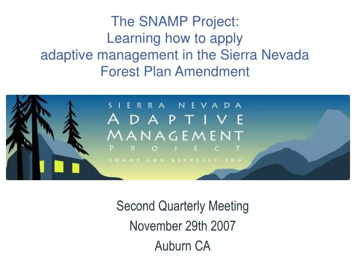
Second Quarterly Meeting November 29th 2007 Auburn CA. The SNAMP Project: Learning how to apply adaptive management in the Sierra Nevada Forest Plan Amendment. Outline for Public Meeting. 1. Review our Guiding Principles and Key Agreements 2. Project Timeline & Team Updates 3. Discussion

E N D
Second Quarterly Meeting November 29th 2007 Auburn CA The SNAMP Project:Learning how to applyadaptive management in the Sierra Nevada Forest Plan Amendment
Outline for Public Meeting • 1. Review our Guiding Principles and Key Agreements • 2. Project Timeline & Team Updates • 3. Discussion • Public Meeting Format • Data Sharing • Celebration and Where Do We Go From Here?
Review our guiding principles and key agreements • Ground Rules • Roles and Relationships for this Meeting: • Facilitator: Kim Rodrigues • Recorder: Susan Clark • Roles and Relationships for the Project: • Lead PI: John Battles • New Project Coordinator: Ann Huber
Adaptive Management Framework USFS: Plan projects with existing management direction (ROD) Analyze & model expected environmental affects USFS: Change management direction as needed Propose adjustments to management? Adaptive Management USFS: Implement projects as treatments Analyze & recalibrate models Observe & measure
January 11, 2007 MOU + UCST Meeting, Sacramento, CA January 24, 2007 SNAMP Public Meeting 2007 January 16, 2007 Revised Workplan Posted January 13,2006 MOU Partner’s Meeting February 10, 2006 Draft Workplan Posted April 28, 2006 MOU + UCST Meeting, Sacramento, CA May 15, 2006 MOU Review & UCST Response Posted July 2, 2006 SNAMP Public Meeting September 7, 2006 MOU + UCST + USFS Staff Field Trip: Bass Lake November 11, 2006 MOU + UCST Meeting, Sacramento, CA 2006 October 2, 2006 MOU + UCST + USFS Staff Field Trip: American River January 20, 2006 Public Comment Website Accessible February 28, 2006 Workplan Posted May 8, 2006 Workplan Peer Review Posted July 21, 2006 MOU + UCST Meeting, Sacramento, CA SNAMP Timeline May 16, 2007 Full UCST Meeting August 20, 2007 1st Quarterly Report, Davis November 29, 2007 2nd Quarterly Report, Auburn February 2005 MOU with UC & USFS April 15, 2005 UC SNAMP Proposal Completed December 9, 2005 First SNAMP Public Meeting December 21, 2005 SNAMP Key Agreements 2005 December 9, 2005 Workplan Agreement with USFS & UCCE
UCST Science Teams Fire & Forest Ecosystem Health • Scott Stephens, PI • John Battles, PI • Brandon Collins, Post-Doc • Adrian Das, Post-Doc • Gary Roller, PM Water • Roger Bales, PI • Martha Conklin, PI • Qinghua Guo, PI • Sarah Martin, Ph.D. Student • Matt Meadows, Hydrologist SNAMP Project Integration • John Battles, Lead PI • Ann Huber, Academic Coordinator Fisher • Reg Barrett, PI • Rick Sweitzer, PM Public Participation • Lynn Huntsinger, PI • Kimberly Rodrigues, PI • Maggi Kelly, PI • Adriana Sulak, Post-Doc • Ann Lombardo, Extension • Ken’ichi Ueda, MS Student Spatial • Maggi Kelly, PI • Qinghua Guo, PI • Marek Jakubowski, Ph.D. Student Owl • Rocky Gutiérrez, PI • Doug Tempel, PM
The SNAMP Study Sites Placeholder for site maps
The SNAMP Study Sites Placeholder for site photos
Monitoring and Research • Monitoring targets are based on key forest management goals: • Reducing the potential for catastrophic wildfire • Protecting wildlife habitat • Maintaining high-quality water • Working with the public
University of California Role • Provide independent third-party monitoring and research • Help develop and evaluate an adaptive management program with strong public participation
Science Team: Our Commitment • Monitoring • We will monitor and analyze impacts of management treatments (and USFS public participation processes) as a third party • Open and Transparent Process • We commit to an open and transparent process, with public participation and full reporting to USFS and public from the beginning • Information Tracking • We will follow how information is gathered and used as it is fed back into the adaptive management process; report on use of information to public, Science Team, and USFS • Public Participation • We will engage the public, as stakeholders, in monitoring and research, to develop a “community of stakeholders” at local and regional scales
Project Integration Group (John) • Accomplishments since Q1 • Formalized internal UCST communication • Bimonthly UCST conference calls • Weekly communication with each science team regarding their progress • Weekly update email posted to UCST • Coordinated: • Getting science team workplans posted to SNAMP website • Q2 meeting and logistics planning with PPT • UCST review of data sharing and publications guidelines agreement with PPT • Owl revised proposal discussion and presentation
Project Integration Group (John) • Accomplishments since Q1 (continued) • Obtained UCST consensus on • Process for proposing new / altered research plans • Revised Neutrality Statement • Communication with MOU Partners • Worked with USFS and Spatial Team to coordinate development of updated, detailed SNAMP project map • Coordination of housing logistics for science teams for next summer • Communication with FS personnel regarding plans for treatment implementation • Served as central information hub for communications between MOU partners and science team members • Developed UCST org chart • Clarified purchasing procedures for UC Berkeley teams
SNAMP Project Challenges (John) • Uneven funding • Implications of one-year delay • Scale Issues
Project Integration Group (John) • Next steps • Progress on data sharing and integration between teams with data • Begin integrating complementary research studies in the Sierra Nevada (meta-replication) • More frequent, improved communication with MOUP
Fire & Forest Health & Adaptive Management Locate study sites that meet criteria, plan treatments USFS: Plan projects with existing management direction (ROD) Develop monitoring protocol, establish plots, inventory forest structure and fuels, fire history reconstruction Analyze & model expected environmental affects USFS: Change management direction as needed Adaptive Management Propose adjustments to management? Adaptive Management USFS: Implement projects as treatments Report results Monitoring of forest conditions and changes Analyze & recalibrate models Observe & measure Use fuel and silvicultural models
Foresthill: Total Plots: 200 138 plots in the two treatment watersheds at a 500m grid, additionally two sets of 16 plots each at a 250m grid 15 plots densified in the Frazier Creek control watershed 15 plots densified in the Bear Trap Creek treatment watershed Rows 250m apart with plots 125m running north to south Sugar Pine: Total Plots: 115 76 plots in the general treatment area around the town of Sugar Pine at a 500m grid 18 plots densified in the Big Sandy treatment watershed 21 plots densified in the North Speckerman control watershed rows 250m apart with plots 125m running north to south Cedar Valley: 71 of 122 plots complete at a 500m grid in the area around the town of Cedar Valley scheduled for immediate harvest Forest Fire & Ecosystem Health (Scott) • Accomplishments & Notes
Forest Fire & Ecosystem Health (Scott) • Ongoing outreach activities & ideas for public participation • Next steps • Complete the inventory in the summer of ‘08 • control firesheds in the northern and southern sites, and complete the new Cedar Valley project in the southern site • We will also collect fire scars and corers from trees to be used in mortality modeling
Water & Adaptive Management USFS: Plan projects with existing management direction (ROD) Based on impacts on streams, water cycle & forest health Analyze & model expected environmental affects USFS: Change management direction as needed Adaptive Management Propose adjustments to management? Adaptive Management USFS: Implement projects as treatments Impact of forest treatments on water quality & budget, aquatic habitat & aquatic biota at 3 levels: watershed, forest, bioregion Monitor changes in water quality & water budget in representative areas Analyze & recalibrate models Observe & measure Potential effects of treatments on watershed processes
Water(Roger & Martha) • Accomplishments & Notes • 4 meteorological stations completed • Additional instrument sites selected • Ongoing outreach activities & ideas for public participation • Yosemite H.S., Oakhurst, CA • Next steps • Sediment basin permitting construction • Procure & install instrument clusters • Set up modeling framework • Await funding & purchases from DWR
Wildlife & Adaptive Management USFS: Plan projects with existing management direction (ROD) Select species for study, develop research protocol, Inventory and mark animals Analyze & model expected environmental affects USFS: Change management direction as needed Adaptive Management Propose adjustments to management? Adaptive Management USFS: Implement projects as treatments Report on species status, conditions, mortality or disappearance Monitor owl and fisher Analyze & recalibrate models Observe & measure
Wildlife: Fisher Accomplishments & Notes Bass Lake/North Fork Research Station established Six project technicians hired (3 M.S., 3 B.S.) Field research was initiated in mid October 15 camera traps established within SNAMP watersheds; 2fisher detections
Wildlife: Fisher Accomplishments & Notes Rick Sweitzer participated in “Sugar Pine Adaptive Mgt Public Fieldtrip” hosted by Bass Lake Ranger District (Sept 29, 2007) Ideas for Public Participation • Will provide Ann Lombardo with information from study as project picks up steam
Wildlife: Fisher Accomplishments & Notes Grid (1 km2) –based design for research Camera traps & other activities linked to numbered grid; example is distribution of 15 camera traps Commercial thinning underway in Nelder Creek watershed Grid will be monitored with camera traps until 20 fisher are collared
Fisher: Next Steps • Next Steps • Continue to establish camera traps in SNAMP watersheds and beyond • Will radio-collar fishers through winter until at least 20 animals collared • All radio-collared fisher will be monitored daily to determine cause of mortality
OPTION 1: Use existing data from Eldorado Study Area (ESA) Determine which owl territories have recently experienced SPLAT-like treatments We have extensive occupancy, reproductive, and survival data for all ESA territories OPTION 2: Use future data from ESA Identify owl territories that will receive SPLAT treatments over same time frame as SNAMP Data will be collected during our ongoing efforts on the ESA Wildlife: OwlOptions to Increase Sample Size
OPTION 3: Expand our survey effort to include additional owl Protected Activity Centers (PACs) on Tahoe or Eldorado N.F. Identify owl PACs near areas scheduled to receive SPLAT treatments over same time frame as SNAMP Survey, capture, and monitor owls in these areas OPTION 4: Expand our survey effort to include any SPLAT treatment sites on Tahoe or Eldorado N.F. Identify any areas scheduled to receive SPLAT treatments over same time frame as SNAMP (regardless of historic owl presence) Survey, capture, and monitor owls in these areas Wildlife: OwlOptions to Increase Sample Size
Increased cooperation between UCST and U.S. Forest Service Required for all options but particularly critical for Options 3-4 With assistance from U.S.F.S., assess the potential increase in sample size from Options 1-2 before the 2008 field season Financial cost Options 1-2 incur no additional costs for SNAMP Options 3-4 incur additional (but unknown) costs for SNAMP Scale of Study Area Expanded scale of owl sampling increases the generality of owl results Strengthens the study (rather than weakens it) Wildlife: OwlImplications of Revised Study Design
Accompany owl crews on night-time surveys Assess areas for presence/absence of owls Surveys generally occur along roads Less physically strenuous than following option U of Minnesota requires participants to sign waiver of liability Accompany owl crews on walk-in surveys Identify or capture (if necessary) owls detected during night-time surveys Assess reproductive status of owls Public participants must be in excellent physical condition The use of mice to assess reproduction may offend some members of public U of Minnesota requires participants to sign waiver of liability Wildlife: OwlPublic Participation
Spatial Analysis & Adaptive Management USFS: Plan projects with existing management direction (ROD) Analyze & model expected environmental affects USFS: Change management direction as needed Adaptive Management Mapping and data support Propose adjustments to management? Adaptive Management USFS: Implement projects as treatments Data & results display Data acquisition and analysis Analyze & recalibrate models Observe & measure Modeling
Accomplishments & Notes Lidar data for the Southern site have been acquired Study Site maps have been created and posted GIS data are continually maintained Facilitated GIS software licensing for other teams Evaluation of large-scale forest structure data for wildlife team use Coordinate Data Sharing Draft Protocol for: Within-team sharing Data sharing with the public Spatial Team: UCB and UCM (Maggi)
Spatial Team: Next Steps • Next Steps • Data Acquisition • Acquiring high spatial resolution images for the study areas • Plan Lidar data acquisition and other spatial data for the Northern site • Updating spatial data, current vegetation maps and high resolution DEM for larger study areas • Data Processing • Processing Southern Site Lidar data to extract DEM and vegetation structure • Process remote sensing data and other spatial data • Data Sharing • Coordinate gathering and sharing of data collected by UCST • Setting up the data sever for users to upload data with security login in and distribute spatial data via web GIS technique Work to link the remote sensing derived products to other team field measurements, and start upscalling
Spatial Team • Ongoing Outreach Activities & Ideas for Public Participation • Study site maps available on SNAMP site • Data Sharing discussion begun • WebGIS site in development • Encourage discussion through Discussion Board
Public Participation & Adaptive Management Incorporate information & ideas from stakeholders into research plan, strategic facilitation USFS: Plan projects with existing management direction (ROD) 1. Effectiveness of web, community-based, & public meeting methods? 2. How is information used by scientists and USFS? 3. Role of UC as third party? Analyze & model expected environmental affects USFS: Change management direction as needed Enable stakeholder participation in monitoring and research; Observe NEPA process of USFS; Initiate Triggers and Thresholds Adaptive Management Propose adjustments to management? Adaptive Management USFS: Implement projects as treatments Track & report use of information and participation in management and research; Work with USFS to incorporate what is learned Analyze & recalibrate models Observe & measure Enable stakeholder and partner participation in interpretation
Public Participation (Lynn) • Accomplishments & Notes • Introducing Anne Lombardo -- local outreach • Introducing Adrianna Sulak -- project analysis • Strategic facilitation continuing including facilitating Triggers and Threshold process • Continued website development with systematic user input • Developed a range of outreach materials: SNAMP handout, maps, newsletter • Participation in, and evaluation of Forest Service and other outreach meetings and activities • Project archival and historical information
Public Participation (Lynn) • Next steps • Triggers and Thresholds Report • Data Sharing protocol • Workshop with Forest Service • Re-organization and re-launch of SNAMP website • Facilitation Training in Spring 2008 • Plan for Q3 • Expand outreach
For Discussion • Public Meeting Format (Kim) • Data Sharing Protocol (Maggi) • Emerging Guiding Principles • Constraints on Data Sharing • SNAMP Data Table • Where do we go from here? (Kim)
SNAMP Data Sharing • The SNAMP Project will collect, analyze and generate large datasets, from data collected by teams on the ground to remotely measured spatial data. • The UCST has a commitment to make our workplan, meeting notes, and discussions public and transparent; yet have not yet formally decided on a protocol for sharing of data. • Sharing data is a key part of adaptive management; but there are constraints associated with sharing
Data Sharing Guidelines • Data propriety begins with the lead PI of the research teams that have collected the data, and each PI will have the ability to decide which of their team’s data can be shared, either internally (within UCST) or externally (outside of UCST); • There is a limited time period that the lead research team PI have propriety of their data (6-12 months); • All data requests must be approved in writing by the science team lead PI that has overseen the study in question; • All science team PIs must archive their data at least annually.
Data Sharing Constraints • The UCST will make efforts to make spatial and non-spatial data public whenever possible and/or appropriate. • There are compelling reasons why a scientist might not want to distribute data, for example: • disclosure of location of people or rare and endangered species might put them at risk; • data might not be complete; • data might have proprietary restrictions originating outside of the UCST. • For spatial data that is common across all teams, the spatial team will review and make recommendations on the appropriate format for data sharing. We are concerned about distributing overly large file sizes.
Data from SNAMP • * shown in public meeting presentation, which is published on the web. • ** There was a public request for these data.
Public Website • Discussion Board • Add comments about current activities • Document Archive • Workplan • Workplan-specific documents • Photographs • From the field and meetings • Meeting Information • News on current and past meetings • Background Reading
Time to Celebrate • Eat • Talk • Be Merry • Please talk to each other and share ideas about how to work together.