Download
1 / 9
90 likes | 214 Views
Internationally Collaborative Joint OSSEs Progress At NOAA. Michiko Masutani [1,2,#], Lars Peter Riishojgaard [2 ,$], Zaizhong Ma[2 ,$], Jack S. Woollen [1 ,+], Dave Emmitt[5], Sid Wood[5], Steve Greco[5], Tong Zhu[3,@], Yuanfu Xie [4 ].

E N D
Internationally Collaborative Joint OSSEs Progress At NOAA Michiko Masutani[1,2,#], Lars Peter Riishojgaard [2,$], ZaizhongMa[2,$], Jack S. Woollen[1,+], Dave Emmitt[5], Sid Wood[5], Steve Greco[5], Tong Zhu[3,@], YuanfuXie[4] [1]NOAA/National Centers for Environmental Prediction (NCEP) [2]Joint Center for Satellite and Data Assimilation (JCSDA) [3]NOAA/ NESDIS/STAR, [4]NOAA/Earth System Research Laboratory (ESRL) [5]Simpson Weather Associates # Wyle Information Systems, McLean, VA, +IM Systems Group)IMSG), MD $Earth System Science Interdisciplinary Center, Univ. of Maryland, College Park,, @Cooperative Institute for Research in the Atmosphere (CIRA)/CSU, CO OSSE:Observing Systems Simulation Experiments http://www.emc.ncep.noaa.gov/research/JointOSSEs/
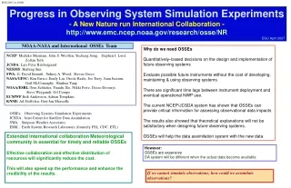
Full OSSEs There are many types of simulation experiments. Sometimes, we have to call our OSSE a ‘Full OSSE’ to avoid confusion. Advantages • A Nature Run (NR, proxy true atmosphere) is produced from a free forecast run using the highest resolution operational model which is significantly different from the NWP model used in Data Assimilation Systems. • Calibrations is performed to provide quantitative data impact assessment. • . Without calibration quantitative evaluation of data impact is not possible. • Data impact on analysis and forecast will be evaluated. • A Full OSSE can provide detailed quantitative evaluations of the configuration of observing systems. • A Full OSSE can use an existing operational system and help the development of an operational system OSSE Calibration Existing Data assimilation system and verification method are used for Full OSSEs. This will help development of DAS and verification tools. Calibration of OSSEs verifies the simulated data impact by comparing it to real data impact. In order to conduct an OSSE calibration, the data impact of existing instruments has to be compared to their impact in the OSSE. International Joint OSSE capability • Full OSSEs are expensive • Sharing one Nature Run and simulated observation saves costs • Sharing diverse resources • OSSE-based decisions have international stakeholders • Decisions on major space systems have important scientific, technical, financial and political ramifications • Community ownership and oversight of OSSE capability is important for maintaining credibility • Independent but related data assimilation systems allow us to test the robustnessof answers
Joint OSSE Nature Run by ECMWF NASA/NCCS http://portal.nccs.nasa.gov/osse/index.pl ID and Password required http://portal.nccs.nasa.gov/josse/index.pl Ellen Salmon Ellen.M.Salmon@NASA.gov Bill McHale wmchale@nccs.nasa.gov NCAR Currently saved in HPSS Data ID: ds621.0 Contact: Chi-Fan Shih chifan@ucar.edu Steven Worleyworley@ucar.edu Archived in the MARS system at ECMWF Accessed by external users. Currently available internally as expver=etwu Based on discussion with JCSDA, NCEP, GMAO, GLA, SIVO, SWA, NESDIS, ESRL, and ECMWF Andersson, Erik and Michiko Masutani 2010: Collaboration on Observing System Simulation Experiments (Joint OSSE), ECMWF News Letter No. 123, Spring 2010, 14-16. ECMWF Nature run used at NOAA Spectral resolution : T511 13 month long. Starting May1st,2005 Vertical levels: L91, 3 hourly dump Daily SST and ICE: provided by NCEP Model: Version cy31r1 Simulated radiance data, with and without MASK in BUFR format for entire Nature run period Type of radiance data and location used for reanalysis from May 2005-May2006 Simulated using CRTM1.2.2 No observational error added Conventional data Entire Nature run Period Restricted data removed Cloud track wind is based on real observation location No observational error added Note: This data must not be used for commercial purposes and re-distribution rights are not given. User lists lists are maintained by Michiko Masutani and ECMWF
OSSE to evaluate Impact of GWOS DWL GWOS: Global Wind Observing Sounder Simulated observation Control data: Observation type and distribution used by reanalysis for 2005. Observational error is not added to the control data but calibration was performed to demonstrate the impact of observational error in control data. DWL data: GWOS concept DWL simulated by Simpson weather associates. Case Study to compare impact of DWL with model resolution Atlantic Hurricane in the nature run for the analysis period of 9/25-10/10 • The coherent subsystem provides very accurate (< 1.5m/s) observations when sufficient aerosols (and clouds) exist. • The direct detection (molecular) subsystem provides observations meeting the threshold requirements above 2km, clouds permitting. Star Tracker Nadir Telescope Modules (4)
Calibration experiments and DWL OSSE at JCSDA Calibration and initial evaluation of DWL impact were conducted for the period 1st Jyly-15 August. No observational were added to simulated control data. Calibration experiments showed reasonable agreement in data impact of RAOB wind in real and simulated impact. (Fig.1 and Fig.2) Fig.3 shows GWOS DWL may have more than RAOB wind. Fig.1Average 500-hPa geopotential height anomaly correlation as a function of forecast range for the Northern (a) and Southern (b) Hemisphere. Tropical wind vector RMS errors (m/s) at 200 hPa (c) and 850 hPa (d) as a function of forecast range. CTRL shown in black, NOUV in red. All observations used were real. Lower plot of each panel shows difference between NOUV and CRTL with, error bars indicating differences that are significant at the 95% confidence level. Fig. 2: As Figure 1, except that all observations were simulated based on T511NR. Related presentations and a poster Thursday, 26 January 2012: 1:45 PM Impact of Different Wind Lidar Configurations on NCEP Forecast Skill Room 340 and 341 (New Orleans Convention Center ) Zaizhong Ma et al. Tuesday, 24 January 2012: 11:30 AM Observing System Simulation Experiments in the Joint Center for Satellite Data Assimilation Room 256 (New Orleans Convention Center ) Lars Peter Riishojgaard et al. Wednesday, 25 January 2012 Joint OSSEs at NOAA, Evaluation of DWL, JPSS, and DWSS Hall E (New Orleans Convention Center ) Michiko Masutaniet al Fig. 3: Average 500-hPa geopotential height anomaly correlation as a function of forecast range in the Northern (a) and Southern (b) Hemisphere. Tropical wind vector RMS errors (m/s) as a function of forecast range at 200 hPa (c) and 850 hPa (d). CTRL in black, NOUV in red, NONW in green, and DWL in blue. Lower plot of each panel shows differences between CTRL and the perturbation experiments (NOUV, NONW or DWL); error bars indicate differences significant at the 95% confidence level. All forecasts were verified against T511NR. NOUV: NO RAOB wind, NONW: No wind data DWL: CTL + GWOS type DWL
Minimum Mean Sea level Pressure The verification period: Sep28-Oct13, 2005 in 72 hour forecast Evaluated at 00Z only This display indicates the hurricane track and intensity T126 With DWL T126 T170 With DWL T170 Nature run Truth T254 WithDWL T254 T382 With DWL T382
T170 with large obs error in radiance DWL added T170 with large obs error in radiance Evaluation of observational error in radiance Add DWL Minimum Mean Sea level Pressure The verification period Sep28-Oct13, 2005 72 hour forecast evaluated at 00Z only Improve radiance data Improve radiance data Better radiance data help track and intensity forecast. DWL also will improve intensity forecast s even with perfect radiance data. T170 No obs error in radiance T170 no obs error in radiance DWL added Add DWL
Impact of resolution vs. GWOS DWL The verification period Sep28-Oct13, 2005 in 72 hour forecast Evaluated at 00Z only Improvement by Increasing resolution Improvement by Adding GWOS DWL T126 T170 Improvement by adding GWOS DWL to radiance data with large obs error T126 T170 T254 T170 Improvement by removing obs error of radiance data. Blue indicate positive impact of random error. T254 T254 T382 More verification planned. Add forecast from 12z. Try DWL with other configuration. Produce hurricane track diagnostics. T382
Summary and discussion OSSE with control observation without observational error is useful to provide initial outlook of the data impact in large scale. Adding random error can have a positive impact. DWL improves both intensity and location of a hurricane at all resolution eve with perfect control observation. Adding DWL is more effective than increasing model resolution in Spring Hemisphere. In Northern hemisphere, increasing model resolution will be more effective in large scale forecast. Improvement due to adding DWL is mainly over hurricane. At least T170 resolution is required to utilize DWL data for hurricane forecast .Impact of DWL is larger in T254 than in T170 model forecast but reduced in T382 model forecast with T511 Nature run. Future Plans Add various observational errors to control observations and study data sensitivity to the data impact . More OSSEs to study detailed evaluation of configurations of DWL planned by NASA and compared with ESA DWL. Prepare control data for OSSE period with 2011-2012 template. Conduct OSSE to evaluate JPSS and DWSS. Acknowledgement The nature runs for Joint OSSEs were produced by Dr. Erik Andersson of ECMWF. We appreciate GMAO to providing initial satellite data for calibration at ESRL. GMAO also provided code to add random error to simulated data.