Download
1 / 22
220 likes | 229 Views
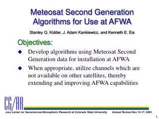
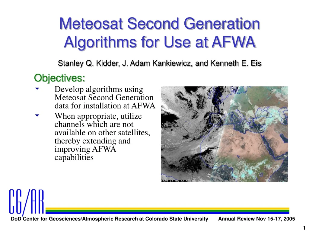
Meteosat Second Generation Algorithms for Use at AFWA. Stanley Q. Kidder, J. Adam Kankiewicz, and Kenneth E. Eis. Objectives: Develop algorithms using Meteosat Second Generation data for installation at AFWA

E N D
Meteosat Second Generation Algorithms for Use at AFWA Stanley Q. Kidder, J. Adam Kankiewicz, and Kenneth E. Eis Objectives: Develop algorithms using Meteosat Second Generation data for installation at AFWA When appropriate, utilize channels which are not available on other satellites, thereby extending and improving AFWA capabilities
DoD Relevance Clouds have a significant impact on DoD operations CI clouds impact reconnaissance, air-to-air refueling operations, and add error to infrared MASINT. Mid-level clouds to fog impact air operations and flight safety as well as air-to-ground operations.
Algorithms Developed Cloud Mask Nocturnal Thin Cirrus Daytime Cirrus Nocturnal Cloud Mask Precipitating Clouds Multi-Channel Skin Temperature Snow/Ice Mask, and Contrail Detection Imagery (Phase I)
Cloud Mask T8.7 • Uses 8.7 µm channel • The warmest pixel in the previous 10 days is used as a background • Pixels colder than the background are cloudy • Over land, radiance difference = 30 W m-2 sr-1 µm-1 • Over water, radiance difference = 7.5 W m-2 sr-1 µm-1 Background Cloud Mask
Cloud Mask Improvements T8.7 • 8.7 um more sensitive than current 10.7 um method • Dynamic background • Uses only satellite data, no model data are used Background Cloud Mask
Nocturnal Thin Cirrus • At night, A3.9 = 1 − L3.9/B3.9(T10.8), where A is albedo, L is observed radiance, B is the Planck function, and T is brightness temperature. • Radiation leaks through thin cirrus from below resulting in a negative albedo. • Algorithm: cirrus (black) are indicated if T10.8 < -30ºC or A3.9 < -0.02.
Daytime Cirrus 255*(A1.6, A0.8, A0.6) • Define Ai≡ πLi/(Sicosζ), whereLi = observed radiance in channel iSi = solar irradiance in channel iζ = solar zenith angle • (Red, Green, Blue) = 255*(A1.6, A0.8, A0.6) • Ice clouds are highly reflective at 0.8 and 0.6 µm, but poorly reflective at 1.6 µm. They therefore appear cyan in the resulting image. • Through color analysis, pick out the cyan points in the image and identify them as daytime cirrus. (Must filter snow.) Cirrus
Nocturnal Cloud Mask T10.8 • Liquid water clouds, as well as cirrus clouds, can be detected at night with the 3.9 µm albedo. • At night, A3.9 = 1 − L3.9/B3.9(T10.8), where A is albedo, L is observed radiance, B is the Planck function, and T is brightness temperature. • Define A8.7≡ 1 − L8.7/B8.7(T10.8) • Form background A3.9 as the A3.9 value which corresponds to the warmest T10.8 in the past 10 days. A3.9 White = Liquid Water CloudBlack = Ice Cloud
Nocturnal Cloud Mask (cont.) T10.8 • Cloud classification • Ice cloud: T10.8 < −30ºC or A3.9 < 0.029 • Liquid Water Cloud: • Over Water A3.9 > 0.18and A3.9 > background A3.9 • Over Land A3.9 > 0.21 andA3.9 > background A3.9 and A8.7 < 0.067 • Otherwise, clear A3.9 White = Liquid Water CloudBlack = Ice Cloud Note: the A3.9 Background test was not applied in these examples
Precipitating Clouds T10.8 • Identifies deep, cold clouds which are likely to be precipitating. • Water vapor is used to screen out low clouds • Precipitation clouds are those for which T10.8 – T6.2 < 11 K (an empirically determined threshold). T6.2 Precipitating Clouds
Multi-Channel Skin Temperature T10.8 • Uses the algorithm of Price (1984), modified for MSG channels • Tskin = T10.8 + 2.5 (T10.4 – T12.0) Tskin
Snow/Ice Mask • Relies on the facts that • Snow/Ice are below the freezing point • The diurnal temperature change of snow/ice-covered surfaces is small • Uses 10 days of hourly 10.8 µm brightness temperatures, i.e., at each pixel there is a 10 24 matrix T10.8
Snow/Ice Mask • The algorithm: • IF MAX(T10.8) > 0ºC, no snow • Form 24-element array Tmax(hour) = MAXday[T10.8(day, hour)] • Calculate average hourly change:
Snow/Ice Mask • Snow/Ice covered if • The test fails if • Cloudiness persists for 10 days • Snow/ice does not persist for 10 days Note: We don’t have a current example of snow/ice cover because it’s the wrong season.
Contrail Detection • Contrails can be identified as near-linear cirrus clouds. They tend to be visible in areas which have naturally occurring thin cirrus. • We offer enhanced imagery which can help an analyst locate areas in which cirrus might occur. • We do not offer a cirrus detection algorithm because MSG imagery, at 3 km resolution, is not sufficient to do this accurately. • During the daytime, the enhanced imagery can be “checked” using the 1-km-resolution HRV (broadband visible) data.
Contrail Detection (cont.) • Two products are suggested to aid the analyst in locating cirrus. • T10.8 – T12.0, scaled between –1 and +6 K (black to white) • T6.2 – T7.3 , scaled between –30 and 0 K
Contrail Detection (cont.) T10.8 – T12.0
Contrail Detection (cont.) T6.2 – T7.3
Contrail Detection (cont.) 1-km Resolution Visible (HRV) Data
Project Status • These eight products have been documented and delivered to Lockheed Martin. Lockheed Martin coded and installed the products at AFWA. We are awaiting AFWA implementation.
Future Plans Validate the algorithms: Compare with CDFS II data MODIS cloud products CloudSat and CALIPSO data Develop improved algorithms for more specific DoD needs (e.g., cloud heights and icing)