Download
1 / 27
270 likes | 276 Views
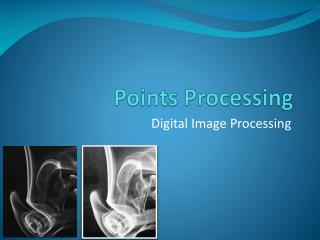
PRESENTATION ON “ Processing Of Satellite Image Using Dip ” by. B a n d a s r e e n i v a s Assistant Professor Department of Electronics & Communication Engineering VIVEKANANDA INSTITUTE OF TECHNOLOGY AND SCIENCE Karimnagar., A.P., INDIA. I M A G E.

E N D
PRESENTATIONON“Processing Of Satellite Image Using Dip”by B a n d a s r e e n i v a s Assistant Professor Department of Electronics & Communication Engineering VIVEKANANDA INSTITUTE OF TECHNOLOGY AND SCIENCE Karimnagar., A.P., INDIA.
I M A G E • A two dimensional signal(analog or digital) that contains intensity (i.e. gray level or colour) information along X and Y axis is known to be an IMAGE “ONE PICTURE IS WORTH MORE THAN TEN THOUSAND WORDS”
DIGITAL IMAGE • Digital image is restricted in both its spatial coordinates and in its allowed intensities. • Their positions and intensities are represented with discrete values, or elements.
What is Digital Image Processing ? Digital Image Processing not a method whose input and output are images but a method whose inputs may be images but whose outputs are attributes extracted from those images. The field of Digital Image Processing refers to processing digital images by means of digital computers i.e. Digital Image Processing is a collection of techniques for the manipulation of digital images by computers. Digital image is composed of finite number of elements, each of which has a particular location and value. These elements are referred to as picture elements or pixel.
Why to process an Image ? • The raw data received from the satellite contains flaws and deficiencies. • To overcome these flaws and deficiencies in order to get the originality of the data, it needs to undergo several steps of processing. • This will vary from image to image depending on the initial condition of the image and the information of interest.
RESOURCES SOURCE OF IMAGE : IRSP-6 SENSOR : LISS-III TOPO SHEET : 55O7 RESOLUTION : 5.8 mts PLACE : RAMTEK, NAGPUR TOOL : ERDAS IMAGINE 8.6
Processing the satellite image using ERDAS IMAGINE It includes….. • Registration of topo sheet • Registration of FCC • Classification Unsupervised classification Supervised classification • Accuracy assessment
What is registration ? • Registration is the process of converting file coordinates into map coordinates. • It can be also called as rectification, and for satellite data it can also be called as geo-referencing of an image. • Geo-referencing is a process of geometrically correcting an image so that it can be represented on a planar surface , in referencing with topo sheet image given by geographical survey of India. • The process of removing the effect of tilt, relief, or other Nonsystematic distortions from imagery, photographs or maps.
Toposheet is a real ground image provided by Geographical Survey of India. It is used to map the satellite images of a particular region. The criteria of mapping the satellite images with the toposheet is called Geo-referencing Topo sheet
Registration of toposheet using GCP(Ground Control Points) tools Registration of TOPOSHEET
Resultant Images …registered …unregistered
False coloUr composite • The display colour assignment for any band of a multispectral image can be done in an entirely arbitrary manner. • In this case the colour of a target in the displayed image does not have any resemblance to its actual colour. • The resulting product is known as a False colour composite image.
Geo referencing of an FCC using GCP tool with original toposheet image Registration of FCC
Raw FCC Registered FCC Resultant images
Swiping the FCC with toposheet • Swiping is a technique used to compare both the images in order to judge whether the rectification is up to the mark
CLASSIFICATION • Multispectral classification is the process of sorting pixels into a finite numbers of individual classes or categories of data, based on their data file values • The overall objective of image classification is to automatically categorize all pixels in an image into land cover classes or themes. • Normally, multispectral data are used to perform the classification, and the spectral pattern present within the data for each pixel is used as numerical basis for categorization. • It has two different categories : -Supervised classification. -Unsupervised classification.
Supervised classification • It is defined as the process of taking samples of known identity to classify pixels of unknown identity. • In supervised classification an operator defines the spectral characteristics of the classes by identifying sample areas ( training areas). • Supervised classification requires that the operator be familiar with the area of interest..
UNSUPERVISED CLASSIFICATION • Unsupervised classifiers do not utilize training data as the basis for classification. • In supervised classification users act as supervisors to identify where as in this the tool itself does the classification. • It performs very well in cases where the values within a given cover type are close together in the measurement space, data in different classes are comparatively well separated by its tools.
Accuracy assessment • Accuracy assessment is a general term for comparing the classification to geographical data that are assumed to be true, in order to determine the accuracy of the classification process. • The goal of accuracy assessment is to determine how accurately pixels were grouped into the correct land cover classes. • Usually, the assumed-true data are derived from ground truth data.
Applications • Image Processing finds applications in the following areas: • Photography and Printing. • Satellite Image Processing. • Medical Image Processing. • Military and Defense. • Face detection and identification. • Archeology and Astronomy.