Download
1 / 46
460 likes | 573 Views
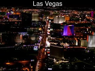
Canopy Analysis Las Vegas Valley. John Watermolen Nevada Division of Forestry. Las Vegas Valley Urban Canopy Analysis. Project funded by a U.S. Forest Service Western Competitive grant, through the State and Private Forestry Program

E N D
Canopy AnalysisLas Vegas Valley John Watermolen Nevada Division of Forestry
Las Vegas Valley Urban Canopy Analysis Project funded by a U.S. Forest Service Western Competitive grant, through the State and Private Forestry Program Thank you to Partners- City of Henderson, UNLV and Southern Nevada Water Authority (SNWA)
Project Description Project was designed to determine the amount of tree canopy in the Las Vegas Valley Tree inventory was also included in the project proposal and an additional ARRA grant
Background During a planning meeting, it was decided that NDF would do most of the work on a valley wide Canopy analysis. Remaining funds from the Canopy analysis would be sub granted to the different municipalities for additional work This would allow for more funding to be available for a Tree Inventory
Workflow UNLV GIS and Remote Sensing lab was sub contracted to create the different land cover layers Land cover classification schema was based on CityGreen definitions
Initial Land Classification Bladed Ground- This layer is composed of land that has been bladed for development. There will be no vegetation on the properties and are usually housing developments that have not been completed. City green classification- Impervious surface-unpaved-dirt or Urban Bare Barren Ground- this is barren ground. It could be next to a golf course fairway or most of a property on larger size parcels. Example if there is a 1 acres parcel with mostly barren ground and a house, just make the whole parcel barren ground. City green classification Arid and Semi Arid Rangeland Sage Brush 30-70% cover or Arid and Semi Arid Rangeland Desert Shrub 30-70% cover Open Space- This later will consist of athletic fields, golf course fairways, greens and sand traps. This could include areas next to schools such as soccer fields. City green classification Grass Scattered Trees-grass cover 50-75% or Grass Scattered Trees-grass cover >75%
Land Classification (cont) Parking lots- This layer consists of large parking lots that would be adjacent to hotels, malls, larger schools, businesses and universities. It would also include runways and general airport lands. City Green Classification Impervious Surface-Paved-Drain to Sewer Buildings-This layer consists of residential, commercial and industrial buildings. In residential areas, complete blocks could be grouped together. In areas of partial development, group houses that are next to each other. Apartment and Condo Complexes include all parking, open space areas. City Green classification Urban or Impervious Surface-Buildings/Structures (could break this out by residential, commercial or industrial Water Features- This layer consist of any ponds in parks, water traps on a golf course, some of the large casino water features. City Green Classification would be Water Area
Final Land Classification Final land classification was, using City Green descriptions: Arid and Semi Arid Rangeland-Sagebrush=Ground cover 30% to 70% Impervious Paved Impervious Drain Sewer-Roads, Parking lots Impervious Unpaved Dirt- Bladed Open Space grass/scattered trees
Final Land Classification Open Space grass/Scattered trees grass cover > 75% (turf) Trees: Grass/turf understory ground cover > 75% Urban: Commercial/Business Urban: Residential Urban: Western Desert Water Area
Results from CityGreen Analysis Snapshot of results from the City Green Analysis Las Vegas Valley-Project Area Within Project Area City of Las Vegas City of Henderson City of North Las Vegas Unincorporated areas of Clark County
Results using incorporated boundaries Did a CityGreen analysis-using the boundaries for: Las Vegas Henderson North Las Vegas
Ecosystem BenefitsIncrease Canopy Cover Increasing Canopy Cover can mitigate Air Pollution, Water Quality and Water Quantity (Runoff) for the Las Vegas Valley
Ecosystem BenefitsIncrease Canopy Cover Increasing Canopy Cover can mitigate Air Pollution, Water Quality and Water Quantity (Runoff) for the Las Vegas Valley
Ecosystem BenefitsIncrease Canopy Cover Increasing Canopy Cover can mitigate Air Pollution, Water Quality and Water Quantity (Runoff) for the Las Vegas Valley
Ecosystem BenefitsIncrease Canopy Cover Increasing Canopy Cover can mitigate Air Pollution, Water Quality and Water Quantity (Runoff) for the Las Vegas Valley
Canopy Cover-Zoning A generalized zoning layer was developed by UNLV. 11 different zoning categories CityGreen analysis done for each zoning category for each entity
Canopy Cover-Zoning The zoning map was prepared by merging the landuse maps of the individual cities. In the merging process, careful attention was given to the merging of the different classification schemes used by the cities. Process for creating a Las Vegas valley zoning map began with researching available data of designated city land use boundaries and government zone policies. Each city website had PDF’s of their zoning map and of the building code which defines land use characteristics. Shapefiles of the zoning maps were accessible at the Clark County GIS Management Office website (GISMO).
How does Las Vegas Compare Las Vegas Valley 8.6% City of Las Vegas 13% City of Henderson 7% City of N. Las Vegas 5.5% Unincorporated 7.7% Truckee Meadows 4.5% Denver, CO 10% Salt Lake City, UT 10% Albuquerque, NM 6%
What’s next Heat Island Study by UNLV-in progress Additional Canopy Analysis such as planting areas-City of Henderson-completed Tree Inventory of public tree-in progress Redo Canopy Analysis in 5 to 10 years
UNLV Heat Island Study This project is an extension of Las Vegas landcover mapping project. We are develop urban thermal model for Las Vegas valley to understand the thermal entrapment that leads to urban heat islands. In this work, we are also investigating the landcover changes over last 30 years using LandSat imagery. This would help link the urban heat island development to the urban sprawl.
City of Henderson Updated Tree canopy using 2010 NAIP imagery Possible Planting Area (PPA) – Open space turf grass Open space other landscaping Parking lots Henderson CommunityViz Analysis: Galleria Parking Lot Analysis including examples of potential costs and benefits for tree planting scenarios including existing tree canopy UTC assessment metrics for HOAs, bus stop buffers, CDBG eligible census tracts, and parcels in the downtown redevelopment area to determine PPA
Questions John Watermolen-Nevada Division of Forestry (775) 684-2530 jwatermo@forestry.nv.gov http://forestry.nv.gov/forestry-resources/urban-tree-canopy-assessment-projects/