Download
1 / 30
300 likes | 414 Views
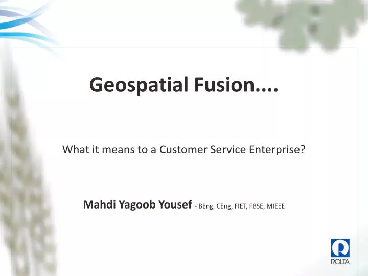
Geospatial Fusion.... What it means to a Customer Service Enterprise? Mahdi Yagoob Yousef - BEng, CEng, FIET, FBSE, MIEEE. Background.

E N D
Geospatial Fusion.... What it means to a Customer Service Enterprise? Mahdi Yagoob Yousef- BEng, CEng, FIET, FBSE, MIEEE
Background Geospatial Fusion fuses the information, applications and processes of an enterprise into a seamless architecture and world class offering. Geospatial Fusion extends the value of legacy systems, GIS, investments in operational and engineering data and enterprise business applications by enabling cross functional integration and creating spatial business and operational intelligence.
Fault Management System Asset Management System Custom Application Custom Application Asset Data Edit Database AssetDatabase Fault Database CRM Disjointed Development Over the Years Having each of these different departmental systems is not wrong in and of itself, provided they are not left as silos. A strategy is needed to bridge the gap between them, allowing an organization to benefit from their combined value. Manage CustomerCalls Needs (Business Processes) Manage Faults Manage Assets Update Data Tools (Applications) Resources (Data) Information Silos Have been Created
Supplier Strategy Changing the Geospatial Paradigm Comprehensive Solutions for Vertical Markets Solutions and Services Domain Expertise Utilities & Communications Transportation GIS Defense Dispatch & Public Safety Land Records and Hydrology Technical Services Data Migration across platforms Thematic Mapping Managed GIS Services Subscription based GIS Services GIS Analysis & Workflow Management Photogrammetry and Imaging LIDAR Data Processing Aero-triangulation 3D Terrain Modeling True Orthophoto Creation Digital Cartography 3D Terrain/Surface Modeling Solutions and Services Geospatial FusionTM Solutions Industry-specific Solutions Mobile Geospatial Solutions Workflow Management Geospatial Business Intelligence Spatial Visualization Business Process Analysis Integration of disparate Geospatial and Non-Geospatial Databases Platform-neutral Implementations Usability Enhancement High-end Consulting Services Domain-specific Solution Architecture Requirements Analysis GIS Data Modeling and Security Work-flow Analysis and Design Integration Strategy Process re-engineering Defense Transportation Government & Infrastructure Utilities & Telecom Rolta Geospatial Fusion - Enterprise GIS Integrator TM Rolta OnPoint TM Rolta iPerspective TM Rolta Periscope TM Other Rolta IP/Toolkits Platform-neutral Interfaces Oracle Enterprise Asset Mgmt ESRI Arc/GIS Server Shape Geodatabase Minar & Minar Telcordia Intergraph Geomedia Webmap Geomedia GeoMedia Pro G/Technology FRAMME Others Map Connectors MapInfo Microstation Autocad Oracle Spatial SQL Spatial Smallworld Cadcorp Virtual Earth SAP Rolta GIS Framework Database Connectors For Heterogeneous platforms ERP Azteca Asset Mgmt Google Comprehensive Services Comprehensive Services OGC Others Business Intelligence Pictometry Data Service Providers Business Application Connectors Database Connectors Integration with GIS Platforms Standards Relational and other Databases Microsoft Access, Sybase, SQL Server, DB2, + 100s of other database Rolta Photogrammetry Suite Rolta Imaging Suite Data Capture, Analysis, Image Manipulation and Photogrammetric Mapping Solutions
Information Dashboard We’ve all seen television news screens like this. • They include: • Video News Coverage • News Headlines • Time • Weather Forecast • Sun rise/set times • Traffic Videos • Exchange Rates • Sport schedules and scores • Stocks……. Etc. The display is designed to give us a broad scope of what’s important...at a glance, “What will be important for us to know before we proceed with our day?”
What is OnPoint? Business System Databases …And The Stuff You NeedIs Way Over Here… Geodata Asset Management Other useful Data PIMS How Do You “Pull It All Together?” …And Over Here. Microstation PDF Word You’re Over Here... Documents and Drawings User
What is OnPoint? Business System Databases You Have Content Providers • ArcIMS and ArcGIS Server for Geographic Data ArcIMS ArcGIS Server Other useful Data Asset Management PIMS Geodatabase • Other Business Systems for their data Other Business Systems • Document Viewers & Document Management Systems for file based content Microstation Word PDF It All Keeps You Very Busy. ! Document Viewers Documents and Drawings Document Management System User
What is OnPoint? Business System Databases Now… How Does This Change With OnPoint? ArcIMS • Geographic Data still comes through ArcIMS or ArcGIS Server • You can tie it all together with OnPoint. • You can also include subscription data… ArcGIS Server LIMS (Observation Data) Asset Management (Ellipse) Geodatabase PIMS Virtual Earth Google Earth Other Data • …or OGC content. • Not only that, but a wealth of OnPoint functionality out of the boxlet you do so much more without any programming • Business System Data Can Come Direct… Other Business Systems • …or by interaction with the Business System. • Documents Can Come Direct… • …or through your Document Systems Microstation Word PDF Document Viewers Virtual Earth Documents and Drawings Google Earth Document Management System OGC-WFS MapPoint User OGC-WMS
Database - After Enterprise Data Model Custom Application Custom Application ORMS AMS/FM Corporate Databases Overall Enterprise Data Model Updated Wood Pole Data Manage Customer Meters Manage System Outages Manage Distribution Assets Needs (Business Processes) Tools (Applications) Distribution Network Asset Connectivity Resources (Data) Distribution Network Wood Poles Distribution Network Assets Distribution Network Meters Distribution Network Wood Poles Distribution Network Assets Distribution Network Asset Connectivity Distribution Network Meters
Geospatial Fusion Users Water Resource Google GeoSpatialFusionTM Asset Management Virtual Earth Financial DocumentManagement System Microstation Word Environmental PDF GIS ESRI GIS Intergraph GIS Others
Application Example In a typical portal, the user would login, ...then begin by selecting a theme area available to them. We’ll continue this example, with the user selecting BUILDING PERMIT. SURVEY Topographic Hydrographic Cadastral BUILDING PERMIT CUSTOMER SERVICE PROJECT TRACKING
DemonstrationExample - SharePoint Integration • Selecting BUILDING PERMIT takes the user to a screen filled with details pertinent to building permits • Map with active building permits (an OnPoint Web-Part) • List of all permits • Bar chart of permit types • Pie chart showing permits per municipality
DemonstrationExample - SharePoint Integration The user may choose to select a number of permits... ...and then close them. Search Actions ID Type Location Municipality Status Inspector Edit Permit Plumbing Abu Dhabi Close Permit Close Permit Open Abdullah Clear Results Apply Apply Exit Result Found 17 records that match your criteria.
DemonstrationExample - SharePoint Integration The user may choose to select a number of permits... ...and then close them. Changes are immediately reflected in the other panels of the dashboard.
Value of Real Estate Sales BHD M % Distribution of Real Estate Sales Price Fluctuation over time BHD PER FOOT 01 02 03 04 05 06 07 08 09 10 11 12
Performance of Survey Operations Statistics of Survey Jobs by Month
Class-1 Class-2 Class-3 Class-4 Class-5 Class-6 Registration Jobs in Progress Number of Registration Jobs
Transportation Example Dubai Roads & Transport Authority On Their Public Site: On Their Internal Site: • Customers can of course examine the routes and stops • They may also want to check out what the stations look like • Or find a parking spot • Staff can manage asset information • And bring up engineering drawings associated with those features
Local Gov Utilities Example City of Cambridge, Ontario Canada In Cambridge, they have an impressive integration between IBM’s Maximo Asset Management System, and their web-GIS • Staff get a full picture of their operation • By clicking on job tickets, they can map them • And generate a print/plot
Economic Development Example Georgia Power Have They Been Successful? ...Consider These Statistics... • Use • Number of Internal Users - 40 • Average number of visits per month - 9700 • Business Impact(June – December 2008) • Customer: • SelectGeorgia provides executives, who are considering moving or a establishing their business in Georgia, a chance to see the characteristics and estimated costs of building properties or location sites through a virtual, user customizable, web-based system. • Financial: • More than $1.3 billion in new capital investment to the state • More than 5,800 new jobs for Georgians • Positive impact on Southern Company revenues • Operational: • 75% reduction in related software maintenance • 70% reduction in Community and Economic and Development organization’s maintenance labor Although it’s a utility, Georgia Power has a significant Economic Development presence, and is the primary site for investors considering Georgia • They have an amazing site that pulls together data from numerous sources; factors the investor must consider when looking for a suitable site • The investor narrows their search, and print reports that detail those factors
Waste Management Environment Example Solid Waste Authority In West Palm Beach Florida, the Solid Waste Authority has the challenge of monitoring the environmental impact of waste disposal • A mountain of data must be monitored in a spatial context • Trends must be analysed, and reported on, and submitted to the US Federal Department of Environmental Protection (FDEP)
Provincial/State Government Example Ontario Ministry of Municipal Affairs At the Ontario Ministry of Municipal Affairs in Canada, data is examined from over 400 municipalities • Factors such as financial health, demographic trends, service availability, and landuse related concerns are examined • Data isn’t simply examined as-is. It’s analyzed in context with features in proximity.
Thank you Mahdi Yousef [M.Yousef@roltaus.com] www.rolta.com