Download
1 / 11
120 likes | 590 Views
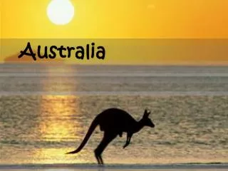
UNIT FIVE:. Australia, Oceania, & Antarctica Physical Geography. Australia. Great Dividing Range – Breaks up Australia’s level landscape. Stretches from Australia’s eastern coast to Tasmania. Most of Australia’s rivers start within the Great Divide. The Great Barrier Reef –

E N D
UNIT FIVE: Australia, Oceania, & AntarcticaPhysical Geography
Australia • Great Dividing Range – Breaks up Australia’s level landscape. • Stretches from Australia’s eastern coast to Tasmania. • Most of Australia’s rivers start within the Great Divide.
The Great Barrier Reef – • The world’s largest coral reef. • Contains more than 2,500 small reefs. • Extends 1,250 miles long
Natural Resources • 10% of the land is farmable. • Examples: Wheat, Barley, Fruit, and Sugarcane. • Ranching cattle, sheep, and chickens. • Very rich in natural resources.
Oceania • Island Groups • Melanesia – “Black Islands” • Lies north and east of Australia. • Micronesia – “Tiny Islands” • Located north of Melanesia. • Polynesia – “Many Islands” • Stretches from the Midway Islands to New Zealand.
Island Types • High Islands – Formed by volcanoes and earthquakes • Some Agriculture is supported by the volcanic soil. • Example: Tahiti • Low Islands – • Atoll – Ring shaped Islands. • Lagoons – Shallow pools of clear water and usually rise only a few feet about sea level. • Low Islands contain very little soil and resources. • Continental Islands – • Formed by the rising and folding of ancient rock from the ocean floor. • Coastal areas consist of plains, swamps, and rivers. • Interior areas consist of volcanoes, mountains, and valleys.
New Zealand • North Island • Lined with golden beaches, forests, and rich soil. • The Central Plateau is full of hot springs and active volcanoes. • Mt. Raupehu is the Island’s highest point.
South Island • Southern Alps – are located along the western edge of the island. • Aorangie“Cloud Piercer” • is also known as Mt. Cook • Sits at 12,316 ft high. • Natural Resources • New Zealand is filled with fertile volcanic soil, which greatly benefits the country’s economy.
Antarctica • Climate in Antarctica is Ice Cap • The lowest Temperature ever recorded was -126 degrees. • However, West Antarctica has a mild climate that reaches above freezing in January. • The Land • Contains several active Volcanoes. • The highest point is Vinson Massif at 16,066 ft.
Animal/ Plant Life • Temperature and isolation have made plant life and animal life difficult. • Most vegetation consists of Algae, Lichens, and mosses • Animals are found in and around the Antarctic Ocean. • Ex. Penguins, whales, and seals • Natural Resources • 1% of the land has been surveyed and proven to be very rich in resources. • Ex. Coal, copper, lead, zinc, silver, gold, oil, and natural gas.
Climate • Humid Subtropical • Located in Oceania and New Zealand • Average precipitation in 80 in. • Filled with tropical forests and grasslands. • Desert • Located in Australia’s Western Plateau • Sparse rainfall and plant life • Steppe • Receives about 10-20 in. of rain a year. • Located around Australia’s Western Plateau