Download
1 / 7
110 likes | 560 Views
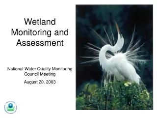
Wetland Classification and Assessment. Why the emphasis on wetlands. Wetlands are aquatic systems that has been and continues to be lost at a rapid rate These ecosystems provide numerous ecological services that would cost the public significant amounts of money to duplicate

E N D
Why the emphasis on wetlands • Wetlands are aquatic systems that has been and continues to be lost at a rapid rate • These ecosystems provide numerous ecological services that would cost the public significant amounts of money to duplicate • Many entities (including the public) do not understand their value • Large numbers of our endangered species are located in wetlands
Wetland delineation • Many federal, state, and local agencies, private organizations, and landowners need to identify or delineate the boundaries of wetlands for a variety of purposes • Each agency may be required to use one or more federal, state, or local laws or guidelines defining wetlands in specific ways.
Who has responsibilities for wetlands • U.S. Army Corps of Engineers (Corps) administers the Section 404 program governing the discharge of dredge and fill material into waters in the U.S. as defined and guided by Section 404 of the Clean Water Act. • The wetlands which fall within the Section 404 regulation are referred to as jurisdictional wetlands. • The U.S. Fish and Wildlife Service scientists and many other scientists, land use planners, and watershed or water quality managers, utilize the Cowardin system for more in-depth identification or classification of wetlands.
What you already know about wetland classification • Cowardin Wetland and Deepwater Systems • The following is a brief description of the major classes of wetlands under the Cowardin system. Marine - Open ocean overlying the continental shelf and coastline exposed to waves and currents of the open ocean shoreward to (1) extreme high water of spring tides; (2) seaward limit of wetland emergents, trees, or shrubs; or (3) the seaward limit of the Estuarine System, other than vegetation. Salinities exceed 30 parts per thousand (ppt). • Estuarine - Deepwater tidal habitats and adjacent tidal wetlands that are usually semi-enclosed by land but have open, partly obstructed, or sporadic access to the ocean, with ocean-derived water at least occasionally diluted by freshwater runoff from the land. The upstream and landward limit is where ocean-de rived salts measure less than .5 ppt during the period of average annual low flow. The seaward limit is (1) an imaginary line closing the mouth of a river, bay, or sound; and (2) the seaward limit of wetland emergents, shrubs, or trees when not included in (1). • Riverine - All wetlands and deepwater habitats contained within a channel except those wetlands (1) dominated by trees, shrubs, persistent emergents, emergent mosses, or lichens, and (2)which have habitats with ocean-derived salinities in excess of .5 ppt. • Lacustrine - Wetlands and deepwater habitats (1) situated in a topographic depression or dammed river channel; (2) lacking trees, shrubs, persistent emergents, emergent mosses, or lichens with greater than 30% areal coverage; and (3)whose total area exceeds 8 hectares (20 acres); or area less than 8 hectares if the boundary is active wave-formed or bedrock or if water depth in the deepest part of the basin exceeds 2 m (6.6 ft) at low water. Ocean-derived salinities are always less than .5 ppt. • Palustrine - All nontidal wetlands dominated by trees, shrubs, persistent emergents, emergent mosses, or lichens, and all such tidal wetlands where ocean-derived salinities are below .5 ppt. This category also includes wetlands lacking such h vegetation but with all of the following characteristics: (1) area less than 8 ha; (2) lacking an active wave-formed or bedrock boundary; (3) water depth in the deepest part of the basin less than 2 m (6.6 ft) at low water; and (4) ocean-derived salinities less than .5 ppt. • A Palustrine system can exist directly adjacent to or within the Lacustrine, Riverine, or Estuarine systems.
What you already know about wetland classification • Wetland indicators of deliniation • Hydric plants (hydrophytic vegetation) • Hydrology • Hydric soils
Interesting, right? This is just a sneak preview of the full presentation. We hope you like it! To see the rest of it, just click here to view it in full on PowerShow.com. Then, if you’d like, you can also log in to PowerShow.com to download the entire presentation for free.