Download
1 / 35
350 likes | 356 Views
Test of forest classification over Bavaria (Germany) using a SPOT-VGT pixel mosaic. Erwann FILLOL, Pamela KENNEDY, Sten FOLVING. Objectives. To create a cloud-free image of Europe by pixel compositing SPOT-VGT S1data

E N D
Test of forest classification over Bavaria (Germany) using a SPOT-VGT pixel mosaic Erwann FILLOL, Pamela KENNEDY, Sten FOLVING
Objectives • To create a cloud-free image of Europe by pixel compositing SPOT-VGT S1data • To evaluate the efficiency of the Maximum NDVI / Minimum Red (MaNMiR) pixel compositing method in discriminating three types of forest cover: Evergreen, deciduous, and mixed through classic classification methods
Databases • SPOT-VGT S1 : 45 daily acquisitions for the months of July and August, 2000 for all of Europe • CORINE Land Cover database (CLC) : 44 classes for 3 hierarchical levels (Artificial surfaces, Agricultural areas, Forests and semi-natural areas),obtained in part using Landsat TM imagery (resolution: 100 meters)
Pre-processing: Compositing MASKING • Cloud cover (Lissens et al.) • if blue> 0.36 and swir> 0.16 Cloud • Dilation of cloud cover – 5kmx5km window • Elimination of cloud shadow • Scan angle limitation • If v > 45° Ground resolution degradation • SWIR detector defects • If swir > 0.75 SWIR defect • Hot-Spot and Specular limitation
Pre-processing: Compositing MASKING • Cloud cover (Lissens et al.) • if blue> 0.36 and swir> 0.16 Cloud • Dilation of cloud cover - 5x5 window • Elimination of cloud shadow • Scan angle limitation • If v > 45° Ground resolution degradation • SWIR detector defects • If swir > 0.75 SWIR defect • Hot-Spot and Specular limitation
Pre-processing: Compositing MASKING • Cloud cover (Lissens et al.) • if blue> 0.36 and swir> 0.16 Cloud • Dilation of cloud cover - 5x5 window • Elimination of cloud shadow • Scan angle limitation • If v > 45° Ground resolution degradation • SWIR detector defects • If swir > 0.75 SWIR defect • Hot-Spot and Specular limitation
Pre-processing: Compositing MASKING • Cloud cover (Lissens et al.) • if blue> 0.36 and swir> 0.16 Cloud • Dilation of cloud cover - 5x5 window • Elimination of cloud shadow • Scan angle limitation • If v > 45° Ground resolution degradation • SWIR detector defects • If swir > 0.75 SWIR defect • Hot-Spot and Specular limitation
s h s d hmin=2km hmax=12km Cloud shadow elimination • Solar zenith and azimuth angles are known • Cloud height minimum and maximum are estimated • The distance [d=h/tan(90- s)] and direction of the cloud shadow can be estimated
Pre-processing: Compositing MASKING • Cloud cover (Lissens et al.) • if blue> 0.36 and swir> 0.16 Cloud • Dilation of cloud cover - 5x5 window • Elimination of cloud shadow • Scan angle limitation • If v > 45° Ground resolution degradation • SWIR detector defects • If swir > 0.75 SWIR defect • Hot-Spot and Specular limitation
Pre-processing: Compositing MASKING • Cloud cover (Lissens et al.) • if blue> 0.36 and swir> 0.16 Cloud • Dilation of cloud cover - 5x5 window • Elimination of cloud shadow • Scan angle limitation • If v > 45° Ground resolution degradation • SWIR detector defects • If swir > 0.75 SWIR defect • Hot-Spot and Specular limitation
Pre-processing: Compositing MASKING • Cloud cover (Lissens et al.) • if blue> 0.36 and swir> 0.16 Cloud • Dilation of cloud cover - 5x5 window • Elimination of cloud shadow • Scan angle limitation • If v > 45° Ground resolution degradation • SWIR detector defects • If swir > 0.75 SWIR defect • Hot-Spot and Specular limitation
90 hotspot dhs dspec specular dcruxhs dcruxspec 180 Hot-Spot and Specular limitation To minimise directional effects, the acquisitions situated near the hot spot and specular zones (± 20°) are eliminated
Resulting mask Image: 26th of August 2000
Resulting mask Image: 26th of August 2000
Resulting mask Image: 26th of August 2000
Resulting mask Image: 26th of August 2000
Pre-processing: Compositing DOUBLE CRITERIA COMPOSITING • Double criteria compositing : • Maximum NDVI (MaN), to eliminate haze and unscreened pixels top 15% retained • Minimum reflectance in the red channel (MiR), to limit atmospheric effects and enhance green vegetation D’Iorio and al., 1991
MaN Classic Raw image (August 26th 2000) MaNMiR Composite result
Test area : Bavaria (Germany) Corine classification Resolution : 100 m
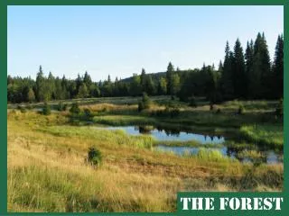
300 km 200 km Test area : Bavaria (Germany) • Test site selection based on: • little topographic effect • 3 forest types present: coniferous, deciduous, mixed • site is representative of temperate forests Corine classification Resolution : 100 m
Test area : Bavaria (Germany) Corine classification Resolution : 100 m
Classification • Maximum Like-lihood algorithm • Training site selected over a homogeneous area (according to Corine classification) • Using channels SWIR, NIR & Red • 3 classes : Coniferous, deciduous, mixed forests
Coniferous forest Broad leaved forest Mixed forest Spectral separability SWIR reflectance SWIR reflectance NIR reflectance Red reflectance NIR reflectance Red reflectance
Classification Results Corine classification SPOT-VGT composite
Coniferous forest Broad leaved forest Mixed forest Classification Results Corine classification SPOT-VGT composite
Coniferous forest Broad leaved forest Mixed forest Classification Results Corine classification SPOT-VGT composite Dense forest zones most accurately classified Over estimation in sparse forest due to surrounding (pasture)
Coniferous forest Broad leaved forest Mixed forest Classification Results Corine classification SPOT-VGT composite
Coniferous forest Broad leaved forest Mixed forest Classification Results Corine classification SPOT-VGT composite Under estimation in sparse and fragmented forest. Surrounding : Non-irrigated arable land
Composition of actual land cover (based on CLC) classified as Coniferous according to SPOT-VGT Coniferous from SPOT-VGT
Composition of actual land cover (based on CLC) classified as Broad-Leaved according to SPOT-VGT Broad-Leaved from SPOT-VGT
Composition of actual land cover (based on CLC) classified as Mixed Forest according to SPOT-VGT Mixed from SPOT-VGT
Composition of actual land cover (based on CLC) classified as Non-Forest according to SPOT-VGT Non-Forest from SPOT-VGT
High Medium Low Classification sensitivity to sub-pixel forest density
Conclusions and discussion • High quality composites are possible with Spot-VGT • High potential in discriminating dense coniferous wood-land • Must be careful with area estimation of forest cover in Europe, especially in fragmented and mixed forest • Potential of combining medium resolution radiometer like IRS-WiFS (200m resolution) and low resolution SPOT-VGT