Download
1 / 33
340 likes | 458 Views
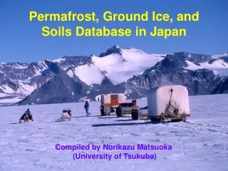
THE UNIVERSITY OF WISCONSIN PERMAFROST/GROUND ICE/SOILS DATABASE J.G. Bockheim. Areas:. McMurdo Dry Valleys Transantarctic Mountains Darwin Glacier area Beardmore Glacier area North Victoria Land Ellsworth Mountains. Antarctic Soils Database:.

E N D
THE UNIVERSITY OF WISCONSIN PERMAFROST/GROUND ICE/SOILS DATABASEJ.G. Bockheim
Areas: • McMurdo Dry Valleys • Transantarctic Mountains • Darwin Glacier area • Beardmore Glacier area • North Victoria Land • Ellsworth Mountains
Antarctic Soils Database: • 473 sites throughout McMurdo Dry Valleys (MDV) • Surface boulder lithology, frequency, and weathering features • Detailed soil descriptions • Observations of patterned ground, permafrost, and ground-ice forms • Laboratory characterization of 46% of soils • Classification of soils in SOIL TAXONOMY, WRB
Unique Features of Antarctic Soils Database: • Product of pedologist-glacial geologist/geomorphologist with goal to reconstruct glacial history of MDV • Description and sampling protocol unchanged over 12-yr period (1975-1987) • Rigorous protocol for site/soil descriptions and laboratory characterization • Soil pits dug by hand to at least 1 m • Standard soil horizon nomenclature applied with some adaptations • Soils classified into ST, WRB
Approach: 1975-1987 • Select site according to “master relative chronology” • Locate on aerial photograph, topographic map (1:50,000) • Determine corrected elevation • Randomly locate plot on moraine crest • Measure surface boulder weathering features • Describe and sample modal soil profile • Restore site • Characterize soils in laboratory 1999-2000 • Electronic storage of data • GIS (ArcInfo) 2000-present -- Utilize data for constructing permafrost/ground ice and soil maps
Excavating Soil in Upper Arena Valley
Describing and Sampling Soil in Wright Valley
http://bonney.sr.unh.edu A GIS For The McMurdo Dry Valleys, Antarctica TheVALMAP (Valleys in Antarctica: Layered Mapping, Analysis, and Planning) Project has produced a Geographic Information System for the McMurdo Dry Valleys, Antarctica, referred to as the MDV GIS. The MDV GIS contains, in a single projection, layers of mapped information, such as images, topographic contours, and geology, to which data are attached according to the "coverage geographic data model" of the Environmental Systems Research Institute (ESRI).
Sand-wedge casts Recession of ice-cemented Permafrost in the MDV
Conclusions: • Dry permafrost pervasive in IVF and on older surfaces in IVS and UV • Ground-ice features are common in the MDV • Sand-wedge casts offer promise in reconstructing paleoclimate • Soil development rates: IVF > IVS, UV > PF > C • 70% of soils of MDV are Anhyorthels reflecting lack of cryoturbation because of low soil moisture