Download
1 / 20
200 likes | 298 Views
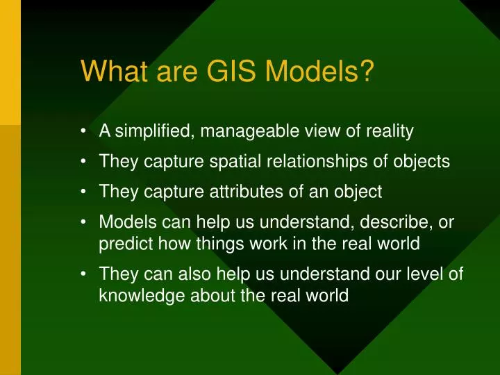
What are GIS Models?. A simplified, manageable view of reality They capture spatial relationships of objects They capture attributes of an object Models can help us understand, describe, or predict how things work in the real world

E N D
What are GIS Models? • A simplified, manageable view of reality • They capture spatial relationships of objects • They capture attributes of an object • Models can help us understand, describe, or predict how things work in the real world • They can also help us understand our level of knowledge about the real world
Flour Put in a OVEN At 300° F Sugar MIXED DOUGH Baking Soda BREAD A cooking recipe is a model
Models are of many different types A model could bea theory, a law,a hypothesis,an equation,or evena structured idea Common types of GIS Models: • Representation • Process: • suitability • distance • surface • hydrologic From Haggett and Chorley, 1967
What is Spatial Modeling ? The process of manipulating and analyzing spatial/geographical data to generate useful informationfor solving complex problems
Reality Why Spatial Modeling ? Homes School Districts Streets Zip Codes Cities Counties Finding relationships among geographic features to understand and address any particular problem Source: ESRI
Systematic distortions in world fisheries catch trends Reg Watson & Daniel Pauly, Nature November 29, 2001 Catch predictions based upon: depth, primary productivity, ice cover, surface temperature, latitude, distance from shore, Upwelling index, 33 biogeochemical provinces, “coastal biome”
Sequence of events • In the 1970s biologists predicted that global fishery catches would start declining in the 90’s. • However, based upon reported catches by the different countries global catches continued to increase. • It was attributed to better technology & unknown fish stocks. • The Watson & Paul model implied there was a problem with the numbers of fish China was reporting. • China rewarded their officials for reporting large catches which encouraged false reporting. • The world’s fisheries maybe in much worse shape than expected.
Differences between fish reported and fish predicted
Modeling Spatial Problems • Are you asking the right question? • Do you have the data to answer your question? • Does the accuracy and resolution of the data meet the demands of your question? • Do you have a good understanding of the objects in the real world that you are trying to model?
ArcMarine – Data Extraction Models to automatically extract environmental data layers for spatio-temporal analysis Model: Get-SST AML to Modeler conversion at ArcGIS 9.x From Marine Data Model Technical Workshop, 2005 ESRI UC, Halpin et al.
Overview of ArcGIS Increasing Functionality from ArcView to ArcInfo ArcReader is freeware. ArcGIS Extensions give added functionality to the software.
ArcGIS • ArcCatalog: database design and data management • ArcMap – map making, editing, spatial analysis • ArcToolbox – opens within ArcCatalog or ArcMap and it is, in essence, a huge toolbox