Download
1 / 8
80 likes | 197 Views
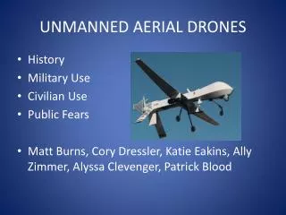
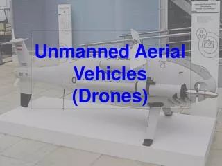
Feasibility of Unmanned Aerial Vehicles(UAVs) for UN Peacekeeping Operations. Ravisha Joshi Kemboi beatrice. Introduction & Problem Statement. U AV is an aircraft without a pilot onboard and its controlled from ground using a remote control system or operated autonomously .

E N D
Feasibility of Unmanned Aerial Vehicles(UAVs) for UN Peacekeeping Operations Ravisha Joshi Kemboibeatrice
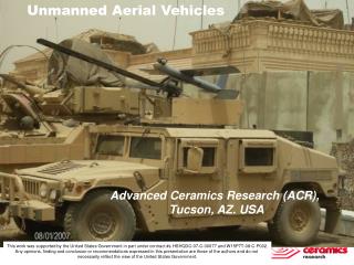
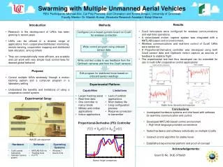
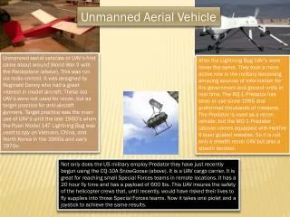
Introduction & Problem Statement • UAV is an aircraft without a pilot onboard and its controlled from ground using a remote control system or operated autonomously. • DPKO has suggested the use of this technology in the following missions. • MONUSCO (DRC) for monitoring the movements of armed groups. • UNIFIL (Lebanon) for surveillance and protection. • UNMISS (South Sudan )for effective surveillance over large area to protect the civilians. • EUFOR (Chad) for aerial photography to assess the situation on ground to detect vehicles and people gathering. Problem Statement • Ground based surveillance methods have limited field of view and risk the exposure of personnel to dangers. • Aerial surveillance provides good coverage and wider area of observation. • use of manned aircraft is expensive and is prohibited under UN rules to fly at night as it does not possess night time search and rescue capabilities. • UAV offer a better option as they are cheap to operate and can provide night surveillance.
Method • UAVs platforms: kites, balloons and model helicopters
Products • Block of photos. DSM Orthophoto Point cloud
Applications for UN Peacekeeping operations • Evidence in the form of images and videos which political analysts can use to derive political conclusions of what is happening on the ground. • For early warning of armed group’s movements and monitor camps for internally displaced persons • Generate maps in disaster hit inaccessible areas and upload to OpenStreetMaps which can be utilised by other organizations offering aid . • Map the extent and boundaries of the refugee camps and assess the patterns in the camps. • DTM generated can be used for planning of potential areas to put up camps. • Point cloud could be used for 3D modelling and Change detection. • Images and videos to create inventory of the area of interest to assess the situation. • In future, the UAVs could be merged with robotics or artificial intelligence capable of recognising the scene and change the flight path if they encounter any obstructions.
Advantages and limitations • Quick results in form of images /videos even of inaccessible areas for initial assessment and planning. • UAVs can be deployed at any time of the day or night and provides datawith high temporal and spatial resolution. • autonomous flight will reduce human dependency to operate on high risk areas. • Inexpensive and can be controlled and transported with ease. • Limitations • Sensitive to adverse weather conditions and the data may not be as expected. • Performances and the accuracy of low cost UAVs are not very good. • Skilled operators are required for data and information analysis. • Could be regarded as overly intrusive by host nations if not adequately controlled and may hinder trust among neighbouring countries.. • Who will be the custodian of the data and information? • The topography of the area should also be considered.
Regulations,Conclusionand recommendations • Existing regulations • The drones deployed should be unarmed surveillance assets designed to collect information with no strike function. • Skilled personnel are required for operation of UAV and data analysis. Conclusions • UAV for mapping in DPKO can be a milestone and will provide real time information for quick monitoring and early warning. • Assessment of the situation in the camps can benefit from this technology in that preventive measures can be taken against diseases such as cholera outbreak. Recommendations • Clear rules and regulation should be formulated to guide the use of drones and address the concerns raised by different countries. • Custodian of the data should be clearly discussed and agreed upon between the UN and the government of the host country. • Extent of its use in a mission and stage at which it is allowed should be clearly specified.