Download
1 / 20
200 likes | 393 Views
Land Use and Population Change in the Coastal Ecosystem. Dave Clark NOAA/National Geophysical Data Center C-GTOS Working Group Meeting March 3-6, 2003 Ispra, Italy . Direct Forest Cover Change Vegetation Cover and Height Class Leaf Area Index Surface Roughness Topography

E N D
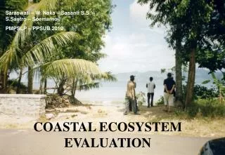
Land Use and Population Changein the Coastal Ecosystem Dave Clark NOAA/National Geophysical Data Center C-GTOS Working Group Meeting March 3-6, 2003 Ispra, Italy
Direct Forest Cover Change Vegetation Cover and Height Class Leaf Area Index Surface Roughness Topography Morph-Tectonics Basin ID Eco-systems Length of Growing Period Cultivation Intensity Acreage Converted to pasture/agriculture. Desertification rate Dry Surface Area (% exposed land) Indirect Albedo Carbon Dioxide Flux Soil Carbon Content Evapotranspiration Water Storage Fluxes Biogeochemical Trans. Land to Ocean Soil Annual Loss /Erosion Soil Depth Soil pH Soil Infiltration Rate Soil Type Habitat Conversion/Fragmentation Land Use/Land Cover Variables/Indicators
Direct Total Population Urban Population Population Density Physiologic Density # Resident Population # Transient Population Age Distribution Population Growth Rate Pop. Living Below Poverty Line Pop. Engaged in Infrml. Econ. Act. Indirect Conventions Ratified Pollution Abate/Contr. Expend. Microbial water-born disease Safe Water Sanitation Runoff Municipal Wastes Water Balance Water Use Intensity Winter Gales Natural Disasters Human Development Index Gross Domestic Product Per Capita Income Environmental Sustainability Index Energy Use Motor Vehicle Network # and Size Dam Projects Land Area Protected Forest Deforestation Forest Total Area Labor Force in Agriculture Arable Land Pesticide Use Fertilizers Human Population Variables/Indicators
Other Relevant Activities Using Indicators • Land Use/Land Cover Change • Core IGBP project, like LOICZ • International Human Dimensions Program on Global Environmental Change
Population and Land use • From US Pew Oceans Commission’s Report “Coastal Sprawl: The Effects of Urban Design on Aquatic Ecosystems in the US” • Land use is growing faster than population • Could be interesting to look at this relationship for the coastal environment
Results of Discussions • Move land cover to Habitat • Impact priorities • Economic effects • Urbanization • Indicator priorities • Population/rate of change • Urbanization/rate of change • Cultivation intensity/rate of change
Distribution of ecoregions around the continental U.S super-imposed on night lights data showing the level of urbanization.
Nighttime Imagery • Use as an indicator of urbanization • Use an an indicator of land use • Use an indicator of population • Research now into change studies • Could be a significant contribution in looking at change in the coastal ecosystem
DMSP OLS Imagery • Used for nighttime imaging of clouds by moonlight • Digital database from 1992 to present • Analog data from 1972; program in place to digitize analog data for change studies • DOD system merged into NOAA weather satellites as NPOESS; 1st satellite ~2010
Change Detection Results (1993 versus 2000) Italy, Croatia, Bosnia, Herzegovina, Tunisia Red: Lights brighter in 2000 Cyan: Lights brighter in 1993 White: Lights saturated in both periods Red: Lights brighter in 2000 Yellow: New lights in 2000 Blue: Lights brighter in 1993 Blue/Grey: Dim lights detected in both years Black: Lights Saturated in both periods
Change Detection Results (1993 versus 2000) - Florida Red: Lights brighter in 2000 Cyan: Lights brighter in 1993 White: Lights saturated in both periods Red: Lights brighter in 2000 Yellow: New lights in 2000 Blue: Lights brighter in 1993 Blue/Grey: Dim lights detected in both years Black: Lights Saturated in both periods
Change Detection Results (1993 versus 2000) Egypt, Israel, Lebanon, Jordan, Syria Red: Lights brighter in 2000 Cyan: Lights brighter in 1993 White: Lights saturated in both periods Red: Lights brighter in 2000 Yellow: New lights in 2000 Blue: Lights brighter in 1993 Blue/Grey: Dim lights detected in both years Black: Lights Saturated in both periods
Change Detection Results (1993 versus 2000) - United Arab Emirates Red: Lights brighter in 2000 Cyan: Lights brighter in 1993 White: Lights saturated in both periods Red: Lights brighter in 2000 Yellow: New lights in 2000 Blue: Lights brighter in 1993 Blue/Grey: Dim lights detected in both years Black: Lights Saturated in both periods
Change Detection Results (1993 versus 2000) - Korea Red: Lights brighter in 2000 Yellow: New lights in 2000 Blue: Lights brighter in 1993 Blue/Grey: Dim lights detected in both years Black: Lights Saturated in both periods Red: Lights brighter in 2000 Cyan: Lights brighter in 1993 White: Lights saturated in both periods
Change Detection Results (1993 versus 2000) – Hong Kong Red: Lights brighter in 2000 Yellow: New lights in 2000 Blue: Lights brighter in 1993 Blue/Grey: Dim lights detected in both years Black: Lights Saturated in both periods Red: Lights brighter in 2000 Cyan: Lights brighter in 1993 White: Lights saturated in both periods
Change Detection Results (1993 versus 2000) - Taiwan Red: Lights brighter in 2000 Cyan: Lights brighter in 1993 White: Lights saturated in both periods Red: Lights brighter in 2000 Yellow: New lights in 2000 Blue: Lights brighter in 1993 Blue/Grey: Dim lights detected in both years Black: Lights Saturated in both periods
Change Detection Results (1993 versus 2000) - Japan Red: Lights brighter in 2000 Cyan: Lights brighter in 1993 White: Lights saturated in both periods Red: Lights brighter in 2000 Yellow: New lights in 2000 Blue: Lights brighter in 1993 Blue/Grey: Dim lights detected in both years Black: Lights Saturated in both periods
Nighttime Lights of Phoenix, Arizona Processed to Show Changes From 1992/93 to 2000 Derived From Low Light Imaging Data From The U.S. Air Force Defense Meteorological Satellite Program (DMSP) Operational Linescan System(OLS) 2000 1991 1991 Landsat TM 2000 Landsat TM Data for each year derived from cloud-free sections of a four month time series of OLS observation. Saturated in both Dates Extent of Lights in 2000 Data processing by the NOAA National Geophysical Data Center, Boulder, Colorado. Brightness Increase from 1992 Major highways Secondary roads Landsat TM images provided by I Cubed. http://www.i3.com 1991 1991 2000 2000 Landsat TM Landsat TM
Future Activities to Note • "Studying Land Use Effects in Coastal Zones with Remote Sensing and GIS” in Turkey, April 2003 • Add Chris Elvidge, PI for DMSP at NGDC to working group • NASA Interdisciplinary Science NRA • “What are the consequences of climate and sea level changes and increased human activities on coastal regions?” • Possible proposal: use nighttime lights time series (1992-2003) to model changes in population density, percent cover of impervious surfaces, and land cover in coastal areas worldwide • NOI due March 14, 2003
We are using the BIOME-BGC and RHESSys ecosystem model, and AVHRR NDVI time series to analyze the carbon dynamics of the US with and without the current level of development. While satellite derived measures such as NDVI cannot quantify the carbon fluxes, they are useful to study the changes in land surface dynamics as a result of development. To study such changes, we used AVHRR NDVI over the east coast of the U.S. with predominantly broadleaf forest canopies. For each 1x1 degree area, we calculated the onset of greenness for urban and rural areas. The onset of greenness is strongly related to carbon sequestration potential. We ran the ecosystem model, BGC, using the eco-regions of the continental U.S as a template. The conterminous U.S is divided into 84 eco-regions. These eco-regions represent similar conditions of climate, vegetation, topography and soil conditions. For each ecoregion, we developed a set of daily climate data covering 18 years (1980-1997), dominant land cover from MRLC, dominant soil properties and topography. For each eco-region, we ran the BGC model to compute net primary production.