Download
1 / 16
160 likes | 264 Views
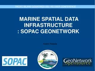
THE USE OF OPEN GEOSPATIAL SOFTWARE IN SOPAC FOR DIGITAL ACHIVING OF MARINE INFORMATION. The Late Brian Bishop- Project Initiator Keleni Raqisia – Geonetwork Administrator and Content Manager Sachindra Singh – System Support and Development.

E N D
THE USE OF OPEN GEOSPATIAL SOFTWARE IN SOPAC FOR DIGITAL ACHIVING OF MARINE INFORMATION The Late Brian Bishop- Project InitiatorKeleni Raqisia – Geonetwork Administrator and Content Manager Sachindra Singh – System Support and Development
Secretariat of the Pacific Islands Applied Geoscience Commission. • Independent ,Intergovernmental , Regional Organization • 12 Member Countries • 3 Programmes • Ocean and Island • Community Risk • Community Lifelines
Large collection of Spatial Information Valuable regional resource Largely unknown outside SOPAC and known to few speacilist within SOPAC Inadequate storage PROBLEM: THE SITUATION
- Improve Information Management - Publicize Work to the Region - Web based Visual Communication Medium - A referenced for more detailed enquiry - Address Risk Management Issues - Low cost INDENTIFY : INFORMATION MANAGEMENT NEED
- Open source ,web geographic metadata catalogue - System implements the ISO 19115/19139, Geographic metadata, Z39.50, CSW 2.0 and OGC- WMS standards among others - Custom Interface - Effective and efficient search facility SOLUTION: GEONETWORK
2 years old Geonetwork version 2.2 Country Categorized - search by country Promotes Data sharing Data Protection PRESENT SITUATION: SOPAC GEONETWORK
SEARCH FACILITY Keyword countries
- Backroom Workflow - Information Rescue - Open Formats PROCESS:INFORMATION MANAGEMENT:
Spatial Data available on Geonetwork -Bathymetry -South Pacific Sea Level Data -Marine Minerals -Scientific Cruises -Maritime Boundaries – Pacific Countries EEZ -Satellite Images, Aerial Photographs Proposed -Ocean Measurements, etc PRESENT SITUATION: SOPAC GEONETWORK
SAMPLE REQUEST: Bathymetry for Marshal Islands – Fish Farming (New business venture) Bathymetry for Solomon Islands – Gizo Earthquake (University research) Bathymetry for Niue – Yacht mooring for race participants. (Yacht race organisers) Petroleum databank – Marine mineral exploration (Resource Company)
ON SCIENTIFIC STAFF AT SOPAC: -SOPAC Geonetwork gives a public presence for their work -The use of simple visuals to communicate information - A reference for more detailed enquiry ON THE COMMUNITY: -New Business venture, government orgarnisation – national , provisional and local level , consultants and NGO's -Google search returned “ SOPAC GEONETWORK” EFFECTS :SOPAC GEONETWORK
FUTURE:GEONETWORK IN SOPAC Expand Contents Interactive Maps Repository Mirror FTP Server Expand knowledge of Open Source Geospatial Tools