Download

1 / 22
220 likes | 390 Views
Dan Widner VGIN Coordinator VGIN Advisory Board January 9, 2008. www.vita.virginia.gov. 1. Presentation Outline. The Need and Vision The Program: Details Benefits Costs Current Status Next Steps Board Endorsement?. IFTN: The Need.

E N D
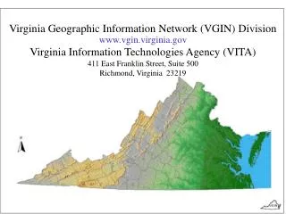
Dan Widner VGIN Coordinator VGIN Advisory Board January 9, 2008 www.vita.virginia.gov 1
Presentation Outline • The Need and Vision • The Program: • Details • Benefits • Costs • Current Status • Next Steps • Board Endorsement?
IFTN: The Need • Aerial and satellite imagery has become the foundation for most public and private GIS • It is an essential dataset, collected by hundreds of entities across the U.S. • leads to higher costs, varying quality, duplication of effort, and patchwork coverage. • Nationwide quality and consistency is lacking • Programs such as Virginia’s have become a desirable model to emulate
IFTN: The Vision The nation will have a sustainable and flexible digital orthoimagery program that meets the needs of local, state, regional, tribal, and federal agencies.
IFTN: The Program • National States Geographic Information Council (NSGIC) is working with the National Digital Orthophoto Program (NDOP) Committee and the Federal Geographic Data Committee (FGDC) to: • work toward creating a public domain, nationwide aerial imagery program to collect and disseminate standardized multi-resolution orthophoto products on a set schedule.
IFTN: The Program • Four alternatives were examined, with the following alternative selected: • Two federal agencies are proposed to support the program: USDA/FSA & USGS. • The USDA’s National Agricultural Imagery Program (NAIP) would provide annual 1-meter nationwide imagery except Alaska. Alaska would be covered by the USGS program. • NAIP would typically collect imagery during the growing season in natural color.
IFTN: The Program • The companion USGS program will produce 1-foot resolution imagery once every 3 years, with an optional 50% cost share from the states • In addition, 50% matching funds would be available to partner on 6-inch imagery for urban areas (Census areas > 50,000). • The USGS program will typically acquire imagery during winter and spring months in leaf-off natural color (like today’s VBMP Ortho Program).
IFTN: The Program • Each State will specify their orthoimagery requirements in a business plan that includes the following information: • Resolution and Accuracy Requirements • Coverage Footprints • Image Type (Color IR, True Color, B&W, etc.) • Contracting Preferences • QA/QC Requirements • Funding Methods
IFTN: The Program • States would have the option to manage the program themselves and have “buy-up” options for enhanced products that better meet their needs – much like today’s VBMP. • Color Infrared • Increased Frequency • Increased Footprint • Increased Horizontal Accuracy • Sampling to Lower Resolutions • Increased Resolution (6” to 3” and 1’ to 6”) • Improved Elevation Data Products • Remove Building Lean (“True Ortho”)
IFTN: Benefits • Provides a consistent nationwide orthoimagery dataset • Buy-up options provide flexibility to state and local governments • Imagery stays in public domain • States and local governments can manage part of the program through their business plans • Federal government funds the baseline program
IFTN: Current Status • The USGS and USDA in FY-2007 jointly funded a comprehensive Cost Benefit Analysis (CBA). • The goal of the CBA was to provide a Business Case that accurately communicates IFTN program goals, objectives, and benefits to decision makers. • The results are available on-line at the NDOP website: http://www.ndop.gov/pdf/Imagery_for_the_Nation_IFTN_CBA.pdf
IFTN: Cost Benefit Analysis • Realistic Phase-In and Acceptance Rates Used: • Anticipated that program would never meet 100% of needs. • Did not expect acceptance by all agencies that could use it’s products. • Projected costs include “other programs” (outside IFTN) that would do “business as usual”. • Analysis based only on programs actually surveyed. • Results were not extrapolated. • Used a conservative approach that avoids any inflation of numbers. • Adoption Rate: 20% - FY09 45% - FY10 70% - FY11 90% - FY12
IFTN: Costs • Nationwide, how much is actually being spent by government on orthoimagery is unknown. • The CBA estimated ~ $167 million annually nationwide or $1.7 billion over the next 10 years - $1.7B in today’s dollars. • Organized IFTN Program will cost ~ $150 million per year.
IFTN: Cost Benefit Analysis Total Costs Optional 50% Cost Share for 1-foot Program
IFTN One-Meter Resolution Annual acquisition with 100% federal funding.
IFTN One-Foot Resolution Acquisition approximately every 3-years with 50% federal funding and optional 50% State funding.
IFTN Six-Inch Resolution Acquisition approximately every 5-years in urbanized areaswith 50% federal cost share.
IFTN: Next Steps • The current objective is to ensure that IFTN is mentioned and partially funded in the Agriculture and Interior budgets for FY09, and that it be fully funded in the FY10 Budget. • To become a reality all the major stakeholders and legislators will need to support it given the increasing demands on the federal budget. • NSGIC is requesting that each of the State GIS Coordination Councils to support the program. • VGIN recommends support of IFTN. • The VGIN Advisory Board is being asked today to consider passing a resolution in support of the IFTN program.
IFTN: Resolution of Support • Supports federal budgeting for the program beginning in FY-2009. • Resolution would state that VGIN Advisory Board believes Virginia and the nation would benefit from federal appropriations being provided to the program. • Ideally, IFTN would enhance VBMP, not replace • If Board approves, VGIN would craft a letter of support and have Chairman sign.
Imagery For The Nation Questions or Comments ?