Download
1 / 23
230 likes | 395 Views
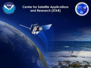
Center for Satellite Applications and Research (STAR). NOAA Contributions to Satellite Calibration and the need for a National and International Framework. Al Powell, Director. Outline. STAR’s Mission and Activities Challenges

E N D
Center for Satellite Applications and Research (STAR) NOAA Contributions to Satellite Calibration and the need for a National and International Framework Al Powell, Director
Outline • STAR’s Mission and Activities • Challenges • NOAA-NIST program to address satellite calibration issues for climate
STAR’s Mission • To provide NOAA with scientific research and development that transitions state‑of‑the-art satellite data systems, products, and services to operations for use by land, atmosphere, ocean, and climate user communities.
STAR Activities • STAR is engaged in product development, readiness, and applications with respect to satellites and satellite data • STAR’s responsibilities include: • Developing algorithms and prototype software systems that are transitioned into the production of operational environmental satellite products • Monitoring and improving instrument calibration • Validating and analyzing products for weather and climate applications • Overseeing the development of future satellite instruments and their requirements specifications • STAR utilizes collaborative environments for product development • Faster research to operations • Interconnectivity across multiple satellite programs and NOAA offices
STAR USER Community Connections Decision makers, educators, analysts, farmers, pilots, ... National Center for Environmental Prediction NOAA Goals Supported: Weather & Water Ecosystems Critical Mission Support Commerce & Transportation Climate NOAA Acquisition Programs: NPOESS (IV&V) GOES-R (AWG & RR) International Collaboration: CGMS, WMO, EUMETSAT Bilateral Agreements: China, India STAR NOAA Projects: NPOESS Data Exploitation (NDE) Scientific Data Stewardship NOAA Programs: Corals, Climate, Ocean, etc NASA EPA Air Force NAVY ARMY
Mission Support to NOAA Programs • Ecosystems • NOAA CoastWatch Program • Real-time distribution of regional SST, Ocean Color and Ocean Winds • Coral Reef Watch Program • Climate • Integrated Climate Data Record Program • Improved calibrated radiances • Time Series of Ozone , Vegetation Condition (Drought), Hydrology, Temperature, Moisture, Radiation Budget, Clouds, Aerosols, and Carbon • Reanalysis Project • Data assimilation algorithms • Radiative transfer models
Mission Support to NOAA Programs • Weather and Water • Joint Center for Satellite Data Assimilation • Radiative transfer models • Surface emissivity models • Cloud cleared hyperspectral infrared radiances • Satellite Derived Winds • Surface conditions • Hazards • Air Quality • Forest Fires/Biomass Burning • Commerce and Transportation • Aviation Weather Satellite Applications • Clear-sky turbulence • Convective cloud conditions • Icing • Volcanic Ash
Support to Existing Observing Systems • Calibration and validation across systems • Pre-launch and post-launch support • Data quality and algorithm improvement Intersatellite Calibration Instrument Calibration In-Situ Systems Product Validation
SUPPORT TO PROTOTYPE AND QUASI-OPERATIONAL SYSTEMS Aqua Metop Cloudsat CALIPSO GRACE TOPEX TRMM GIFTS Meteor/ SAGE NOAA/POES Landsat GOES MTSAT SeaWiFS Jason Aura MSG SORCE ICESat Terra
Support to Future Observing Systems GOES-R and NPOESS are the next generation of environmental satellites. STAR’s work will ensure data continuity and advanced products to the benefit of all users • Provide services to ensure accurate instrument data and algorithms from future sensors, involving • calibration and validation • algorithm development • instrument performance specifications For • Metop Instrument Functional Chain Teams (IFCT) • NPOESS Operational Algorithm Teams (OAT) • GOES-R Algorithm Working Group and Risk Reduction Plan • Risk Reduction applied to acquisition programs, quasi-operational data use from non-NOAA satellites • Developing data reduction techniques for user assimilation of hyperspectral data and climate data records
Future Challenges • New satellites sensors, both domestic and international, will create new challenges • Continuity of past, present, and future data for climate data records, calibration accuracy, stability of satellite sensors, reprocessing and analysis of long-term series for reproducible results • Data assimilation methodologies for weather, climate, and oceans • Hyperspectral technology applied to radiative transfer models and interpretation of spectral signatures • New applications from advanced sensors, including water and air quality, trace gas monitoring, and coastal and ocean forecasts • Generating blended products and multi-disciplinary algorithm development in support of GEOSS • Working in a collaborative environment as new operational and research satellite data becomes available
Climate Calibration and Measurement NOAA-NIST Joint Program Plan
Goal • Reduced measurement uncertainties to meet climate monitoring requirements Accurate climate information for sound policy decisions Program Strategy • NOAA and NIST partnership to leverage complementary expertise to broadened DoC portfolio on climate change Technical Strategy • Improved instrument characterization and calibration • Aerosols & greenhouse gas measurements and standards • Reference sites and satellite intercalibration
BackgroundWhat is the problem? • Unreliable estimates of climate trends due to uncertainties in: • pre-launch and post-launch characterization and standards • instrument inter-calibration • physical and chemical properties of atmospheric constituents • No joint strategy to leverage DOC’s unique capabilities to address these uncertainties • Lack of a framework to relate climate observations with international standards to provide climate change information to policymakers
Requirements are not being met! Example: Total Solar Irradiance Total Solar Irradiance [W/m2] Year Target Precision 0.3 W m-2 Target Accuracy 1 W m-2
What are the challenges? • Instruments are complex and operate in a hostile environment. • Opportunities to modify space instrumentation problems are on decadal scale. • Integration of multiple observations • different instruments • different spectral ranges • long time periods • Gaps in critical chemical & physical reference data (e.g. aerosols, Volatile Organic Compounds (VOCs), GreenHouse Gases (GHG)).
Why a NOAA NIST Partnership? • DoC is the lead agency on Global Climate Change • Leverages NIST’s core competencies in measurement science and standards • Leverages NOAA’s core competencies in climate monitoring and satellite remote sensing • Partnership will ensure accurate climate data to underpin policy decisions
NOAA-NIST Climate Calibration & Measurement Program GOAL Reduced measurement uncertainties to meet climate monitoring requirements NOAA Lead NIST Lead In current NOAA program * IASI GHG maps (CO2, CO, CH4) * CrIS GHG maps * VIIRS aerosol maps Climate monitoring measurements, including aerosols & GHG DATA MANAGEMENT *METOP/IASI cal/val system *Cal/Val Framework *NPP cal/val system *NPOESS cal/val sys. On-orbit cal/val and satellite intercalibration *Continue operations Marine Optical Buoy (MOBY) for ocean color *Carbon measurements from aircraft and towers coincident with satellite *Benchmark balloon measurements coincident with satellite overpass *Field campaigns Reference sites & vicarious calibration *Reference metrology & standards for critical atmospheric constituents *Reference data & standards to validate climate models *Lifecycles of aerosols * Mitigation Strategies Chemical and physical reference standards for aerosols & GHGs *Pre-launch calibration standards *Post-launch calibration standards *Extra terrestrial standards * Field standards Standards for absolute instrument characterization & calibration 2008 2009 2010 2011 2012
Benefits • Accurate estimates of climate trends • Joint strategy to leverage DOC’s unique capabilities • Framework to relate climate observations with international standards • Ability to make sound policy decisions based on accepted accurate information
Next Steps • Develop joint NOAA-NIST program plan on Climate Calibration and Measurements • Develop a National Roadmap to include other agencies and institutions • Part of a coordinated international WMO effort -- Global Space-based Intercalibration System (GSICS)