Download
1 / 15
150 likes | 359 Views
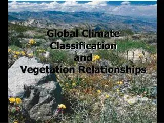
CPC Unified Gauge – Satellite Merged Precipitation Analysis for Improved Monitoring and Assessments of Global Climate Pingping Xie, Soo-Hyun Yoo, Robert Joyce, and Yelena Yarosh 2009.10.29. CPC ’ s Unified Precipitation Project.

E N D
CPC Unified Gauge – Satellite Merged Precipitation Analysis for Improved Monitoring and Assessments of Global Climate Pingping Xie, Soo-Hyun Yoo, Robert Joyce, and Yelena Yarosh2009.10.29.
CPC’s Unified Precipitation Project Multiple precipitation analyses generated at CPC over the past ~20 years to satisfy various requirements Inconsistencies due to different input data and analysis procedures used A project is underway at CPC To create a single suite of unified precipitation products for global / regional applications; To increase the accuracy, reliability and quantitative consistency of the new products.
Components of the Unified Products Station reports Unified, quality controlled Satellite estimates Multiple satellites / multiple instruments / integrated Analyses Gauge-based; gauge-satellite merged Global / Regional ;
Gauge Analysis of Global Daily Precipitation Interpolation of gauge reports from ~30K stations Optimal Interpolation (OI) with orographic correction (Xie et al. 2007) Interpolated on 0.125olat/lon, then averaged on 0.5olat/lon grid over global land for release Global fields from1979 to present updated daily on a real-time basis CONUS analysis from 1948 on 0.25olat/lon Example for July 1, 2003
High-Resolution Satellite Estimates CMORPH : CPC Morphing technique (Joyce et al. 2004) Combined use of satellite PMW and IR data 8kmx8km / 60oS-60oN; 30-min interval / from September 2000 / Real-time Project on the way to back-extend the CMORPH to 1998 Sample for August 18, 2003
Merging Gauge and Satellite Data [ 1 ] Combining the strength of gauge and satellite data to produce a merged analysis with improved quality Gauge: accurate point measurements but sparse distribution Satellite: complete coverage but with bias and random error Bias-corrected Satellite Estimates over the Globe Correcting the bias and discontinuities in the CMORPH estimates over land through matching the PDF of CMORPH against that of the gauge-based analysis Over ocean Adjusting the CMORPH to a long-term data set (pentad GPCP) to facilitate the definition of anomaly
Merging Gauge and Satellite Data [ 2 ] Sample bias-corrected Satellite Estimates
Merging Gauge and satellite data [3] Daily Gauge CMORPH Comparison of satellite estimates with gauge data for Apr. – Sep., 2009 Bias is corrected almost completely over the global land; Correlation for daily precipitation over 0.25olat/lon grid boxes is improved by ~0.05 Gauge-Adjusted CMORPH
Merging Gauge and Satellite Data [ 4 ] July 2005 Monthly Mean Precip at T382
Merging Gauge and Satellite Data [ 5 ] July 2005 Diurnal Standard Deviation of Hourly Precip.
Merging Gauge and Satellite Data [6] Combining Bias-corrected Satellite Estimates with Daily gauge over the Several Regions This is only possible for several regions due to different daily ending time in the gauge reports Africa (06Z) CONUS/MEX (12Z) S. America (12Z) Australia (00Z) China (00Z) Combining the bias-corrected CMORPH with gauge observations through the Optimal Interpolation (OI) over selected regions where gauge observations have the same daily ending time in which the CMORPH and gauge data are used as the first guess and observations, respectively
Prototype algorithm is developed and test products are constructed for the gauge-satellite merged global precipitation analyses • Two sets of gauge-satellite precipitation analyses • Bias-corrected Satellite Estimates • Global • 8kmx8km; 30-min • 1998 to the present • Gauge-satellite combined analyses • Regional • 0.25olat/lon; daily • 1998 to the present • Unified gauge – satellite precipitation analyses useful for climate monitoring, model verifications, hydrological studies, et al. Summary