Download
1 / 19
190 likes | 204 Views
This study aims to differentiate between the impacts of climate change and human activities on vegetation in Botswana. Using satellite mapping and climate change scenarios, the study provides updated vegetation maps, identifies possible vegetation changes, and suggests adaptive and policy options for resource managers. The study area includes the arid-like climate of Botswana, with low human population but high growth rate and a skew in settlement towards the southeast.

E N D
An attempt to differentiate climatic and human induced changes on vegetation in Botswana A.C. Chipanshi [Chipanshia@em.agr.ca] S. Ringrose W. Matheson R. Chanda
Background/Introduction • Impacts of humans/animals on veg is low at low population densities • Impacts of climate climax veg (confounded by episodic events) • Natural and human forces are not mutually exclusive
Objectives… • Develop an up-to date map of veg cover since first one was made in 1971 • Suggest possible changes to vegetation using climate change scenarios • Indicate adaptive and policy options to resources managers
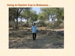
Study area details • Botswana sits astride the Tropic of Capricorn and hence it has an arid-like climate • Low human population (~1.3 million) but has high growth rate (3.5%); area of 582K km2 • Settlement is skewed in favour of the SE • Domesticated animals are estimated at 3 times the human pop (cattle & goats ~ 4.8 million)
Vegetation types, 30 years ago • Early mapping based on photos and field surveys (Weare and Yalala) • Noticeable trend with moisture gradient • No one species dominates the landscape
Implications from the early mapping • Degradation due to human activities low • Species diversity quite widespread • Fires and droughts were the main agents controlling vegetation dynamics
Current Mapping (1995) • Thematic Mapper: bands 3,4,5 were used • Mapping supplemented by field work for species type and density assessment • Current mapping reveals changes in species type and density
Summary of the satellite mapping 1995) • Arid shrub savanna coincides with 1971 map • Kalahari bush savanna degraded most on eastern side but less so on west • North of Kalahari, dense tree and bush savanna is followed by sparse savanna (reverses 1971) • Floodplain area is now a mixture of shrubs but this was grassland in 1971 • Bushy species are more common in east than elsewhere (Terminalia sericea)
Lessons from the map inter-comparison • In the less settled west, climate appears to be the dorminant factor on vegetation • In the east and northern fringes, there appears to be an accelerated rate of vegetation density and species change (humans and climate)
Projections into the future • Climate change experiments suggest warming in Botswana (1 to 2o C above present climatology) in next 50yrs • Rainfall shows a decrease by 5 to 20% by most models and composites • What vegetation biomes can we expect?
Summary of changes likely to impact vegetation • In all scenarios, grassland degrades into dry forest or tree and shrub savanna • In dry and ‘core’ scenarios, forests decline and thorn and shrub savanna expands • Over all degradation of present biomes
What adaptive options do we take under these conditions? • Informed tree planting programmes (ATHTP vs. ATPP) • Community Based Natural Resources Management strategies (e.g. communal rangelands) are a good adaptive strategy • Include indigenous knowledge • Diversify rural economy
Policy Options • Carry out inventories at regular intervals • Reform land tenure to allow open access to forestry resources in less degraded areas (state land and commercial properties) • Involve communities in managing forestry resources
CONCLUSIONS • Changes that have taken place in vegetation cover in the past 30 yrs (trees to shrubs) are expected to continue in the near future • Both human and natural forces are contributing to forestry degradation (difficult to separate) • Current adaptive and policy arrangements are not sufficient; community based approaches are the options