Download
1 / 48
490 likes | 612 Views
Land Navigation. NOTE: THIS IS NOT A COMPLETE GUIDE. You should already be familiar with the topics within this presentation, and should seek additional information for definitions and terminology. Basic Map Skills. Identify Map colors Identify Map Symbols Identify Marginal Information

E N D
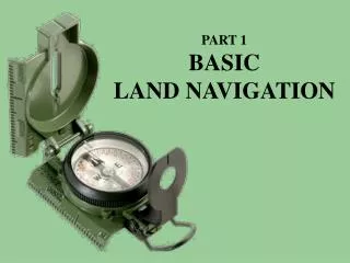
Land Navigation NOTE: THIS IS NOT A COMPLETE GUIDE. You should already be familiar with the topics within this presentation, and should seek additional information for definitions and terminology.
Basic Map Skills • Identify Map colors • Identify Map Symbols • Identify Marginal Information • Identify Terrain Features
Basic Map Skills • Identify Grid • Identify Elevation • Grid vs. Magnetic Azimuth • Determine Azimuth • Back Azimuth • Determine Distance
Map Colors • Black - Indicates cultural (man-made) features such as buildings and roads, surveyed spot elevations, and all labels • Red-Brown - Combined to identify cultural features, all relief features, non-surveyed spot elevations, and elevation, such as contour lines on red-light readable maps
Map Colors • Blue - Identifies hydrography or water features such as lakes, swamps, rivers, and drainage • Green - Identifies vegetation with military significance, such as woods, orchards, and vineyards • Brown - Identifies all relief features and elevation, such as contours on older edition maps, and cultivated land on red-light readable maps
Map Colors • Red - Classifies cultural features, such as populated areas, main roads, and boundaries, on older maps • Other - Occasionally other colors may be used to show special information. These are indicated in the marginal information as a rule
Identify Map Symbols Refer to Map Legend
Marginal Information • Geographic area and scale - top left • Name of map sheet - top center • Map edition, map series, and map sheet number - top right • Legend - bottom left • Bar scale, contour interval, grid reference box, and declination diagram - bottom center • Elevation guide, adjoining map sheet diagram, and boundaries box - bottom right
Terrain Features - Major • Hill • Ridge • Valley • Saddle • Depression
Terrain Features - Minor • Draw • Spur
Terrain Features - Supplementary • Cliff • Cut • Fill
Identifying a Grid • Read Right then Up • Bottom left corner identifies first two digits I.e. 12__56__ • Use coordinate scale to identify last two digits I.e. __34__78 • Add proper grid zone designator to front I.e. AB ________
Elevation • Locate point on the map • Determine contour interval of map • Locate index contour line nearest point • Count number of contour lines up or down that must be crossed to get to point • Points at top of hill add half the contour interval • Points at bottom of depression subtract half the contour interval
THREE NORTH'S G N N TRUE NORTH MAGNETIC NORTH GRID NORTH
Determine Azimuth • Plot location of two points • Use straight edge to draw line between both points (line must be long enough to cross scale on protractor) • Use protractor to determine azimuth
Back Azimuth • Back Azimuth - azimuth taken from a distant point toward your location • Used in Resection • Numbers less than 180 - add 180 • Numbers greater than 180 - subtract 180
Determine Distance • Straight Line • Use edge of paper and mark distance between points • Line paper up next to scale to determine distance • Road Distance • Break curve into series of straight lines and measure from curve to curve • Line paper up next to scale to determine distance
Advanced Skills • Intersection • Single Point, 2-Point, etc • Resection • Single Point, Dual Point, etc