Download
1 / 32
520 likes | 958 Views
MAP READING AND LAND NAVIGATION. FM 21-26. DEFINITION OF A MAP. A MAP IS A GEOGRAPHIC REPRESENTATION OF A PORTION OF THE EARTH’S SURFACE DRAWN TO SCALE, AS SEEN FROM ABOVE. IT’S USES COLORS , SYMBOLS AND LABELS TO REPRESENT FEATURES FOUND ON THE GROUND. PURPOSE OF A MAP.

E N D
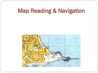
MAP READING AND LAND NAVIGATION FM 21-26
DEFINITION OF A MAP A MAP IS A GEOGRAPHIC REPRESENTATION OF A PORTION OF THE EARTH’S SURFACE DRAWN TO SCALE, AS SEEN FROM ABOVE. IT’S USES COLORS, SYMBOLS AND LABELS TO REPRESENT FEATURES FOUND ON THE GROUND.
PURPOSE OF A MAP A MAP PROVIDES INFORMATION ON THE EXSISTENCE OF, THE LOCATION OF, AND THE DISTANCES BETWEEN GROUND FEATURES.
MAP SCALES LARGE: 1:50,000 MEDIUM: 1: 100,000 SMALL: 1: 250,000
COLORS OF THE MAP BLACK: MAN-MADE FEATURES, SUCH AS BUILDINGS AND ROADS. RED-BROWN: RELIEF FEATURES AND ELEVATION (CONTOUR LINES ON RED-LIGHT READABLE MAPS). BROWN: RELIEF FEATURES & ELEVATION (CONTOUR LINES ON OLDER MAPS). GREEN: VEGETATION (WOODS, ORCHARDS, VEGITATION). BLUE: DRAINAGE (WATER). RED: POPULATED AREAS, MAIN ROADS AND BOUNDARIES ON OLDER MAPS.
TERRAIN FEATURES • Five Major • Three Minor • Two Supplementary Hidden Valley Ranch Salad Dressing Hilltop, Valley, Ridge, Saddle, Depression Draw, Spur, Cliff Cut, Fill
HILL: AN AREA OF HIGH GROUND. FROM A HILLTOP, THE GROUND SLOPE DOWN IN ALL DIRECTIONS. FM 21-26: PAGE 10-9 (FIGURE 10-17)
VALLEY: A STRETCHED-OUT GROOVE IN THE LAND, USUALLY FORMED BY STREAMS OR RIVERS. FM 21-26: PAGE 10-10 (FIGURE 10-19)
RIDGE: A SLOPING LINE OF HIGH GROUND. FM 21-26: PAGE 10-11 (FIGURE 10-20)
SADDLE: A DIP OR LOW POINT BETWEEN TWO AREAS OF HIGHER GROUND. FM 21-26 PAGE 10-11 (FIGURE 10-18)
DEPRESSION: A LOW PO INT IN THE GROUND OR SINKHOLE. THEY ARE REPRESENTED BY CLOSE CONTOUR LINES THAT HAVE TICK MARKS POINTING TOWARD LOW GROUND. FM 21-26: PAGE 10-11 (FIGURE 10-21)
DRAW: A LESS DEVELOPED STEAM COURSE THAN A VALLEY. THERE IS ESSENTIALLY NO LEVEL GROUND AND, THEREFORE, LITTLE OR NO MANEUVER ROOM WITHIN ITS CONFINES. FM 21-26: PAGE 10-12 (FIGURE 10-22)
SPUR: A SHORT, CONTINUOUS SLOPING LINE OF HIGHER GROUND, NORMALLY JUTTING OUT FROM THE SIDE OF A RIDGE. FM 21-26: PAGE 10-12 (FIGURE 10-23)
CLIFF: A VERTICAL OR NEAR VERTICAL FEATURE; IT IS AN ABRUPT CHANGE OF THE LAND. THE SLOPE IS SO STEEP THAT THE CONTOUR LINES CONVERGE INTO ONE CONTOUR LINE OR THE LAST CONTOUR LINE HAS TICK MARKS POINTING TO LOW GROUND. FM 21-26: PAGE 10-13 (FIGURE 10-24A & B)
CUT: A MAN-MADE FEATURE RESULTIING FROM CUTTING THROUGH RAISED GROUND, USUALLY TO FROM A LEVEL BED FOR A ROAD OR RAILROAD TRACK. FILL: A MAN-MADE FEATURE RESULTING FROM FILLING A LOW AREA, USUALLY TO FORM A LEVEL BED FOR A ROAD OR RAIL- ROAD TRACK.
200 CONTOUR LINES ELEVATION IN METERS Three types of contour lines Intermediate: Are contour lines located between two index lines. Supplementary: Are contour lines placed to specify half of the contour interval. EXAMPLE: CONTOUR INTERVAL 20 meters 100m 120m 130m and 140m SUPPLEMENTARY CONTOURS 10meters Index: Are major elevation points and have the elevation number written withing the contour. (ex.100m,200m,300m)
FINDING POINTS • (Orient the map) • Compass or Terrain Association • (Compass Technique) • Cheek and Center hold methods • (Grid Coordinates) • Grid Zone Designator (RP) and Number sequence • FOUR DIGIT, SIX DIGIT or EIGHT DIGIT • Remember RIGHT then UP • DEAD RECKONING
Compass Technique The compass to cheek technique is used almost exclusively for sighting and is the best technique for this purpose. COMPASS TO CHEEK METHOD CENTER HOLD METHOD The Center hold method is much faster but is also less precise.
ORIENTING THE MAP A MAP IS ORIENTED WHEN IT IS IN A HORIZONTAL POSITION WITH ITS NORTH/SOUTH CORESPONDING TO THE NORTH/ SOUTH ON THE GROUND
MILITARY PROTRACTOR BASE LINE DEGREES MILS THE GTA 5-2-12 IS THE MOST COMMONLY USED PROTRACTOR FOR MAP READING. FM 21-26: PAGE 6-4 & 6-5 (FIGURE 6-6 & 6-7) INDEX
GRID COORDINATES To locate any coordinate: Must go RIGHT then UP Four Digit Coordinate Location Within 1000m (RP5904)
GRID PRECISION Six Digit Coordinates Locate a point within 100 meters Eight Digit Coordinates Locate a point within 10 meters
TERRAIN IDENTIFICATION TEST • Stations: • Shoot two azimuths, either in MILS or DEGS • using both methods. • a) Given a known point ID its 4-Digit or • 8-Digit coordinate. • 3) a) Find Pace Count. • b) Given a 4 digit and an 8 digit coordinate • plot both points and ID the Feature or structure.
TERRAIN FEATURES • Five Major • Three Minor • Two Supplementary Hilltop, Valley, Ridge, Saddle, Depression Draw, Spur, Cliff Cut, Fill