Download
1 / 4
40 likes | 40 Views
The main aim of this project is to provide a solution to unmanned railway crossing using a Smartphone based warning system. Protection of common people is indeed a challenge in today's world with the enormous growth in the transportation field over the past 5 years, around 613 have become victims to unmanned railways crossings and the count is increasing at an alarming rate. Statistics states that there are a total of 9340 unmanned level crossings in India which is prone to accidents. This system is mainly used to prevent these accidents through alarms by the use of GPS technologies. GPS communication plays an important role in the implementation of this system. The GPS can calculate the co ordinate positions with the centre of the Earth as the origin by receiving signals from the satellite. The signals thus received help us to perceive the location of the user and the train. Thus, this system aims to detect dangerous situations and to avoid untimely and false alarms. Noorul Shajitha Banu H | Sangeeth T | Saravana Pandi M | Swathi M | Vishnu R "Alert System for Unmanned Railway Crossing using GPS - A Survey" Published in International Journal of Trend in Scientific Research and Development (ijtsrd), ISSN: 2456-6470, Volume-2 | Issue-3 , April 2018, URL: https://www.ijtsrd.com/papers/ijtsrd10779.pdf Paper URL: http://www.ijtsrd.com/engineering/computer-engineering/10779/alert-system-for-unmanned-railway-crossing-using-gps---a-survey/noorul-shajitha-banu-h<br>

E N D
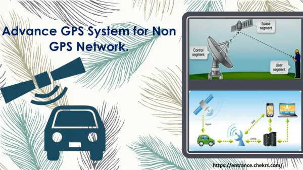
International Journal of Trend in Scientific Research and Development (IJTSRD) International Open Access Journal ISSN No: 2456 - 6470 | www.ijtsrd.com | Volume - 2 | Issue – 3 Alert System for Unmanned Railway Crossing using GPS - A Survey Noorul Shajitha Banu H1, Sangeeth T2, Saravana Pandi M3, Swathi M4, Vishnu R5 Assistant Professor, Department of Computer Science, Easwari Engineering College, Ramapuram, Chennai UG Student, Department of Computer Science, Easwari Engineering College, Ramapuram, Chennai, India ABSTRACT The main aim of this project is to provide a solution to unmanned railway crossing using a Smartphone based warning system. Protection of common people is indeed a challenge in today’s world with the enormous growth in the transportation field over the past 5 years, around 613 have become victims to unmanned railways crossings and the count is increasing at an alarming rate. Statistics states that there are a total of 9340 unmanned level crossings in India which is prone to accidents. This system is mainly used to prevent these accidents through alarms by the use of GPS technologies. GPS communication plays an important role in the implementation of this system. The GPS can calculate the co-ordinate positions with the centre of the Earth as the origin by receiving signals from the satellite. The signals thus received help us to perceive the location of the user and the train. Thus, this system aims to detect dangerous situations and to avoid untimely and false alarms. technology to identify the location. Both the user and the driver are required to have smart phones on them. Based on the type of danger predicted, the driver and the person will receive a high risk warning. Warning is given in the form of audio and vibration to alert them of the impending danger. The above mentioned parameters are taken into account to improve the accuracy of the system by eliminating false alarms. Depending on the type of warning received, the driver can take suitable actions to avoid unwanted collisions by applying the brake or by changing the lane. 2.LITERATURE SURVEY In [1], three phases of the system are considered namely, the Activation phase, Prediction phase and the Warning phase. Increase in the real time values of TTC increases the risk of collision. This system was installed on smartphones and it uses GPS sensor and 4G wireless communication for LP implementation. It also makes use of a fuzzy inference engine in the system which accounts for only 75% accuracy. The same technique can also be used in smart watches, smart bands and other kits. Keywords: GPS technologies, alarms, smartphones 1.INTRODUCTION The idea proposed in [2] follows an adaptive approach along with V2P wireless communications over 3G but the effects of the environmental factors have not been taken into account. The system can be enhanced by performing simulations based on realistic data to improve accuracy. In this system, we provide warnings to the drivers and the person crossing the tracks simultaneously which lowers the probability of collisions. With the help of appropriate sensors in the smartphone and an easy to use interface, we can achieve this. The system takes into consideration various parameters such as the train’s location, speed, driver’s age, time of the day, weather condition, the person’s age, his/her walking pace to compute the probability of collision. Both the driver and the person’s phones are equipped with GPS In [3] both GPS and GSM technologies are used along with sensors placed on the railway tracks. The downfall to this approach is that sensors have a short @ IJTSRD | Available Online @ www.ijtsrd.com | Volume – 2 | Issue – 3 | Mar-Apr 2018 Page: 49
International Journal of Trend in Scientific Research and Development (IJTSRD) ISSN: 2456-6470 reliable lifecycle and requires periodic replacement every 2 years. Another issue in this system is that due to the use of GSM technology it gets difficult in situations when coverage is not available. This renders the whole system complicated and expensive. This can be overcome by making use of satellite communication. The model proposed in [7] includes a system that obtains data from traffic cameras installed in thecrosswalks but this is very expensive and the features are limited. To solve this limitation, we present a new system by considering different characteristics of the user and the driver. The system proposed in [8] makes use of various methods to predict collision risks but they are not effective as no real time data are considered. [4] makes use of a self-acting micro controller and a two way ZigBee based data communication system which takes inputs from signal posts and from level crossing gates. The system communicates with the nearest signal posts, level crossing gates and control stations to continuously monitor various signals arriving in the control centre and taking decisions based on the received information. It is shown that the proposed two-level depth-based alarming service can significantly reduce a pedestrian’s reaction time to a main warning message, leading to the provisioning of better safety for pedestrians. This system can be upgraded by providing real time data of moving trains like speed, location etc. [9] makes use of simple mechanical andelectrical components that control the railway gate and infrared detectors to detect the arrival and departure of trains. The proposed system includes a smartphone based warning system using wireless communication which eliminates the need for complicated hardware. The system in [10] proposes a model for safe railway crossing for developing countries. The major aim of the proposed model is to develop a railway crossing system which is safe, reliable and cost effective. In order to make a cost effective system, the paper proposes the use of ZigBee modules for wireless communication between Wireless Sensor Networks. This system claims to reduce human efforts and eventually human errors. But this system doesn’t prove to be accurate. The system used in [5] enhancements can be made to improve the accuracy of the system by providing real time data as inputs. People prefer an apparent warning to a transparent background-color warning forless disturbance. Participants expressed that the less clear notification message is provided with transparent background, the more disturbed they are. 3.COMPARATIVE ANALYSIS The following table presents the various technologies followed by previous systems and the issues related with them. The proposed system aims to eliminate such drawbacks and follows a reliable approach by taking several factors into account. [6] proposes a depth based alarming service using an Android application using technologies such that the user is informed of the risk in advance. A similar method is adopted for preventing accidents at unmanned level crossings. The reliability of communication can bp improved to a great extent such that we can know the exact position of trains in caves and mountains. GPS and GSM TABLE 1: TECHNOLOGIES ID TITLE 1 Three-Phases Smartphone- Based Warning System to Protect Vulnerable Road Users Under Conditions AUTHORS KEY TECHNOLOGIES GPS and GSM. Fuzzy logic to provide warnings ISSUES Decrease TTC increases risk of collision. RoyaBastaniZadeh, Ghatee, and Hamid Reza Eftekhari Mehdi in value Fuzzy 2 Cellular-based vehicle to pedestrian (V2P) adaptive communication collision avoidance MehrdadBhageri, MattiSiekkinen,Jukla.k.Nur minen V2P communication. wireless Environmental factors are not taken account. for into @ IJTSRD | Available Online @ www.ijtsrd.com | Volume – 2 | Issue – 3 | Mar-Apr 2018 Page: 50
International Journal of Trend in Scientific Research and Development (IJTSRD) ISSN: 2456-6470 3 A Humanitarian Intelligent Level Controller Utilising GPS and GSM. C.Chellaswamy, SrinidhiSrinivasan, R.RameshBabu GSM technologies and sensors. Sensors costly and need to be replaced every 2 years. are 4 Implementation of ZigBee Based Train Anti-Collision and Level Protection System Indian Railways. Design and Evaluation of a Smartphone-based Alarming System Pedestrian Vehicular Networks Alarm System of Railway Gate Crossing Based on GPS and GSM Arun Madhukumar S, Careena P P, Sabarinath G, Self-acting controller which takes inputs from crossing gates. micro No data is taken. real time Crossing level for 5 Burra. Raju B. Sreenivas GPS technologies and GSM Enhancements can be made. for in Safety 6 Jiyoon Kim Younghwa, Jaehoon (Paul) Jeong This makes use of a depth based alarming service using Android app with GPS and GSM Improve reliability an 7 An expert fuzzy system for predicting object collisions J.L. Castro, M. Delgado, J. Medina, M.D. Ruiz-Lozano Traffic cameras are installed on crosswalks High cost and complex. 8 SANA: Navigation pedestrian protection in vehicular networks Automation in Unmanned Railway Level Crossing Safety Aware Taehwan Jaehoon Eunseok Lee Hwang (Paul) and It methods collisions It makes use of several mechanical components infrared detectors. uses various detect They are not effective. App for Jeong, to 9 B.BrailsonMansingh, Selvakumar, R.S Vignesh Kumar K.S It uses complex hardware not reliable. and and GPS, we are able to collect real-time data which improves the accuracy of the application. The service handles these requests and communication with the system’s location providers (GPS and network). 5.CONCLUSION 4.RESEARCH METHODS AND DESIGN Almost all recent mobile phones have a GPS connection. A method using GPS (Global Positioning System) is mainly used to provide position information in the proposed system. The GPS can calculate the co-ordinate positions with the centre of the Earth as the origin by receiving signals from the satellite. The signals thus received help us to perceive the location of the user and the train. The location information obtained is fed as input to the Android application via third party access. This can be done by explicitly requesting the operating system for the location information by specifying the location provider. The Location Manager instances receives the requests from the application and forwards them to the Location Manager Service. With the help of A new model has been proposed to overcome the drawbacks of the existing models. The system that has been proposed is a very reliable one. The GPS technology proves efficient especially for outdoor navigation and improves the accuracy of the system. This system aims to provide accurate warnings and eliminate false alarms and prevent accidents. @ IJTSRD | Available Online @ www.ijtsrd.com | Volume – 2 | Issue – 3 | Mar-Apr 2018 Page: 51
International Journal of Trend in Scientific Research and Development (IJTSRD) ISSN: 2456-6470 REFERENCES 1.Three-Phases Smartphone-Based Warning System to Protect Vulnerable Road Users Under Fuzzy Conditions, RoyaBastaniZadeh, Mehdi Ghatee, and Hamid Reza TRANSACTIONS, 2017 2.Cellular-based vehicle to pedestrian (V2P) adaptive communication for collision avoidance, MehrdadBhageri, MattiSiekkinen,Jukla.k.Nurminen ICCVE, 2014. 3.A humanitarian Intelligent Level Crossing Controller Utilizing Chellaswamy, R.RameshBabu, IEEE Technology Conference, 2014 4.Implementation of ZigBee Based Train Anti- Collision and Level Crossing Protection System for Indian Railways, Arun P, Sabarinath G, Madhukumar S, Careena P, IJLTET, 2013. 5.Design and Evaluation of a Smartphone-based Alarming System for Pedestrian Safety in Vehicular Networks, Jiyoon Kim, Younghwa Jo, Jaehoon (Paul) Jeong, International Conference on Internet of Vehicle, pno: 221-223,2015. 6.Alarm System of Railway Gate Crossing Based on GPS and GSM, Burra. Raju, B. Sreenivas, International Journal of Scientific Engineering and Research, 2013. 7.An expert fuzzy system for predicting object collisions, J.L. Castro, Medina,M.D. Ruiz-Lozano, Journal of the Transportation Research Board, 2011 8.SANA: Safety Aware Navigation App for pedestrian protection in vehicular networks, Taehwan Hwang and Jaehoon (Paul) Jeong, Eunseok Lee, ICTC, 2014. 9.Automation in Unmanned Crossing, B.BrailsonMansingh, Selvakumar,R.SVignesh Conference on Intelligent Systems and Control, 2015. Eftekhari, IEEE GPS and SrinidhiSrinivasan, Global Humanitarian GSM, C. M. Delgado, J. Railway Level K.S Kumar, International @ IJTSRD | Available Online @ www.ijtsrd.com | Volume – 2 | Issue – 3 | Mar-Apr 2018 Page: 52