Download

1 / 16
160 likes | 256 Views
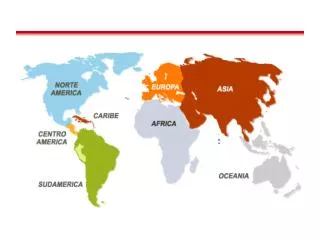
Peru, a country with treasures to enrich the world history. Project location. The project area is located in the Lambayeque region of northern Peru. It is located 13 kilometers in from of the Pacific coast and 770 kilometers from the nation's capital, Lima.

E N D
Project location The project area is located in the Lambayeque region of northern Peru. It is located 13 kilometers in from of the Pacific coast and 770 kilometers from the nation's capital, Lima.
General information of the project area • Clima: It has a warm and very dry desert climate with the sun shining all year around. • The main agricultural products of the area are rice, sugar cane and cotton. • Soil type : sandy. • Vegetación: Dry forest and carob tree (Main forest species).
Antecedents of the study area The Moche civilization existed from the years A.D. 100 to A.D. 800, occupying the territory which is now the northern coast of Peru The Brüning Museum in Lambayeque, contains hundreds of gold and silver pieces, as well as textiles and ceramics the Moche Culture. In this museum we can find The Tumba Real (Royal Tombs), which contains artefacts from the tomb of the Lord of Sipan.
Objective of the project Mapping of archaeological sites with Field Map technology to acquire the Certificate of non archaeological rests (C.I.R.A) in order to get the approval for the enlargement of the Picsiprison.
Technology – Field team • Software: FMDC • Hardware • Laser impulse 200 • Electronic compas MapStar Compass Module II • Armor computer • Accessories • Engineering Staff : 5 people • 1 Archaeologist • 2 Field Map operators • 2 local guiders ( Reflector)
Archaeological project designed in Field-Map Project Manager • Preparation of satellite images and georeferencing. • Grid of points 75x75. Archeological site or Piramide Enlargement area
Archaeological project design in Field Map Project Manager • Point: Pits (x,y,z, depth,) and Topography. • Area: archaeological sites • Ceramics: Type 1, 2,3 • Cemetery • Infrastructure: Walls, murals, hydraulic channel • Shell • Areas: Land cover • Crops: sugarcane, rice, cereals, etc • Carob tree forest • Vegetation: grass, bushes, etc.
Field Activities • Mark the limits of the study area positioning stakes every 50 meters: • Evaluation area • Enlargement of the prison Area • Mark staked grid: 75 M x 75 M. • Locate points of the excavation. • Mapping the archaeological sites according excavations. • Archaeological rescue.
Results • Maps of archaeological sites: Cemeteriesceramics, shell middens, infrastructure. • Land cover maps: forest and crops • Certificate of non archaeological rests for the rescue.
Next steps • Integrate the codified database of the excavations from the archaeological rescue with its report on platforms and vertical walls. • For future projects in the Amazonas jungle: • Importance of vegetation and topography mapping. • Localization of pits.
Search by plane of archaeological traces with Field Map technology
The project area is located in the Junín region in the central jungle of Peru.
Goals • Localization and assessment of the deforested areas. • Archaeological traces • Guide the pilot by the track planned by using satellite images.