Download
1 / 20
210 likes | 340 Views
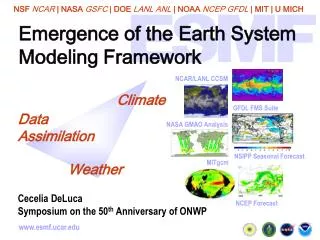
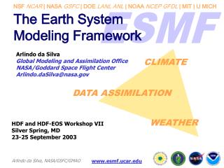
Earth System Modeling Framework. ESMF and the Transformation of Earth System Modeling. Sylvia Murphy murphys@ucar.edu. http://www.esmf.ucar.edu. Outline. What is ESMF? Who is Using it? How is ESMF Transforming Earth System Modeling? Current Development Status Future Directions.

E N D
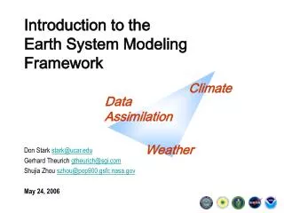
Earth System Modeling Framework ESMF and the Transformation of Earth System Modeling Sylvia Murphymurphys@ucar.edu http://www.esmf.ucar.edu
Outline • What is ESMF? • Who is Using it? • How is ESMF Transforming Earth System Modeling? • Current Development Status • Future Directions
What is ESMF? ESMF is a software library that consists of coupling tools and model utilities that increase modularity, interoperability, and performance of geoscience applications.
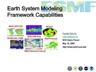
What models are using ESMF? Operational Version of the GFS Weather Forecasting Model GEOS-5 Atmospheric GCM HYCOM Ocean ModelCOAMPS Atmospheric ModelCICE-HYCOM MIT GCM WRF Weather Forecasting Model ADCIRC Hydrodynamic modelADCIRC-WASH123 GFDL FMSMOM4 UCLA AGCM 58 components are currently using ESMF
What programs are using ESMF? NUOPC: National Unified Operational Prediction Capability Consortium (NOAA, Navy, Air Force Weather Agency) Has announced intentions to base its next generation National Weather Prediction (NWP) system on ESMF Image from NOAA rapid refresh (RR) model, a replacement model for the Rapid Update Cycle (RUC) model. BEI: Battlespace Environments InstituteDeveloping integrated forecasting systems across DoD. MAP: Modeling and Analysis ProgramFacilitating research and model use of NASA data
The Transformation of Earth System Modeling • How models are structured • How models are developed • The scale of collaborations • Governance strategies for developing community scientific software ESMF is changing:
How Models are Structured • Hierarchical component based architecture • Interchangeability • Easy replacement of component elements • Interoperability • Swapping component between applications • Coupling diverse applications
How Models are Developed • Large number of components available from across the community • Develop science components for a well-understood community architecture and interfaces • Technological advances are propagated quickly across many applications simultaneously
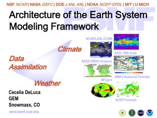
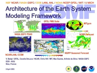
The Scale of Community Collaborations Collaborations across: • Operational centers (e.g CNMOC, COPC, FNMOC) • Research centers (e.g. GFDL, NCAR, NASA Goddard) • Universities (e.g. MIT, University of Hawaii) • Different domains (weather, climate, space weather, hydrology) BEI: Battlespace Environment Institute NUOPC: National Unified Operational Prediction Capability CCSM: Community Climate System Model WRF: Weather Research & Forecasting Model MAP: Modeling Analysis and Prediction Program
Governance strategies for developing community scientific software Shared governance model emphasizes: • Distributed, global development • Direct participation of users in setting development priorities • Multi-agency management • Incorporates open-source methodologies into scientific software development esmf_jst@ucar.edu has 300 subscribers who participate in ESMF development
ESMF Release Plan 2002 2003 2004 2005 2006 2007 2008 2009 2010 ESMF v1 Prototype ESMF v2 Components, VM and Utils ESMF_GridCompRun() ESMF v3 Index Space Operations ESMF_ArraySparseMatMul() ESMF v4 Grid Operations ESMF_GridCreate() ESMF_FieldRegrid() ESMFv5 Standardization Build, init, data types, error handling, … Last public ESMF v2.2.2r Last internal ESMF v3.0.3
Current Features (v3.0.3) • Component-based architecture • Allows serial or parallel execution • Components can run concurrently or sequentially • Single executable support, limited support for multiple executables • Support for model ensembles • User friendly uniform, rectilinear, and curvilinear grid representation • Unstructured and multi-patch grids represented in index space • Regridding via sparse matrix multiply with user defined weights • Utilities such as time manager, message logger, and resource file manager are usable and adding features • Fortran interfaces and complete documentation, increasing number of C interfaces • Distributed with Reference Manual, Users Guide, ~2500 tests and examples • ~2000 downloads
Cray X1 Cray XT3/4 HP ZX6000 Linux intel IBM Bluegene, IBM Opteron Linux pathscale IBM Opteron Linux pgi IBM SP MAC G5 Darwin xlf MAC G5 Darwin xlfgcc MAC G5 Darwin nag MAC G5 Darwin absoft Pentium III Linux lahey Pentium III Linux pgi Pentium III Linux pgigcc PC Xeon Cluster Linux absoftintel PC Xeon Cluster Linux g95 PC Xeon Cluster Linux intel PC Xeon Cluster Linux nagintel SGI Altix Linux nagintel SGI Origin 3800 Current Supported Platforms ESMF runs 2500 tests on all these platforms every night
Sparse Matrix Multiply Updated • User supplied weights • Facilitates the widest possible couplings • The methods have the following new features: • Improved performance and reduced memory usage • Support for distributed definition of factors • Support for user-supplied arbitrary sequence indices via 1D DistGrid • Support for ESMF_TYPEKIND_I4/I8/R4/R8 • Default initialization of destination Array to zero (can be overridden)
New Structured Grids Image of HYPSE (Hydrostatic Padua Surface Elevation Model) Dept .of Physics, Univ. of Padua • Support 1D, 2D, 3D and higherdimensions • Supports parallelization across any or all grid dimensions • Supports uniform, rectilinear and curvilinear grids
Near Future: Structured Grids • Multi-tile grids (e.g. cube-sphere) • More efficient memory use for non-curvilinear grids • Coordinate halo • A wide variety of different types of connections between tile edges • Automatic generation of topology and coordinates for common shapes (e.g. sphere) Image courtesy Steve Thomas and Rich Loft, NCAR
Near Future: General Regridding Curl of bilinear interpolant Exact curl Curl of patch-recovered interpolant Work conducted by David Neckels/ESMF in collaboration with Bill Large of the ocean modeling section at NCAR.
Near Future: Unstructured Grids • Uses same infrastructure as general regridding • Representation for hydrology grids and other grids • Future basis for exchange grids and observational data streams Image of rossby waves on a triangular adaptive grid (Alfred-Wegener-Institute for Polar and Meteorological Forecasting)
Longer Term: Interoperability & Integration Initiative • Enable groups with compilations of ESMF components to develop integrated modeling systems • Define standards to increase component interoperability • Metadata conventions • Strategies for automation and supplemental tools (e.g. MAPL) http://esmfi3.org/wiki/
Questions? http://www.esmf.ucar.edu