Download
1 / 16
160 likes | 334 Views
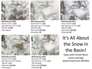
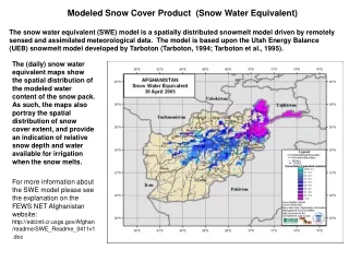
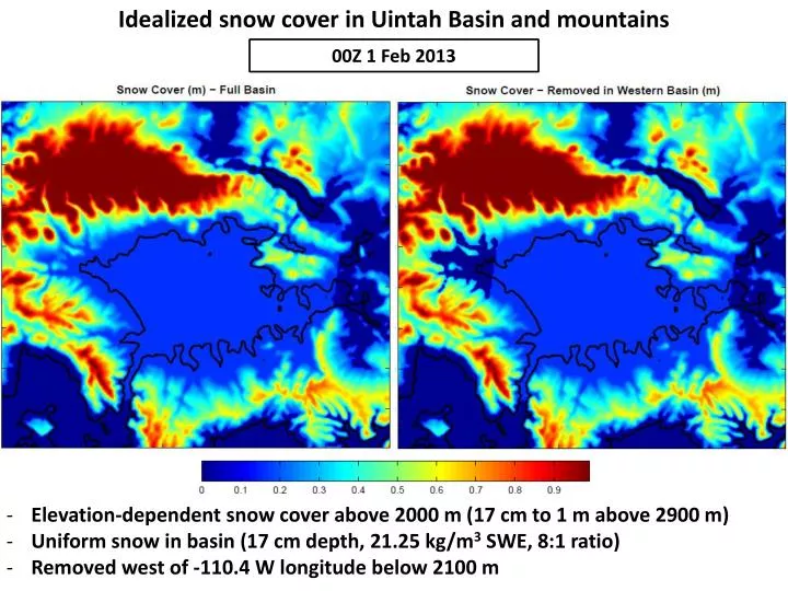
Idealized snow cover in Uintah Basin and mountains. 00Z 1 Feb 2013. Elevation-dependent snow cover above 2000 m (17 cm to 1 m above 2900 m) Uniform snow in basin (17 cm depth, 21.25 kg/m 3 SWE, 8:1 ratio ) Removed west of -110.4 W longitude below 2100 m.

E N D
Idealized snow cover in Uintah Basin and mountains 00Z 1 Feb 2013 • Elevation-dependent snow cover above 2000 m (17 cm to 1 m above 2900 m) • Uniform snow in basin (17 cm depth, 21.25 kg/m3 SWE, 8:1 ratio) • Removed west of -110.4 W longitude below 2100 m
Impact of Microphysics Modifications on Accumulated Precipitation in Domain 1 • Basic precipitation pattern and maximas are very similar • Small differences in mountainous terrain
Impact of Microphysics Modifications on Accumulated Precipitation in Domain 1 • Minor increases of 2-4 mm in ID/WY and CO mountains • Very small increase (~.1 or .2 mm) in center of Uintah Basin - almost imperceptible
Impact of Microphysics Modifications on Accumulated Convective Precipitation in Domain 1 • No significiant impacts for early Feb 2013 case
U-wind Cross Sections Full Snow No Western Snow • Stronger Easterly flow typically seen near surface along snow/no snow boundary in “No Western Snow” run
U-wind Cross Sections Full Snow No Western Snow • Overall flow patterns largely the same in both cases
Tracer Cross Sections 11Z 5 Feb 13Z 5 Feb • Tracer plume moving west in easterly flow from 11-17 Z on 5 Feb 2013 15Z 5 Feb 17Z 5 Feb
Tracer Cross Sections 06Z 2 Feb 18Z 4 Feb • Tracer concentrations build in low levels throughout the simulation • Pushed around by flows within basin and depth is modulated by stability