Download
1 / 31
310 likes | 313 Views
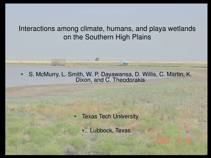
Interactions among climate, humans, and playa wetlands on the Southern High Plains. S. McMurry, L. Smith, W. P. Dayawansa, D. Willis, C. Martin, K. Dixon, and C. Theodorakis Texas Tech University Lubbock, Texas. Description of region. Southern Great Plains

E N D
Interactions among climate, humans, and playa wetlands on the Southern High Plains • S. McMurry, L. Smith, W. P. Dayawansa, D. Willis, C. Martin, K. Dixon, and C. Theodorakis • Texas Tech University • Lubbock, Texas
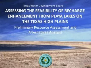
Description of region • Southern Great Plains • About 30,000 playas (ideal experimental replicates) • Each playa within its own watershed • Heavy agriculture, mostly cotton and under irrigation from the Ogallala • Significant wildlife use of playas
Lubbock County Study site 40 miles Weather stations are scattered throughout the Southern High Plains. Data from these stations are continuously updated and available online.
Estimated rainfall: June 7, 2003 24 hour period Lubbock County
Playa in native grassland near Hereford, Texas (north end of our study area)
Rain Temperature Total amount Frequency Geographically & seasonally variable How long will a playa stay wet? South winds Surface runoff: amount dictated by watershed size, cultivation practices, and rain dynamics Surface runoff Evaporation/transpiration Sediment loads (yes/no) Playa depth (-) Aquifer recharge
Visual playa soil edge Edge infiltration? Playa depth Following sedimentation Caliche layer Original playa depth Sediment depth due to anthropogenic processes Crack Water Profile of an idealized playa in the Texas Southern High Plains (from Luo et al., 1997).
Economics Sediment Rain Playa hydroperiod Climate CRP Landuse Temperature Grassland Vegetation Birds Biota Amphibians • Hypothesis: Climatic variation and landuse practices dictate hydroperiod and spatial distribution of wet playas, influencing the ecological structure of vegetation and animal communities that rely on playas for many life requisites.
Experimental Design • Southern High Plains in west Texas • 40 wet playas selected per year (20 cropland and 20 grassland) • Sample amphibian, avian, and vegetative communties • Determine playa hydroperiod, volume, sediment depth. • Estimate extreme temperature and precipitation patterns. • Estimate sediment runoff into playas.
Avian Studies • Avian community composition in crop and grass playas • Water fluctuation effects on avian community composition • Local and landscape variable correlations to avian density, richness, and diversity
Amphibian Studies • Amphibian community composition in crop and grass playas • “Mechanistic” analysis of community responses (differential sensitivity of species to hydroperiod) • Local variable correlations with amphibian community composition
Climatic predictions • Spatial distributions of rainfall and temperature • Long-term forecasts • Correlate rainfall and temperature patterns with biotic data
Integration • Rainfall and temperature – 3 levels • Playas & watersheds – vary soil, slope, sediment loads • Biotic data • Economic cost-benefit models • Predicted outcomes under current and new policies (mitigation strategies) • e.g., dryland, crop rotations, buffer strips, excavation
Buffalo Grass Buffer Strips Irrigated Cotton Irrigated Corn Playa Irrigated Sorghum Irrigated Wheat Representative playa watershed to be modeled in APEX.
APEX TAES Budgets Climatic Predictions Direct Agricultural Response Model Indirect Playa Ecology Data BioEconomic Model Economic/Biologic Effects on SHP BMP’s Application of data analysis tools for BMP development.