Download
1 / 19
190 likes | 308 Views
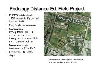
Pedology Field Assignment. by: Brant Phelps. Map of Georgia (web soil survey). 1. 2. Location of profile 1 (web soil survey). AP Bwc Btvc1 Btvc2. Name or group Irvington SOS 4715/5716 Soil Description Form Site Phelps

E N D
Pedology Field Assignment by: Brant Phelps
AP • Bwc • Btvc1 • Btvc2
Name or group Irvington SOS 4715/5716 Soil Description Form Site Phelps No. of horizons 4 University of Florida Depth 52”
B. Soil Properties and Interpretations • Infiltration Rate Available Water Soil interpretation High Very Low(≤7.5cm) 2 Dwellings with basements x Moderate Low (>7.5-≤15cm) 3 Septic Tank adsorption Low x Moderate(>15-≤22.5cm) 1 Local roads and streets High (>22.5cm) 1-Slight limitations 2-moderate limitations 3-severe limitations Hydraulic Conductivity Seasonal High Water Table depth High >150cm x moderate 100 to <150cm Low x 50-<100cm 25-<50cm <25cm
Site Characteristcs Erosion Potential Very Low Position of Site x Low Depression Medium Drainageway High Flood Plain Very High Stream Terrace Footslope D. Soil Classification x upland Epipedon Parent Material Mollic x Marine x Ochric Fluvial Umbric Eolian Histic Soil SlopeSubsurface Horizon x Nearly Level (0-2%) Albic Gently Sloping (2-6%) x Argillic Sloping (6-12%) Kandic Strongly Sloping (12-20%) Spodic Moderately Steep (20-30%) None Steep (>30%) Order Surface Runoff Alfisols Ponded Entisols x very slow Histosols slow Inceptisols medium Mollisols rapid Spodosol very rapid x Ultisol
Ap Btg1 Btg2
Btg2 Btg3
Name or Group Brookman SOS 4715/5716 Soil Description Form Site Phelps University of Florida No. of horizons 4 Pedon Depth 42”
B. Soil Properties and Interpretations • Infiltration Rate Available Water Soil interpretation High Very Low(≤7.5cm) 3 Dwellings with basements Moderate Low (>7.5-≤15cm) 3 Septic Tank adsorption x Low x Moderate(>15-≤22.5cm) 3 Local roads and streets High (>22.5cm) 1-Slight limitations 2-moderate limitations 3-severe limitations Hydraulic Conductivity Seasonal High Water Table depth High >150cm moderate 100 to <150cm x Low 50-<100cm 25-<50cm x <25cm
Site Characteristcs Erosion Potential Very Low Position of Site Low Depression x Medium Drainageway High x Flood Plain Very High Stream Terrace Footslope D. Soil Classification upland Epipedon Parent Material Mollic x Marine Ochric Fluvial x Umbric Eolian Histic Soil SlopeSubsurface Horizon x Nearly Level (0-2%) Albic Gently Sloping (2-6%) x Argillic Sloping (6-12%) Kandic Strongly Sloping (12-20%) Spodic Moderately Steep (20-30%) None Steep (>30%) Order Surface Runoff Alfisols Ponded Entisols very slow Histosols x slow Inceptisols medium Mollisols rapid Spodosol very rapid x Ultisol