Download
1 / 51
510 likes | 514 Views
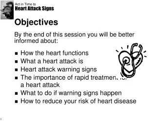
State the importance of accurate weather data. Summarize the instruments used to collect weather data from Earth’s surface. Analyze the strengths and weaknesses of weather radar and weather satellites. Section 12.3. Objectives. Gathering Weather Data. Section 12.3. Gathering Weather Data.

E N D
State the importance of accurate weather data. Summarize the instruments used to collect weather data from Earth’s surface. Analyze the strengths and weaknesses of weather radar and weather satellites. Section 12.3 Objectives Gathering Weather Data
Section 12.3 Gathering Weather Data Accurate measurements of atmospheric properties are a critical part of weather analysis and prediction. Review Vocabulary temperature: the average thermal energy of the particles that make up a substance
Section 12.3 New Vocabulary Gathering Weather Data thermometer barometer anemometer hygrometer radiosonde Doppler effect
Section 12.3 Data from Earth’s Surface Gathering Weather Data Two important factors in weather forecasting are the accuracy of the data and the amount of available data.
A thermometer measures temperature using either the Fahrenheit or Celsius scale. A barometer measures air pressure. Section 12.3 Data from Earth’s Surface Gathering Weather Data Temperature and air pressure
An anemometer measures wind speed. A hygrometer measures relative humidity. Section 12.3 Data from Earth’s Surface Gathering Weather Data Wind speed and relative humidity
The Automated Surface Observing System (ASOS) gathers data in a consistent manner, 24 hours a day, every day. It provides essential weather data for aviation, weather forecasting, and weather-related research. Section 12.3 Data from Earth’s Surface Gathering Weather Data Automated Surface Observing System
The instrument used for gathering upper-atmosphere data is a radiosonde. A radiosonde’s sensors measure the air’s temperature, pressure, and humidity. Also wind speed and direction( by its movement) Section 12.3 Data from the Upper Atmosphere Gathering Weather Data
A weather radar system detects specific locations of precipitation. The Doppler effect is the change in pitch or frequency that occurs due to the relative motion of a wave, such as sound or light, as it comes toward or goes away from an observer. Section 12.3 Weather Observation Systems Gathering Weather Data Weather radar
Analysis of Doppler radar data can be used to determine the speed at which precipitation moves toward or away from a radar station. Section 12.3 Weather Observation Systems Gathering Weather Data Doppler radar
Infra red, 2. visible light, 3.water vapor imagery. Some satellites use cameras that require visible light to photograph Earth. These digital photos are sent back to ground stations, and their data are plotted on maps. Unlike weather radar, which tracks precipitation but not clouds, satellites track clouds but not necessarily precipitation. Section 12.3 Weather Observation Systems Gathering Weather Data Weather satellites -3 types of imaging
Some weather satellites use infrared imagery to make observations at night. Objects radiate thermal energy at slightly different frequencies. Infrared imagery detects these different frequencies, which enables meteorologists to map either cloud cover or surface temperatures. Section 12.3 Weather Observation Systems Gathering Weather Data Weather satellites track clouds and water vapor.
Another type of satellite imagery that is useful in weather analysis and forecasting is called water-vapor imagery. Water-vapor imagery is a valuable tool for weather analysis and prediction because it shows moisture in the atmosphere, not just cloud patterns. Section 12.3 Weather Observation Systems Gathering Weather Data Weather satellites
Analyze a basic surface weather chart. Distinguish between digital and analog forecasting. Describe problems with long-term forecasts. Section 12.4 Objectives Weather Analysis and Prediction Review Vocabulary model: an idea, system, or mathematical expression that represents an idea
Section 12.4 New Vocabulary Weather Analysis and Prediction Several methods are used to develop short-term and long-term weather forecasts. station model isobar isotherm digital forecast analog forecast
Section 12.4 Surface Weather Analysis Weather Analysis and Prediction Station models A station model is a record of weather data for a particular site at a particular time.
Section 12.4 Surface Weather Analysis Weather Analysis and Prediction Station models Meteorological symbols are used to represent weather data in a station model. Advantages: universal language, more info in less space.
Section 12.4 Surface Weather Analysis Weather Analysis and Prediction Plotting station model data To plot data nationwide and globally, meteorologists use lines that connect points of equal or constant values.
Section 12.4 Surface Weather Analysis Weather Analysis and Prediction Plotting station model data Lines of equal pressure are called isobars. Lines of equal temperature are called isotherms.
Section 12.4 Surface Weather Analysis Weather Analysis and Prediction Interpreting station model data The weather map shows isobars and air pressure data for the continental United States.
Section 12.4 Surface Weather Analysis Weather Analysis and Prediction Interpreting station model data Using isobars, isotherms, and station model data, meteorologists can analyze current weather conditions for a particular location.
Section 12.4 Types of Forecasts Weather Analysis and Prediction Digital forecasts A digital forecast is created by applying physical principles and mathematics to atmospheric variables and then making a prediction about how these variables will change over time.
Section 12.4 Types of Forecasts Weather Analysis and Prediction Analog forecasts An analog forecast is based on a comparison of current weather patterns to similar weather patterns from the past.
Section 12.4 Short-Term Forecasts Weather Analysis and Prediction The most accurate and detailed forecasts are short term because weather systems change directions, speeds, and intensities over time.
Section 12.4 Long-Term Forecasts Weather Analysis and Prediction Because it is impossible for computers to model every variable that affects the weather at a given time and place, all long-term forecasts are less reliable than short-term forecasts. Short term forecasts are more reliable.
12 Section 12.3 Gathering Weather Data Study Guide Key Concepts Accurate measurements of atmospheric properties are a critical part of weather analysis and prediction. • To make accurate weather forecasts, meteorologists analyze and interpret data gathered from Earth’s surface by weather instruments.
12 Section 12.3 Gathering Weather Data Study Guide Key Concepts • A radiosonde collects upper-atmospheric data. • Doppler radar locates where precipitation occurs. • Weather satellites use infrared, visible-light, or water-vapor imagery to observe and monitor changing weather conditions on Earth.
12 Section 12.4 Weather Analysis and Prediction Study Guide Key Concepts Several methods are used to develop short-term and long-term weather forecasts. • A station model is used to plot different weather variables. • Meteorologists plot lines on a map that connect variables of equal value to represent nationwide and global trends.
12 Section 12.4 Weather Analysis and Prediction Study Guide Key Concepts • Two kinds of forecasts are digital and analog. • The longer the prediction period, the less reliable the weather forecast.
12 12.3 Section Questions Meteorology Which weather instrument is used to measure wind speed? a.barometer b.thermometer c.anemometer d.hygrometer
12 12.3 Section Questions Meteorology Doppler radar data show that the return echo from one side of a storm has a shorter wavelength than the emitted wave. What can be concluded about the reflecting particles? a.They are very small. b.They are very large. c.They are moving toward the station. d.They are moving away from the station.
12 12.3 Section Questions Meteorology Why are weather satellites important to forecasters?
12 12.3 Section Questions Meteorology Answer: Satellites can monitor weather conditions over large regions of Earth using a variety of wavelengths. The satellites provide information about cloud cover, moisture, atmospheric circulation, and more, which can be used together to provide current and rapid forecasts.
12 12.4 Section Questions Meteorology What is an isobar? a.a line of constant altitude b.a line of constant temperature c.a line of constant pressure d.a line of constant moisture
12 12.4 Section Questions Meteorology Which weather forecast is usually the most accurate? a.one-day forecast b.three-day forecast c.seven-day forecast d.thirty-day forecast
12 12.4 Section Questions Meteorology How are digital forecasts made? Possible answer: Digital forecasts are made by using computers to model future weather conditions based on current weather data.
12 Chapter Assessment Questions Meteorology What characteristics describe a continental tropical air mass? a.cool and dry b.hot and dry c.mild and humid d.hot and humid
12 Chapter Assessment Questions Meteorology A high-pressure system has moved directly over a region. What weather condition most likely exists in this region? a.fair weather b.steady rain c.high winds d.thunderstorms
12 Chapter Assessment Questions Meteorology Which type of wave is transmitted by weather radar units? a.X rays b.sound waves c.radio waves d.infrared waves
12 Chapter Assessment Questions Meteorology Examine the isobar map. From approximately which direction is the wind blowing in central Ohio? a.southwest b.southeast c.northwest d.northeast
12 Chapter Assessment Questions Meteorology A warm, moist air mass is currently over a region. What changes will occur as a strong cold front advances over this region?
12 Chapter Assessment Questions Meteorology Answer: The front has a high temperature contrast across it and a supply of moisture in front of it. As the cold front advances, uplift of moisture-laden air will occur and thunderstorms will probably develop. Some of these storms could be severe.
12 Standardized Test Practice Meteorology Which type of air mass forms over the Gulf of Mexico and Caribbean Sea? a.continental polar b.continental tropical c.maritime polar d.maritime tropical
12 Standardized Test Practice Meteorology A frigid, winter air mass is moving south across the central United States. Which feature can most modify the characteristics of this air mass? a.a large lake b. tree-covered hills c.snow-covered plains d.a lowland area
12 Standardized Test Practice Meteorology Which winds converge and rise at the intertropical convergence zone? a.polar easterlies b.westerlies c.trade winds d.jet streams
12 Standardized Test Practice Meteorology How is the path of a moving current of air in the southern hemisphere affected by Earth’s rotation? a.It curves to the right. b.It curves to the left. c.It curves upward. d.It curves downward.
12 Standardized Test Practice Meteorology How does the polar jet stream affect weather in the midlatitudes?