Download
1 / 51
510 likes | 517 Views
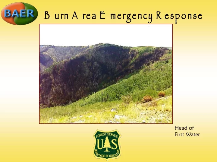
Burn Area Emergency Response. Head of First Water. Why is BAER Necessary?. The EMERGENCY initially caused by the fire may not be over when the flames are out! Post-fire hazards can KILL people and DAMAGE property and resource values. Stuart Guard Station – Mouth of Nuck Woodward.

E N D
Burn Area Emergency Response Head of First Water
Why is BAER Necessary? • The EMERGENCY initiallycaused by the fire may not be over when the flames are out! • Post-fire hazards can KILL people and DAMAGE property and resource values. Stuart Guard Station – Mouth of Nuck Woodward
BAERis… • A process with very tightly defined goals • Identify values at risk. • Identify cost effective treatments with a high likelihood of success that can help reduce those risks. • Implement those treatments in a timely fashion and monitor their effectiveness. • An emergency funding source • Funds can only be spent on National Forest System lands – but the values at risk can be on adjacent lands.
Resources at Risk • Human life and safety is the number one value at risk
Resources at risk • Water quality • Fish habitat • Irrigation diversions and systems • Power plant operations • Recreation facilities, roads and trails Bob Wright Road
Timing isCritical The assessment must be completed within 7 days of containment of the fire. Treatments should begin before the first damaging storms that threaten life, property, or the resource values needing protection. All treatments must be done in time to be effective. All work must be finished within 1 year of containment of the fire. Bridge above Old Folks Campground
BAER is a race against the weather • BAER IS an immediate response to an emergency situation. • BAER IS NOT an attempt to put the land or its facilities back to their former condition. Nuck Woodward
BAER is a body of knowledge • Some treatments are not very effective for emergency control of erosion • Seeding • Ground hydromulching • Use of PAM (polyacrylamide) soil binding agents • BAER is not the only source of assistance after a fire • NRCS Emergency Watershed Programs • Utah Emergency Management Services
Existing seeds and tree and shrub root systems will create natural regeneration There is no special Forest Service funding available for long-term restoration efforts. Castle Valley Ridge
SeeleyBurn Area Emergency Response BAER AssessmentFindings and Recommendations July 31, 2012
How Did We Assess the Fire? Fire Intensity - “Above ground” visual fire effects: Loss of overstory and understory vegetative canopy. Loss of surface litter and debris. • Burn Severity - degree of change to soil conditions and hydrologic function: At & below ground: • Total heat • Residence time • Alters soil structure and ability to absorb water
BARC Map (Burned Area Reflectance Classification)
Aquatic/Riparian & Wildlife Habitat Value Identification Identify critical values in, or in close proximity to, the burned area. Life and Safety Cultural Resources
Findings: Post-Fire Effects • 23% of FS area is high burn severity
Findings: Post-Fire Effects • 46% of FS area is moderate burn severity
Findings: Post-Fire Effects • Debris Flows and floods can impact: • Human safety • Downstream Values-at-Risk • Water quality
Findings: Post-Fire Effects • Rains on July 6, 7, and 16 resulted in flows that carried tons of mud, ash and debris across SR-31 and into streams draining the fire. Ash deposition was seen in irrigation ditches below the Huntington airport and below Price Utah.
Findings: Post-Fire Effects • Side Canyon Drainages above Hwy. 31 • Debris flows/flooding • Excessive channel scour • Channel headcutting
Findings: Post-Fire Effects • Assessed Roads at: • Nuck Woodward, Bob Wright, • Corner Canyon, Campground roads • Debris flows and flooding from side drainages • Cut-slope Failure • Streambank Erosion • Washouts in Road • Culverts Undersized and • Non-Functioning
Findings: Post-Fire Effects • State HWY 31 Huntington Canyon • Multiple culverts and roadside ditches along State HWY 31 are clogged with debris and not functioning. • Flash Floods and Debris flows from side drainages after short-duration high intensity storms have overtopped highway. Larger storms could result in even greater damage to HWY 31. • Public Safety
Findings: Post-Fire Effects • Recreation: • Approximately 13 miles of trails received damage from debris flows and burned out stumps. Tread damage and down trees impede trail use. • Most campgrounds and dispersed camping areas were unaffected by the fire; however, they are now sustaining damage from debris flows and flash flooding. • Water systems were damaged and rill erosion could bury spring collection areas and expose waterlines on the hill slopes. • Risks to visitors from hazard trees will persist for many years. • Barriers across user-created routes have been burned in the fire. Pole Canyon Trail South Stuart campsite
Findings: Post-Fire Effects South Stuart campsite Left Fork silt fence damage Sawmill Canyon barriers Pole Canyon Trail
Findings: Noxious Weeds • KNOWN WEED POPULATIONS • Musk Thistle, Hounds Tongue and Scotch Thistle infest Huntington Canyon, Nuck Woodward, Trough Springs Ridge and Castle Valley Ridge. • SUPRESSION ACTIVITIES CREATE GROUND DISTURBANCE WHICH CAN INCREASE WEEDS • Hand lines, dozer lines, burnout, engines, hose lays, use of retardant, helibases, cargo/slingsites, spike camps
Range Findings: Post-Fire Effects Allotments that were damaged significantly by fire: • Castle Valley Ridge C&H 60% • Bob Wright S&G 56% • Trough Springs Ridge S&G 54% • Candland S&G Forage Reserve 42%
Findings: Wildlife and Fisheries • Direct fire effects (i.e. mortality) to listed terrestrial wildlife species were not observed within the Seeley Fire perimeter. • In the short term there will be negative impacts to some wildlife species within areas with high and moderate burn severity. • The fire will have long-term positive impacts to many wildlife species including mule deer, elk, goshawk and golden eagle. • The fire, itself, had little to no direct effect on fish populations because nearly all high intensity/severity areas occurred on the mid-upper slopes.
Findings, continued • Approximately 38,231 acres of Mule Deer Summer Range are within the Seeley Fire Perimeter. Approximately 9,356 acres are winter/transition range. • There are 25,109 acres of elk summer range, and 22,478 acres of elk transition/winter range.
Findings: Post-fire Effects • Fish kill was observed in Huntington Canyon and downstream fisheries after July 7th and 16th debris flows. • Future storms on burned areas will likely cause similar debris flows over the next 3-5 years. • Habitat-degrading fine sediment will likely accumulate in streams important for both recreational and native fisheries along Huntington Creek for 5 years or more.
BAER Recommendations Hill Slope Treatment: Wood Mulch • 584 acres to reduce erosion and runoff • 6 tons/acre, 50% coverage • Harvest and shred beetle-kill and burned snags along roads • Trough Springs Ridge • Gentry Mountain • Use helicopter for placement
BAER Recommendations: • Roads General • Reconstruct washed out portions of roads • Rehab waterbars/rolling dips, culverts and catch basins • Replace under sized/non-functioning culverts • Construct additional waterbars/rolling dips • Construct low water crossings • Armor streambank erosion and culvert inlets • Close Nuck Woodward Road until repairs have been completed. • Install warning signs on roads that enter or provide access to burned areas and along Highway 31. • Monitor road drainage structures after storm events to ensure the maximum drainage capacity is maintained.
BAER Recommendations • Side Canyon Drainage Treatments to Protect Hwy. 31 • Construct Overflow Basins in natural flat areas or existing flood plains adjacent to stream channels to dissipate flow over a larger area. • Construct Debris Racks along drainage channels to minimize amount of debris carried downstream during flow events. • Construct Rock Armored Overflow structures where channels intersect cut slopes adjacent to the highway to protect these slopes from headcutting. • Stream Grade Stabilization to help reduce or prevent continued headcutting in stream channels. • Monitor structures after storm events to ensure the maximum drainage capacity is maintained until the natural re-vegetation has occurred.
BAER Recreation Recommendations: • Clean existing trail drainage structures on high and moderate severity trails. • Install 300 additional drainage structures on high and moderate severity trails. • Temporarily close trails until proper drainage can be established, down trees are removed and slopes stabilize. • Install hazard warning signs on roads, trails, and campsites threatened by flash flooding and fire effects on soils and vegetation. • Install barriers and signs to prevent uncontrolled motorized use in areas where it is likely to occur. • Enlarge and clean ditches around spring collection areas, construct water bars/check dams over waterlines, repair the silt fence around Left Fork of Huntington water system, and repair/replace the sediment liner at the Old Folks Flat spring collection area.
BAER Recreation Recommendations: Conditions change with every storm, and the response must change to accommodate current conditions. • Initial campground closure recommendations: South Old Folks Flats, South Stuart, Beaver Dam, Big Rock, Bridges (Site A), dispersed sites along Nuck Woodward Creek, South Hughes and Old Folks Flat. • Pump vault toilet at Big Rock to prevent stream contamination.
BAER Weed Recommendations: • Monitoring – Monitor within the burned area, focusing on areas with existing noxious weeds and all locations associated with fire suppression activities (e.g., spike camps, dozer line, hand lines) • Chemical Treatment – Treat approximately 1,088 acres of existing infestations and treat any new infestations resulting from suppression activities
Wildlife Recommendations: • Monitor Aspen recovery within the burned area. • Aspen regeneration and stand survival is important to numerous wildlife species. Stand survival is a concern if sufficient heights (approximately5- 6 feet) are not met, or if elk and deer use is concentrated in areas of new aspen growth. • Monitor Management Indicator Species populations and compare results to pre-fire data.
Fisheries Recommendations: • Monitor the head cut control treatments in Nuck Woodward. • Monitor fine sediment depth in pools in low-gradient reaches of upper Huntington Creek and Nuck Woodward to measure rate of fine sediment accumulation and scouring. • Consider post-fire electro-fishing surveys in cooperation with the Utah Division of Wildlife Resources to compare to pre-fire electro-fishing surveys.
Recreation Recommendations: Pole Canyon bridge • Replace bridges that were burned or washed away in flash floods. • Reconstruct Second Water and Sawmill Canyon Trails which were damaged in flooding. • Construct fence along road into Stuart Guard Station. • Monitor trails in the high or moderate severity burns for proper drainage. Road into Stuart Guard Station
Range Recommendations • Within 3 years, replace all burned watering troughs (17) and 6.75 miles of fencing to support proper distribution of livestock grazing. • Salting will not be done close to edges of burned areas. • All areas that burned will be rested for at least two growing seasons. Meaning the soonest grazing could continue in burned areas is the fall of 2014.
Coordination is Essential • The Seeley Fire caused high and moderate intensity burns on steep slopes that drain off the forest in the Huntington Creek, Miller Creek, Serviceberry Creek, Los Angeles Canyon, Corner Canyon, First and Second Water Canyon, and Mud Canyon drainages. • Recent debris and mud flows have shown just how far material from the fire can travel.
Huntington Creek • PacifiCorp should install a river gauge and weather station as recommended by Brian McInerney, hydrologist with the National Weather Service in Salt Lake City. • The Huntington/Cleveland Irrigation Company should considerremoving accumulated sediment behind their Huntington headgate to minimize additional sediment from entering irrigation pipes and sprinkler lines.
Adjacent Lands (BLM, State, County, Private) Gordon Creek Clear Creek Wiregrass Bench Hiawatha
Replace down powerlines (Clear Creek, Hiawatha) and protect from future debris flows. Install waterbars, enlarge culverts, and add relief culverts. Install flood warning signs and issue flood alerts based on rainfall amounts. Protect existing structures in coal loadoutfacilities from debris flows. Excavate mine ponds (Hiawatha) that have filled with sediment/ash. Repair/maintain outlet culverts. Adjacent Lands (BLM, State, County, Private)
Locate and clean all relief culverts Increase ditch capacity Reinforce sections of road where high flows are causing streambank erosion Continued maintenance after storm events THANK YOU FOR YOUR EFFORTS!!! Highway 31 - UDOT