Download
1 / 13
130 likes | 133 Views
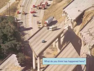
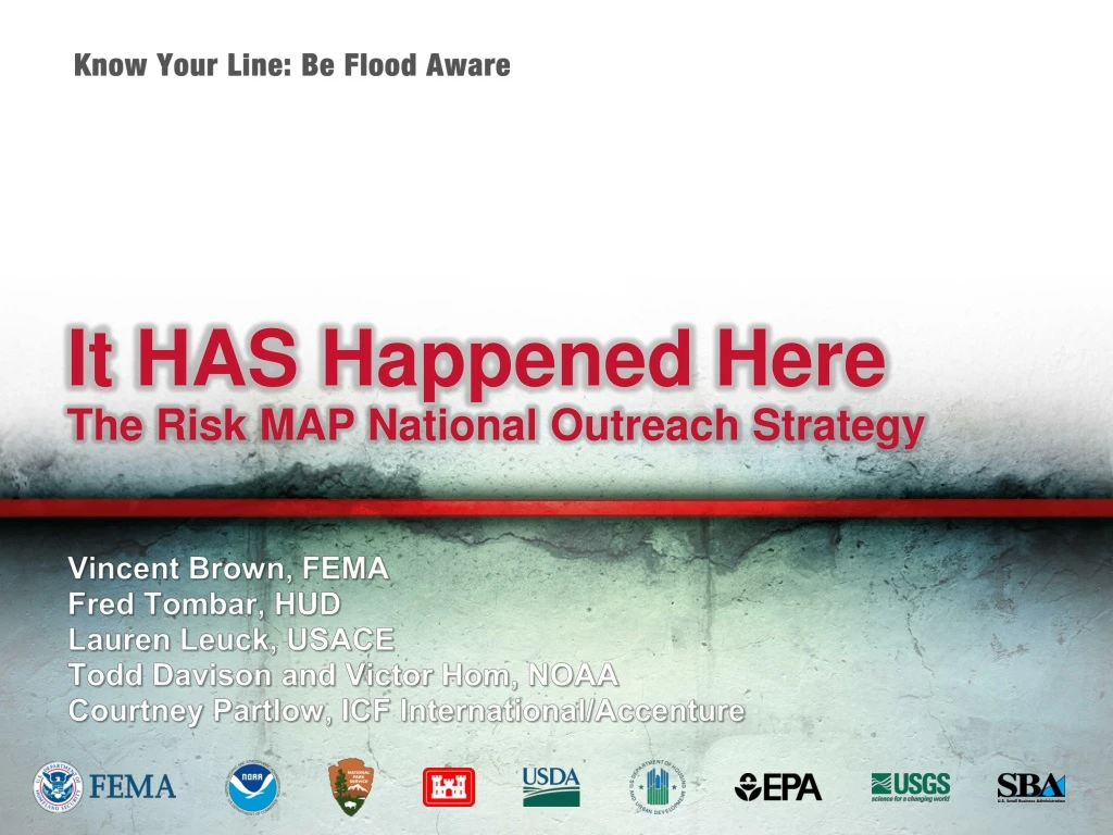
It HAS Happened Here The Risk MAP National Outreach Strategy. Vincent Brown, FEMA Fred Tombar , HUD Lauren Leuck , USACE Todd Davison and Victor Hom , NOAA Courtney Partlow, ICF International/Accenture. The Problem.

E N D
It HAS Happened HereThe Risk MAP National Outreach Strategy Vincent Brown, FEMA Fred Tombar, HUD Lauren Leuck, USACE Todd Davison and Victor Hom, NOAA Courtney Partlow, ICF International/Accenture
The Problem • Floods are the most common and costly natural disaster in the United States and all communities are vulnerable • Over a 30-year mortgage, homes and businesses in high-risk areas have a 26% or greater chance of flooding • 2 ½ times greater than the chance of fire • People and businesses often take few steps to protect themselves from floods “It won’t happen here.”
Part of the Solution • FEMA knows that the public does not want to hear about flooding from the Federal government* • Prefer to hear about it from local officials • Developed a strategy for a high water mark campaign that relies on local ownership and implementation • Showcasing the outcome of a community’s most severe flood can offer a powerful testimony and daily reminder to local citizens • FEMA approached other Federal agencies with similar concerns about flooding to jointly implement the strategy • The High Water Mark Initiative, “Know Your Line: Be Flood Aware” was born • Nine Federal agencies working together • Goal is to motivate individuals to reduce risk *Per findings of 2010 and 2011 Risk MAP Flood Awareness Surveys
“Know Your Line” Overview • Description • Encourages communities to post markers on prominent buildings to identify how high flood waters have risen in the past, conduct a kick-off event, then reinforce with outreach over time • Objectives • Raise flood risk awareness, drive action to reduce risk • Audience • Homeowners and renters, youth, elderly, local businesses • Features • Turnkey outreach strategy and customizable tools and materials to allow communities to quickly establish a tailored initiative • Established partnerships with numerous agencies and organizations to support widespread outreach
Benefits of Community Participation • Underscores its commitment to the well-being of its citizens and local business community • Galvanizes the community to take steps now to reduce the often devastating impact of floods • Earn Community Rating System Rating (CRS) points to reduce the cost of flood insurance across the community • Put Federal and state mitigation assistance funds to work
First Step: Pilot Communities • Identified 6 potential pilot communities • Talking with them now to determine their interest in participating • To choose pilots, we considered: • Regional and demographic diversification • Subject to a range of types of flooding • Different flooding histories • Availability of data • Availability of funding • Strong relationships with community members or demonstrated interest in this type of activity • Highly visible locations
Pilot Project Responsibilities • Federal agency point of contact will: • Help the community tailor the strategy and materials to suit their needs • Provide recommendations and consultation on implementation activities • Provide recognition to pilot participants online and at conference and trade association meetings • Help the community determine where the signs will go • Pilot participants will: • Establish a point-of-contact for “Know Your Line” activities • Tailor the strategy and materials to suit their specific needs • Launch the initiative and sustaining activities • Provide feedback, best practices, and insights to help us improve the campaign prior to national roll-out • Potentially act as a mentor to communities moving forward
Next Step: National Roll-Out • The High Water Mark Working group will update, enhance, and add tools based on pilot feedback • We will then open participation up nationwide, hopefully in time for National Preparedness Month in September • Announcements will be made to local officials through many vehicles, potentially including: • Outreach through CRS Program • Articles in trade association newsletters (e.g., NACo, U.S. Conference of Mayors) • Outreach through Federal agency contacts located throughout the country
Tools for Communities* • Customizable “Know Your Line” sign and printing instructions • Access to data to determine where signs should be placed • Launch event ideas • Customizable community outreach plan • Pre-existing relationships with supporting organizations that can be engaged at the local level • Website to house local flood information and “Know Your Line” events • In development • Press materials to support launch • Release • Advisory • Campaign “help desk” for feedback or assistance *More to come based on pilot community feedback
For More Information Please contact Vince Brown at vincent.brown@fema.dhs.govor 202.646.2725
Q&A Questions?