Download

1 / 19
190 likes | 267 Views
FGDC Facilities Working Group Update Nancy Blyler USACE. Mission

E N D
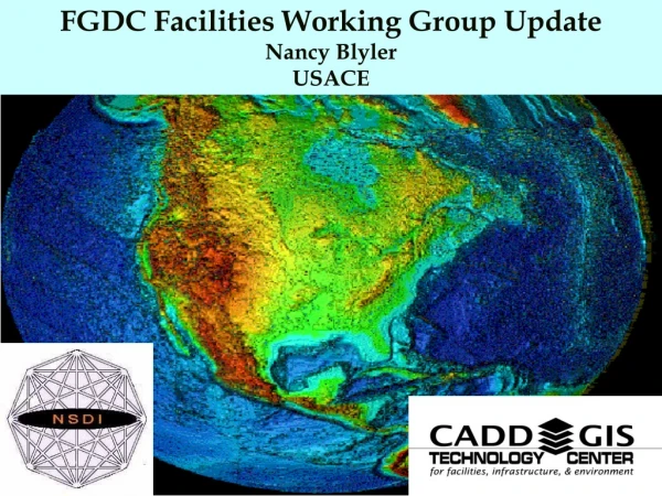
FGDC Facilities Working Group Update Nancy Blyler USACE
Mission • To serve as a multi-agency vehicle to coordinate facilities, infrastructure, and environmental use of CADD and GIS activities within DoD and with other participating governmental (federal, state, and local) agencies, and the private sector. • Develop CADD/GIS Standards • Technical Support to Military Installations • Promote the NSDI throughout Military Installations and Participating Agencies
Originally established as the “Tri-Service CADD/GIS Technology Center” in 1992 at the Army Waterways Experiment Station, Information Technology Laboratory, Vicksburg, Mississippi . Established by the Army (including Army Corps of Engineers), Navy, and Air Force (i.e, Tri-Services). • The FGDC Facilities Working Group was established in January 1995 to develop standards for facility management and civil engineering.
The Tri-Service Center’s name changed to “CADD/GIS Technology Center for Facilities, Infrastructure, and Environment” in July, 1999 to reflect a broader mission. • In October 1999, the FGDC Coordination Group approved a plan to merge the FWG with the CADD/GIS Technology Center for Facilities, Infrastructure and Environment.
Participating Department of Defense (DoD) and Federal Government Agencies (as of January 2001) • U.S. Army Corps of Engineers • U.S. Army • U.S. Navy • U.S. Air Force • U.S. Marines • National Aeronautics and Space Administration (NASA) • Defense Logistics Agency (DLA) • U.S. Coast Guard • General Services Administration (GSA) • National Institute of Building Sciences (NIBS) • U.S. Environmental Protection Agency
Charter and Business Plan • Charter has been updated incorporating language concerning the FGDC Facilities Working Group (FWG) and signed by USACE, Navy, Army, National Institute for Building Science (NIBS), NASA and Coast Guard • Updated the Business Plan incorporating language concerning the FGDC FWG
Board of Directors • Industry Associates: • ESRI • Autodesk • Bentley • Intergaph • Societies/Organizations • NIBS • CSI • AIA • IFMA • ISO • ANSI • ASTM • ACS • Nature Conservancy • OGRIP • PaMAGIC • National Assoc.. of Counties • Federal Partners: • USACE • (Military Programs) • (Civil Works) • (Research and Development) • Naval Facilities Command • Air Force Civil Engineer • Marine Corps • General Services Admin. • NASA • Coast Guard • Department of State • Defense Logistics Command • FAA • EPA • Federal Associates: • Architect of the Capitol • Army Reserve • National Guard • Veteran;s Affairs • Department of Interior Corporate Staff Center Staff External Partners Field User Groups Corps’ FAC/SAC Groups FGDC Facilities Subcommittee
Corporate Staff Center Standards Working Group Cultural/ Natural Resources Design Construction Facility Management Civil Works Military Planning Environmental Systems Architect Mechanical Electrical Interior Designer Structural Civil Geotechnical Landscape Arch Surveyor Project Mgr Cost Specifications . . . . . . . NT, UNIX, DOS Banyan/Novell System Manager Networking Budgeting Data Mgmt Communication Programming Internet Client/Server E-Mail, SMTP SGML/HTML . . . . . . . Envr Engineer Envr Scientist Pollution HTRW Air Water Noise . . . . . . . Master Planner Mapping Spec Remote Sensing GPS Space Utilization MOB BCP . . . . . . . Operations Maintenance Work Order Mgt. Systems Crafts Manager Facility Manager IFSM WIMS NFADB . . . . . . . Agronomist Forester Biologist Archaeologist Natural Planner Historic Pres Off Cultural Planner NEPA Specialist Landscape Arch . . . . . . . Study Manager Economist Hydrologist Specialty Planner Recreation Spec Hydraulic Engr Social Scientist Mapping Spec Real Estate Master Planner . . . . . . . Field User Groups
CADD GIS TECHNOLOGY CENTER • NCITS Accredited IT Standards Committee NCITS* PROJECT 1411 Spatial Data Standard for Facilities, Infrastructure & Environment (formerly Tri-Service Spatial Data Standards)
What is Being Standardized • CD-based Data Content (catalog and logical data model) for Facilities, Infrastructure & Environment • includes SQL schema generation tools • includes: FGDC Standards (Soils, Wetlands, Veg., Utilities, …) • follows: ISO (15046-10.2) GI - Feature Cataloguing Methodology
Status: • Completed 1st draft (in review by Center/FWG.) • Submission to ANSI/NCITS L1 Mar. 01 • Review by L1 and NCITS staff • Out for public review this spring.
FGDC Facilities Working Group, working with three Local Government Consortiums: • Kern Geographic Information Network (Kern GEONET) • San Joaquin Valley Information Association (SJV ISIS) • California Geographic Information Association (CGIA)
and two military installations Edwards AFB China Lake NWC
Provide training to local government and military personnel on SDSFIE use. • Develop and Provide an SDSFIE Implementation Guide for Local Governments
Develop an Access Database or Excel Spreadsheet annotating additional entities for inclusion into the SDSFIE data schema and….
Incorporation of USGS DLG Data into the SDSFIE • Phase I • Detailed technical guide with workflows for automated scripts and materials for converting USGS DLG digital map data formats into SDS. • Draft User guide with a step-by-step conversion of digital line graph (DLG) data into SDS. • Phase II • Bulk conversion tools • Final User guide