Download
1 / 14
140 likes | 310 Views
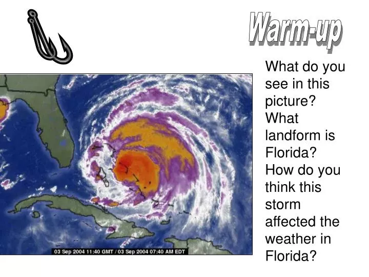
Warm-up. What do you see in this picture? What landform is Florida? How do you think this storm affected the weather in Florida?. Graphic Organizer. Factors affecting climate. L. A. M. E. C. O. W. S. L ATITUDE. A IR PRESSURE. M OUNTAIN BARRIERS. E LEVATION. C ONTINENTAL LOCATION.

E N D
Warm-up What do you see in this picture? What landform is Florida? How do you think this storm affected the weather in Florida?
Factors affecting climate L A M E C O W S
LATITUDE AIR PRESSURE MOUNTAIN BARRIERS ELEVATION CONTINENTAL LOCATION OCEAN CURRENTS WIND BELTS STORMS
Latitude has the biggest effect on climate because… LATITUDE AIR PRESSURE MOUNTAIN BARRIERS ELEVATION CONTINENTAL LOCATION OCEAN CURRENTS WIND BELTS STORMS
AIR PRESSURE Air Pressure 1. Caused by unequal heating of earth’s surface 2. Low pressure = warm, moist air → rises & forms clouds → storms (thin air) 3. High pressure = cold, dry air → sinks → stable and clear weather (dense air)
Mountain BarriersOrographic Effect • Winds cool as they move up the side of a mountain, eventually releasing rain or snow. By the time the winds reach the other side of the mountain, they are dry and become warmer as they flow down the mountain.
Elevation(Snows of Kilimanjaro) Refer to Pg. 56 Elevation Increase in elevation = Decrease in temperature ↑ 1000 ft = ↓ 3.6°F COLD COOL WARM HOT
Continental Location GO TO PAGE S-33 IN YOUR BOOK! Continental Location Oceans are solar energy collectors Because water heats & cools more slowly than land… 1. Coastline has a stable temperature 2. Interior of continent has extreme temperatures (hotter & colder)
Ocean CurrentsBalance the Earth A better look on Pg. 55 Movie: Day After Tomorrow Ocean Currents 1. Giant rivers of sea water flowing at surface of oceans 2. Flow in circular paths: Warm currents carry water from low → high latitudes, Cool currents return cooled water from high → low latitudes.
Wind Currents-Balance Earth Wind belts “Wind” = movement of air from high pressure to low pressure (ex: poke a hole in a tire) Trade Winds: high P (30°) → low P (0°) Westerlies: high P (30°) → low P (60°) carry weather across U.S. from west → east Polar winds: → bring cold air from poles (90° → 60°)
StormsBring heat from tropics (Balance) Storms Occur during low pressure conditions. Storm front = when two air masses with different temperatures meet. 1. Thunderstorms: Fronts & high pressure areas along equator 2. Tornadoes – formed along fronts 3. Tropical storms (hurricanes) – formed in oceans
SINKER • Use at least 5 of these factors affecting climate as examples of why Houston’s climate is the way it is…
SINKER--Bottom of PAGE 50 Go back to your island on page 7. Sketch a climate map of the same island. Include 2-3 climate regions and explain how each region is geographically reasonable.