Download
1 / 48
480 likes | 620 Views
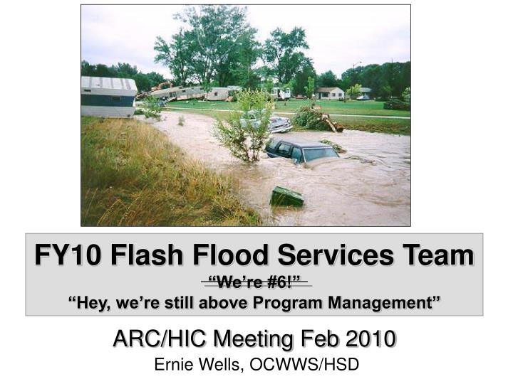
FY10 Flash Flood Services Team “We’re #6!” “Hey, we’re still above Program Management”. ARC/HIC Meeting Feb 2010 Ernie Wells, OCWWS/HSD. Photo courtesy of NOAA (photographer unknown). Team Members. Peter Ahnert (MARFC) Tom Donaldson (WGRFC) David Welch (LMRFC) John Schmidt (SERFC)

E N D
FY10 Flash Flood Services Team“We’re #6!”“Hey, we’re still above Program Management” ARC/HIC Meeting Feb 2010 Ernie Wells, OCWWS/HSD Photo courtesy of NOAA (photographer unknown)
Team Members • Peter Ahnert (MARFC) • Tom Donaldson (WGRFC) • David Welch (LMRFC) • John Schmidt (SERFC) • Greg Smith (CBRFC) • Julie Dian-Reed / Jim Noel (WFO/RFC Wilmington OH) • Brian McInerney (WFO – Salt Lake City) • John Woynick (WFO – Topeka) • Kent Frantz (WFO – Atlanta) • Mike Schaffner (WFO – Binghamton) • Ernie Wells (NWSH/HSD) • Harold Opitz (NWRFC)** ** Honorary Member 2010 ARC/HIC Meeting
FY08-FY10 Funding Profile • DHM-TF 36% • FFMP-A Small Basin Support 27% • FFMP-Advanced 15% • Dam Break Modeling 10% • FF Forecasting Tool Evaluation 10% 97% 2010 ARC/HIC Meeting
Recent FF Enhancements • FFMP-Advanced delivered in AWIPS OB8.2 • Delivered capability to ingest, display, and monitor multiple guidance and gridded precip sources • FFMP-A software enhancements delivered in AWIPS OB9 • Incorporated novel approach to more accurately compare QPE to FFG, including mechanism to interpolate FFG values between regular updates from the RFC • FFMP-A Small Basin Support • Delivered and maintained the Basin Customization Repository, supported WFOs in their FFMP-A basin dataset customization, created visual metadata, and delivered webinar training • Currently working to host and maintain RFC GFFG datasets • DHM-TF WFO Prototype • Prototype model operating at PBZ and portion of LWX domain in real time; adding BGM domain • HPE delivered in AWIPS OB8.3 • HPN delivered in AWIPS OB9 • NMQ development/operations • ABRFC Gridded FFG • SSHP enhancements delivered in AWIPS OB9 (VAR and HPN QPF ingest) • MPE enhancements delivered in AWIPS builds (DailyQC, etc) • Delivered Enhancements to RiverMonitor application to monitor gage precip data in AWIPS OB8.3 • FF Forecasting Tool Evaluation/Verification • Establishes framework to evaluate the skill/effectiveness of new FF forecasting techniques and better define warning thresholds for WFO forecasters • DamBreak Modeling 2010 ARC/HIC Meeting
FFG Developments • Effort initiated by ABRFC (Tony Anderson) to reconvene meetings with RFC FFG focal points • Ad-Hoc group with no charter • Initial Goals/Impetus • Re-start dialogue among FFG focal points • CHPS transition impacts on FFG production • GFFG implementation at northern-tier RFCs • National support of GFFG production • Five meetings starting 26 Aug 09 2010 ARC/HIC Meeting
Discussion Topics • Reported status of FFG/FFH ops at 10 RFCs • Confirmed need for FFH products (SSHP input, FFG vs. FFH computational differences) • Confirmed need for text products (detailing outside users of county products, etc) • Modifying GFFG algorithm to account for increases in runoff potential due to frozen ground and rain-on-snow • More frequent updates of FFG • QPE improvements affecting FFG(also addressed by forcings team) • Confirmed non-use of FFD PIL for GFFG • Standardization of GFFG physical datasets • Moving to national support of GFFG • Reviewed OHD’s description of logic/calculations for generating legacy FFG/FFH 2010 ARC/HIC Meeting
Current Status • OHD leading effort to migrate existing FFG/FFH functionality to CHPS • FFH functionality to be delivered to CAT RFCs in March 2010 • FFG functionality delivered by June 2010 • Effort by northern-tier RFCs to develop strategy for GFFG algorithm modification to account for increases in runoff potential due to frozen ground and rain-on-snow is delayed by workload associated w/CHPS migration. • Ongoing FY10 AHPS effort to host and maintain baseline GFFG datasets (e.g. operational threshR grids, LULC datasets, etc.), documentation, and training materials for central backup and national support of GFFG. 2010 ARC/HIC Meeting
FY10 AHPS Flash Flood Services • Team Members • Summary of Prioritized Projects/ Funding Details • Project Descriptions 2010 ARC/HIC Meeting
Prioritized Projects Total: 264.4 • Team recommends focusing AHPS funding on projects 1 – 6, given “target” funding of 250K • May share the cost of Dam Break Project with Hydraulics Team 2010 ARC/HIC Meeting
Task #1: DHM-TF development and expanded prototypingObjective: Demonstrate the validity and effectiveness of the DHM-TF approach as a flash flood forecasting tool via prototyping at WFOs. Increase the portability and applicability of the technique by developing data sets necessary for operations in other geographic regions of the country. Define requirements for future operational development via feedback from prototyping efforts at WFOs. 2010 ARC/HIC Meeting
Task #2: Dam Break Modeling Objective: Document a nationally supportable, consensus set of dam break modeling procedures; foster collaboration with other federal agencies; identify software functional requirements for improved tools Completed or Ongoing Work: Reviewed existing procedures, learning from USACE and DHS activities, learning about NID, analyzing case studies using different dam break models, developing rapid cross-section extraction and SMPDBK model building tool, writing first draft of guidance document 2010 ARC/HIC Meeting
Task #3: CBRFC Frequency Surface Response – distributed modeling effort.Objective: To investigate how exceedance percentile discharge and surface flow grids produced using HL-RDHM can be used in real time by forecasters at WFO Tucson to aid their operational flash flood warning decisions. Expand deployment to another WFO and, collaborating with OHD, define requirements for future operational development via feedback from prototyping efforts. 2010 ARC/HIC Meeting
Task #4: FFMP Basin Customization Metadata, Support, and Training Modules (also GFFG dataset repository) Objectives: To create textual and visual metadata for the FFMP-A small-basin customized datasets submitted to the Basin Customization Repository. Continue to develop instructions / training modules for specific requested customization tasks, maintain the Basin Customization Repository, and provide technical support to all WFOs using the FFMP dataset and repository. Develop, host, and maintain RFC datasets associated with GFFG operations. 2010 ARC/HIC Meeting
Task #5: Flash Flood Forecasting Tool Evaluation / VerificationObjective: Quantify the skill in legacy flash flood guidance (FFG), gridded approaches (GFFG), and distributed hydrologic model simulations using USGS streamflow observations, NWS Storm Data reports, and NSSL’s flash flood observation database. 2010 ARC/HIC Meeting
Task #6: Incorporate snow / frozen ground effects into GFFGObjective: Leveraging expertise at northern tier RFCs, identify a strategy to modify GFFG algorithm to account for increases in runoff potential due to frozen ground and rain-on-snow. This will help support implementation of HL-RDHM derived gridded flash flood guidance in the northern tier RFCs and allow for national implementation/support of the GFFG system. 2010 ARC/HIC Meeting
Task #7: Gridded FFG workshopsObjective: Continue to enhance and customize the Arkansas Red Basin River Forecast Center (ABRFC) GFFG product in different geographical regimes with the assistance of local Hydro Program Managers (HPM). 2010 ARC/HIC Meeting
Task #8: Flash Flood Fatalities StudyObjective: To begin an in-depth study of flash flood fatalities in the U.S. during the past five years in order to assess the factors that contributed to these incidents (precipitation, weather phenomena, geographic and topographic conditions, social/cultural aspects) both spatially and temporally towards improving warning services. 2010 ARC/HIC Meeting
Task #9: CONUS Basin Precipitation Accumulator within NMQObjective: To develop a prototype seamless CONUS basin precipitation accumulator within the NSSL National Mosaic and Multi-Sensor QPE (NMQ) system to serve as a research tool for evaluating multi-sensor inputs and guidance products within a hydrologic framework. 2010 ARC/HIC Meeting
Task #10: Gage Precipitation Monitor EnhancementsObjective: Update the Gage Precipitation Monitor application within WHFS with several enhancements requested by Western Region WFOs 2010 ARC/HIC Meeting
Task #11: Site Specific Hydrologic Predictor (SSHP) EnhancementsObjective: Update the SSHP application within WHFS with several enhancements requested by WFOs 2010 ARC/HIC Meeting
Dam Break Modeling Project Goals • Document a nationally supportable, consensus set of dam break modeling procedures. • Where and how to get data • How to choose a model based on available data (Rule of Thumb, SMPDBK, HEC-RAS) • How to QC data • How to derive cross-sections downstream of dam • How to estimate breach parameters • How to interpret results • Examples showing the range of uncertainty • Examples for training • Foster collaboration with other federal agencies (USACE, DHS) • Identify software functional requirements for improved tools 2010 ARC/HIC Meeting
DHM-TF for Flash Flood Forecasting Modeling Approach Distributed hydrologic model with a frequency post-processor Looking to augment flash flood decision assistance at WFOs Modeling Process DHM produces gridded flow forecasts Gridded frequency (return period) forecasts are derived based on historical simulations Historical Simulations Conducted with DHM Same type of forcing data used as in forecast simulations (need significant record of unbiased precip) Interpretation of Model Output Map of modeled flood frequencies Threshold frequency map–local information or 2-yr out-of-bank assumption–for flash flood determination 2010 ARC/HIC Meeting
Pittsburgh WFO DHM-TF Domain Pittsburgh DHM-TF Prototype at WFO • Initial Pittsburgh WFO contact, obtained support and computer accounts for DHM-TF • Derived routing parameters over Pittsburgh domain • Set up and tested two DHM-TF configurations on Pittsburgh server • 1) DHM-TF with local routing • 2) DHM-TF with cell-to-cell routing • Worked with PBZ to refine DHM-TF output display and to create movie-type displays. • Collaborated with PBZ to analyze July 2007 flash flood event and assess real-time and retrospective DHM-TF performance. Example DHM-TF Return Period Output 2010 ARC/HIC Meeting
Sterling WFO DHM-TF Domain Sterling DHM-TF Prototype at OHD • Presented DHM-TF case study at 2009 EWRI Water Congress • Ran local routing simulation over Maryland and tested against standard routing for June 2009 flash flooding event • Analyzed DHM-TF flash flood simulation performance for September 2009 flash flood over Maryland domain • Monitored real-time DHM-TF prototype at OHD 2010 ARC/HIC Meeting
Completed, then enhanced, Grass GIS and Google Earth programs/scripts needed to visualize DHM-TF output Redeveloped HOSIP project plan for DHM-TF, also, work will be continued under new AHPS project Traveled to CBRFC to define areas of collaboration between their DHM-FSR research and OHD’s DHM-TF research. Bi-monthly telecons will be conducted to share information on WFO feedback, visualization efforts, and model performance Investigated potential collaborative opportunities with ABRFC, in particular with respect to their low water crossing survey effort Conducted telecon with CBRFC to discuss DHM-TF simulations at Pittsburgh WFO and DHM-FSR simulations at CBRFC. Also reported on OHD’s KML conversion tools and CBRFC’s AWIPS display tools Additional FY09 DHM-TF Tasks 2010 ARC/HIC Meeting
Future DHM-TF Tasks Incorporate use of HPE and HPN data at Pittsburgh WFO Continue operations at Pittsburgh, OHD operations over Sterling domain Expand prototype to additional WFOs Continue DHM-TF/DHM-FSR collaboration with CBRFC Develop simplified CONUS routing parameter data set Continue work with field to refine CONOPS and data visualization techniques Activate and assess Snow17 within DHM-TF system Assess impact of length of stream flow history on DHM-TF output Investigate sources of long term precipitation and flow data 2010 ARC/HIC Meeting
FFMP Small Basin Support • Developed, Populated, and Maintained the Basin Customization Repository with datasets submitted for sharing with other WFOs, and developed metadata with customization and version information to track changes in each dataset. • Investigated potential workarounds/solutions for reducing the number of FFMP basin names included in Warngen FFW products • Served as support point-of-contact for WFOs FFMP-A basin dataset customization • Developed/provided instructions for customization tasks such as table editing, name transfer, basin subdivision, customized CWA integration, creation of additional FFMP “HUC level” shapefiles, and basin delineation in ArcGIS 9.3, as well as general GIS tasks such as converting flooding locations to shapefile format. • Provided FFMP datasets to WDTB staff and AWIPS software engineers, and provided a copy of the Canadian Digital Elevation Data (CDED) to OHD (for derivation of SNOW17 model parameters). • Updated the FFMP Toolbox for ArcGIS with additional tools to automate customization tasks to the extent possible. Updates and testing are still in progress. Upon their completion (end of September), the customization webinars will begin. 2010 ARC/HIC Meeting
FFMP Small Basin Support Webinars 1) 13 Oct 2009 (2:00 PM EDT) The Basin Customization Repository: How to Share Your Customization and Incorporate Your Neighbors’ Customization 2) 27 Oct 2009 (2:00 PM EDT) Tier II Processing: Stream Name Verification and Editing 3) 10 Nov 2009 (2:00 PM EST) Tier III Processing: Merging and Subdividing Basins 4) 24 Nov 2009 (2:00 PM EST) Tier III Processing: Clipping Lake/Reservoir and Wide River Polygons 5) 08 Dec 2009 (2:00 PM EST) Tier III Processing: Manual Editing NOTE: Repeats of these webinars will be scheduled (one or two per week) beginning in January for anyone who cannot make the first offering or needs a refresher after getting started on the customization tasks. 2010 ARC/HIC Meeting
FFMP Small Basin Support Future Plans • Continue as support point-of-contact for WFOs FFMP-A basin dataset customization • Develop additional webinars for WFO customization training • Enhance Basin Customization Repository with Google Maps API visually depicting customization changes 2010 ARC/HIC Meeting
FFG Verification/Evaluation Objectives Compare the performance of FFG and GFFG using NWS Storm Data reports, United States Geological Survey (USGS) stream gauge data, and the National Severe Storms Laboratory’s (NSSL) Severe Hazards Analysis and Verification Experiment (SHAVE) reports Study Domain is ABRFC using available data archive from September 2006 to August 2008 2010 ARC/HIC Meeting
FFG Verification/Evaluation Evaluate skill of FFG techniques using Stormdat data, observed discharge, and NSSL flash flood verification database leveraging Severe Hazards Analysis and Verification Experiment (SHAVE) reports Provide framework to validate approach(es) for national implementation/support Increase knowledge of warning thresholds to share with WFO forecaster 2010 ARC/HIC Meeting
Methods Data Sources: 1-hour Quantitative Precipitation Estimate data (QPE) from National Precipitation Verification Unit (NPVU) 1-, 3-, and 6-hour GFFG from ABRFC 1-, 3-, and 6-hour FFG from ABRFC 2010 ARC/HIC Meeting
Storm Data Study Verification Source: County-based NWS flash flood reports from 9/1/2006 - 8/22/2008 Reports meant to encompass all flash flooding events Study Region: Counties completely within the ABRFC border Methods Compute county maximum ratio and county mean ratio Populate a contingency table 2010 ARC/HIC Meeting
Streamflow Study Verification Source: 15 minute streamflow data from USGS Objective, continuous Study region: ABRFC basins less than 260 km2 (19 gauges) Calculate 2- and 5-year return periods for each gauge Identify peak flows that exceed these return periods Defined as observed flash floods Populate contingency table based on basin-averaged ratio and basin-maximum ratio 2010 ARC/HIC Meeting
SHAVE Study Verification source: 2008 SHAVE flash flooding reports 472 Reports in ABRFC High spatial and temporal resolution Database does not include all flash flooding events that occurred in study region Reports with questionable time were given a 24 hour backward search window 2010 ARC/HIC Meeting
FFG Verification/Evaluation Preliminary study results near completion Plan to present initial results at the AMS Radar Conference (5-9 October) 2010 ARC/HIC Meeting
Future Verification/Evaluation Work Interpolate GFFG and FFG to minimize false alarms and misses Weighted interpolation based on rainfall Linear interpolation when conditions are drying Expand analysis to other GFFG approaches (DHM-TF method) and larger domains Consider testing a hydrologic model running at the flash flood scale 2010 ARC/HIC Meeting
Improved Guidance for Dambreak Forecasting Identify/document best method to derive cross-sections Setup dambreak analysis using DAMBRK, SMPDBK, and HECRAS; run multiple scenarios; analyze differences in model simulations Suggest HECRAS enhancements to USACE Complete Dam Break Guidance and Training Documents FF Team set aside 50K to support Hydraulics Team effort 2010 ARC/HIC Meeting
CBRFC Frequency Surface Response (FSR) Developed a Google Maps over-laid web-based viewer for the FSR Grids hosted on the CBRFC website Conducted analysis of historic FSR grids with WFO Tucson and began process of identifying preliminary thresholds Supported the operational grid production during the 2009 monsoon season (little precip) Began work converting xmrg model output to netCDF for delivery and display in D2D at WFO Tuscon Delivered case study presentation to Arizona Hydrologic Society Extended routing parameters, HL-RDHM calibrations and FSR to additional portions of the Tuscon warning area 2010 ARC/HIC Meeting
A swift water rescue occurred at the CDO Wash and Overton Road. Motorist stranded in flooded road near Beverly Road and 29th Street in Tucson Percentile Surface Flow Grids 7/11/2008 11z 7/11/2008 12z 2010 ARC/HIC Meeting
CBRFC FSR Future Plans Continue expansion of model domain and refine model calibration Finalize method of converting and delivering model output files for display in D2D at WFO Tuscon Continue analysis of model output and events to determine appropriate warning thresholds Continue collaboration with OHD DHM-TF efforts (Brian Cosgrove) 2010 ARC/HIC Meeting
Potential Future Projects Gridded FFG workshops FFMP-A User’s Conference Gage Precipitation Monitor Enhancements SSHP Enhancements Debris Flow modeling demonstation GFFG enhancements (e.g. integrating effects of snow) 2010 ARC/HIC Meeting
FY09 Project Descriptions • DHM-TF WFO Prototype (Cosgrove) • Prototype model at least two WFOs • Revise product visualization based on feedback from WFO • Expand portablility of prototype via development of national set of routing parameters • Study impacts of 2km grid resolution and length of flow history on DHM-TF operations • FFMP-A Small Basin Support (Arthur) • Develop a series of training webinars and online instructions detailing Tier II / III tasks • Host and maintain the Basin Customization Repository • Serve as point-of-contact to support the WFOs in their FFMP-A basin dataset customization • FFG Evaluation/Verification (Gourley) • Evaluate skill of FFG techniques using Stormdat data, observed discharge, and NSSL flash flood verification database • Validate approach(es) for national implementation/support • Increase knowledge of warning thresholds to share with WFO forecaster 2010 ARC/HIC Meeting
FY09 Project Descriptions • Improved Guidance for Dam Break Forecasting (Reed) • Identify/document best method to derive cross-sections • Setup dambreak analysis using DAMBRK, SMPDBK, and HECRAS; run multiple scenarios; analyze differences in model simulations • Suggest HECRAS enhancements to USACE • Complete Dam Break Guidance and Training Documents • CBRFC Frequency Surface Response (FSR) distributed modeling (Clark) • Develop a web-based viewer for the FSR grids hosted on the CBRFC website • Analyze historic FSR grids with WFO Tucson and identify preliminary thresholds • Produce FSR grids for WFO Tuscon during 2009 monsoon season • Gridded FFG workshops at WGRFC/MBRFC (Cooper) • FFMP-A User’s Conference (Smith) • Gage Precipitation Monitor Enhancements (Gobs) • SSHP Enhancements (Gobs) 2010 ARC/HIC Meeting
Recommended Funding 2010 ARC/HIC Meeting
Recommended Funding * Additional Funding from Hydraulics Team 2010 ARC/HIC Meeting