Download

1 / 13
130 likes | 136 Views
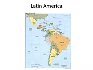
Latin America. Physical Geography Chapter 8, Section 1 The Land. Subregions. 1) Middle America 2) The Caribbean 3) South America. Mountains and Plateaus. Sierra Madres (Mexico) Central Highlands (Central America) Andes (South America). Mountains and Plateaus.

E N D
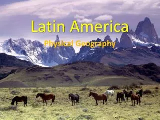
Latin America Physical Geography Chapter 8, Section 1 The Land
Subregions 1) Middle America 2) The Caribbean 3) South America
Mountains and Plateaus • Sierra Madres (Mexico) • Central Highlands (Central America) • Andes (South America)
Mountains and Plateaus • The rugged landscape is caused by its location along the Pacific Ring of Fire. • The mountains cooler climates and rich natural resources attracted settlers. • The terrain historically isolated communities but new technology is breaking down physical barriers.
Mountains of Middle America and the Caribbean • Mexico’s Sierra Madres surround the densely populated Mexican Plateau. • Humans are attracted to the mild climate, fertile volcanic soil, and rainfall. • The Central Highlands are a chain of volcanic peaks that cross Central America and include many Caribbean Islands.
Andes of South America • World’s longest mountain range • Consist of cordilleras-several ranges that run parallel to each other • In Peru and Bolivia, the Andes encircle the Altiplano-high plain.
Highlands of Brazil • The MatoGrosso Plateau is a sparsely populated plateau of forests and grasslands. • The Brazilian Highlands span several climate and vegetation zones and are used for raising livestock. • The eastern highlands plunge to the Atlantic Ocean, forming a steep slope called an escarpment.
Lowlands and Plains • South America’s inland grasslands-the llanos of Colombia and Venezuela and the pampas of Argentina and Uruguay-provide grazing for cattle. • Cowhands called gauchos drive the herds across the plains. • With its fertile soil, the pampas are one of the world’s breadbaskets.
Water Systems • The Amazon River is the Western Hemisphere’s longest river and the world’s second longest. • The Amazon and hundreds of smaller rivers flow together into the Amazon Basin.
Water Systems • The Parana, Paraguay, and Uruguay Rivers form the second largest river system. • The rivers provide commercial water routes between cities and hydroelectric power-electricity generated from the energy of moving water. • The rivers flow into the Rio de la Plata estuary-where the ocean tide meets a river current.
Water Systems • The Rio Grande River forms part of the border between Mexico and the United States. • The Panama Canal allows quick travel between the Atlantic and Pacific Oceans. • Lake Titicaca is the world’s highest navigable lake. • Lake Maracaibo is South America’s largest.
Natural Resources • Some Latin American countries are among the world’s leading producers of energy resources (oil and natural gas). • Rich in mineral resources such as gold, silver, emeralds, copper, and bauxite.
Natural Resources • Because of diverse landforms, the region’s resources are not evenly distributed. • Geographic inaccessibility, lack of capital for development, and social and political divisions keep many of the region’s natural resources from being developed.