Download
1 / 9
90 likes | 211 Views
CPA-03-10 Location Map. Oakmont at Gainesville, LLP. CPA-03-10 Aerial Map. Oakmont at Gainesville, LLP. CPA-03-10 Zoning. Oakmont at Gainesville, LLP. CPA-03-10 Future Land Use. Oakmont at Gainesville, LLP. Policy 7.1.7 (FLUE).

E N D
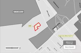
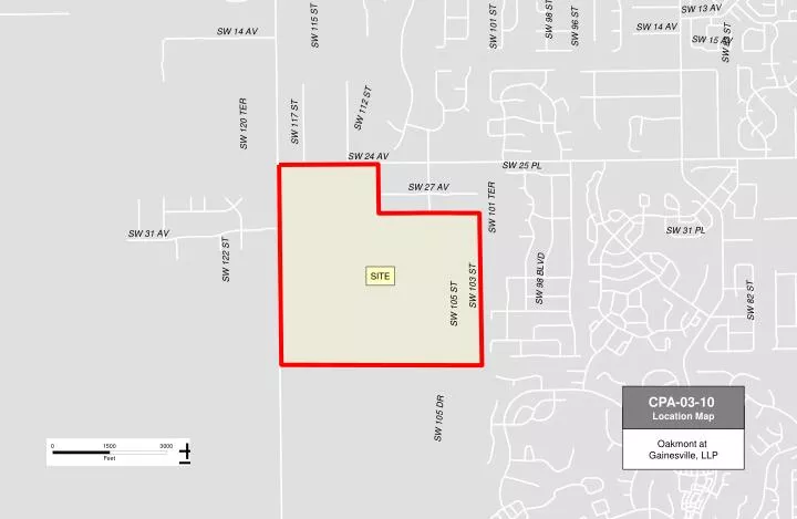
CPA-03-10 Location Map Oakmont at Gainesville, LLP
CPA-03-10 Aerial Map Oakmont at Gainesville, LLP
CPA-03-10 Zoning Oakmont at Gainesville, LLP
CPA-03-10 Future Land Use Oakmont at Gainesville, LLP
Policy 7.1.7 (FLUE) The development of 480 acres (Parcel #04427-000-000) designated Low Density Residential by the approval of Application #CPA-15-97 shall be developed subject to the following requirements: a. An overall development plan shall be submitted prior to development within the 480-acre area. The development shall provide for a variety of lot sizes/densities consistent with the Alachua County Comprehensive Plan. b. All development shall be connected to centralized sanitary sewer and centralized potable water supply. c. The 480-acre parcel shall be developed at an average density of not more than two (2) dwelling units per acre. These site specific requirements may be reconsidered through a public hearing process involving notification to surrounding property owners.
Policy 7.1.7 - Proposed Revisions The development of 480 acres (Parcel #04427-000-000) shall be developed with an overall development plan and shall provide for a variety of lot sizes/densities . b. All development shall be connected to centralized sanitary sewer and centralized potable water supply. c. The 480-acre parcel shall be developed at an average density of not more than two (2) dwelling units per acre. These site specific requirements may be reconsidered through a public hearing process involving notification to surrounding property owners.
Staff Bases • FLUE Policy 1.2.4 requires hookup to sanitary sewer and potable water within the Urban Cluster. Therefore Policy 7.1.7(b), which requires connection to these services, is redundant. • Numerous policies within the FLUE support development at greater densities and intensities. FLUE 1.3.7.2 gives the development range for the low density residential land use at 1-4 du/acre. Deleting Policy 7.1.7(c) is consistent with this policy.
Staff Bases • Principal 5 of the FLUE calls for densities and intensities to support transit. This is best achieved through developing land at the upper limit of the density range. Deleting Policy 7.1.7(c) will help achieve this goal. • Provision for greater densities promotes the goals found in FLUE Strategy Three, which promotes greater densities, mixed use developments and integrated neighborhoods.
Staff Recommendation • Staff recommendsthat Policy 7.1.7(a) be retained in the Future Land Use Element of the Comprehensive Plan but concurs with the applicant’s request for removal of sub-Policies (b) and (c). Staff recommends that the Board hear the item and transmit this large scale comprehensive plan amendment to the Department of Community Affairs (DCA) for their review and comment.