Download
1 / 13
240 likes | 747 Views
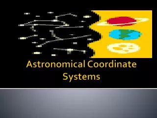
Astronomical Coordinate Systems. Coordinate Systems. There are 2 types: Az /Alt. -The horizontal coordinate system is a celestial coordinate system that uses the observer's local horizon as the fundamental plane.

E N D
Coordinate Systems • There are 2 types: • Az/Alt. -The horizontal coordinate system is a celestial coordinate system that uses the observer's local horizon as the fundamental plane. • Equatorial (R.A./Dec.) - is a widely used celestial coordinate system used to specify the positions of celestial objects. It may be used in spherical or rectangular coordinates • defined by an origin at the center of the Earth, • a fundamental plane consisting of the projection of the Earth's equator onto the celestial sphere (forming the celestial equator), • a primary direction towards the vernal equinox • a right-handed convention.
Celestial Sphere • Both Az/Alt and equatorial coordinate systems are based off of what is called the celestial sphere. • This is an imaginary ball that surrounds the earth and hold all the stars. • To the naked eye, stars appear fixed on the sky with respect to one another. These patterns are often grouped into constellations.
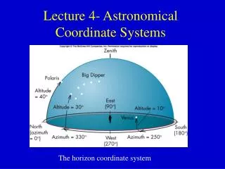
Az/Alt – Simpler System • This system is based on you, the observer, as well as the horizon and NESW • Azimuth – Cardinal directions NESW • North = 0° • East = 90° • South = 180° • West = 270° ***If the azimuth is between 0° and 180° (north–east–south), it is rising. ***If the azimuth is between 180° and 360° (south–west–north), it is setting Sometimes referred to as elevation, is the angle between the object and the observer's local horizon. For visible objects it is an angle between 0° degrees to 90° degrees.
Az/Alt – Simpler System c.) Altitude – angle measure above the horizon • Zenith – straight up/+90°; the distance from directly overhead • Nadir – straight down/-90°; the direction pointing directly below a particular location • Horizon - 0° The angle of the object around the horizon, usually measured from the north increasing towards the east.
Problems • Coordinates change as your change locations • Coordinates of stars change as they move across the night sky • Requires time and location for other people to determine the stars you were looking at
Equatorial System (RA/Dec) • Is a widely used celestial coordinate system used to specify the positions of celestial objects. • Based on stars relative one another and celestial poles/equator (celestial sphere). • More scientific, accurate, and complex
Equatorial System (RA/Dec) A star’s spherical coordinates are usually expressed as a pair right ascension and declination, without a distance coordinate. c.) Right Ascension = longitude of the celestial sphere • Lines go from pole to pole vertically • Angular distance of an object going eastward • Measured in hrs, min, and sec from • 0 hrs to 23 hrs, 59 min, 59 seconds • There are (360° / 24h) = 15° in one hour of right ascension, 24h of right ascension around the entire celestial equator d.) Declination = latitude of celestial sphere • Celestial north pole = Polaris +90° • Celestial south pole = -90° • Celestial Equator = 0° • From -90° to +90° • measures the angular distance of an object perpendicular to the celestial equator, positive to the north, negative to the south.
Problems • More complex • Requires a star or two for star taking data
How to Measure the Night Sky • To help locate the stars on the celestial sphere, we make use of angles. • In degrees; a degree is 1/360 of a circle • Use of hand during night sky measurement: 1 finger = 1 degree 3 fingers = 5 degrees Full clenched fist = 10 degrees Outstretched hand = 20 degrees
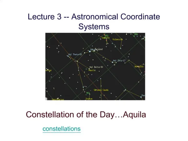
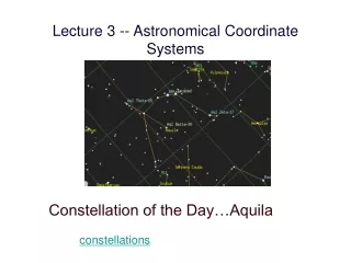
Constellation: Formal Name for a Grouping of Stars • Ursa major • Cygnus • Lyra • Aquila
Asterism • Common/informal name for a grouping of stars • Big Dipper • Summer Triangle