Download
1 / 12
120 likes | 276 Views
Managing the Agricultural urban interface ! In Imperial County. CALAFCO 2011 Annual Conference – Napa. Imperial LAFCO Jon Edney Ed Snively Ray Castillo Michael Kelley Colleen Ludwig. J urg Heuberger , AICP, CEP Executive Officer Imperial LAFCO. I mperial County.

E N D
Managing the Agricultural urban interface!In Imperial County CALAFCO 2011 Annual Conference – Napa Imperial LAFCO Jon Edney Ed Snively Ray Castillo Michael Kelley Colleen Ludwig Jurg Heuberger, AICP, CEP Executive Officer Imperial LAFCO
Imperial County Located in the southeast corner of the state. Bordered on the north by Riverside County, on the east by Arizona (Yuma), on the south by Mexico, and on the west by San Diego County.
General Information Area4,200 square mile Ag. Land 440,000 acres Population 175,000 City/County Population 85%/15% Demographics 76% Hispanic; 16% White; 3% Black; 2% Asian; Median Income $38,000 v state average of $58,000 Largest Property TaxAgriculture, Geothermal, Mining
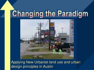
Farm land protection policies: • 1993/1996 General Plan established: • Urban boundary limits • Right to farm ordinances • Non-conversion policy • Development agreements • LAFCO/County/Cities consensus on General Plan: • Consensus on urban boundaries being same as sphere of influence boundaries • Urban development would be directed toward urban units • LAFCO would not allow annexations of agricultural land w/o approved projects • County would not allow development outside urban boundaries and • County would require developments in urban boundaries to meet urban standards
Did It Work? For the most part, at least until 2010………YES! Did the community support the plan? For the most part, yes. Farmers supported only to the extent that “it wasn’t their land.” Did the cities support it? Yes! What was probably the major reason it really worked? The county has no infrastructure (sewer/water), so the only way substantial developments could be approved if they were positioned for annexation, which meant they had to be within the urban boundary/sphere of influence areas.
Is It Still Working? You Tell Me! Is the conversion of agricultural land to renewable energy project comparable to urban land conversion?
megawatts • This map depicts the various projects that have been submitted to County Planning over the past two years. • A total of 30,000 to 78,000 acres is currently under permit review by the county for solar and wind projects.