Download
1 / 31
310 likes | 434 Views
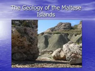
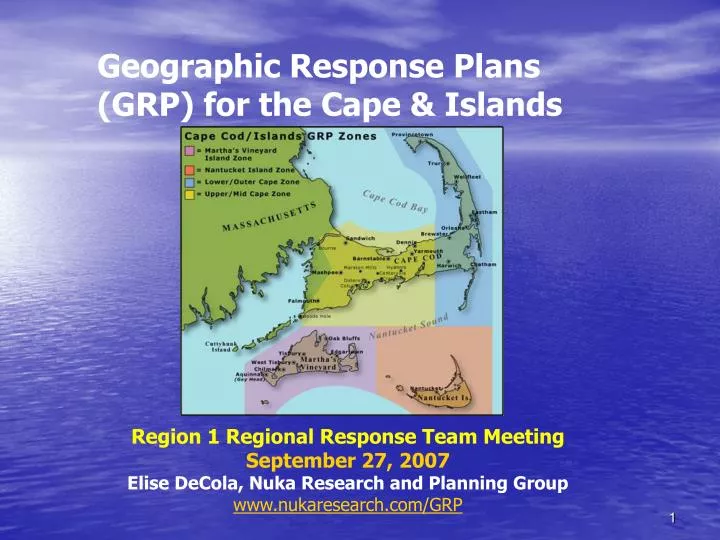
Geographic Response Plans (GRP) for the Cape & Islands. Region 1 Regional Response Team Meeting September 27, 2007 Elise DeCola, Nuka Research and Planning Group www.nukaresearch.com/GRP. A GRP is…. Map-based response strategy to protect sensitive areas.

E N D
Geographic Response Plans (GRP) for the Cape & Islands Region 1 Regional Response Team MeetingSeptember 27, 2007Elise DeCola, Nuka Research and Planning Group www.nukaresearch.com/GRP
A GRP is… • Map-based response strategy to protect sensitive areas. • A consensus plan developed in a non-emergency setting. • A tactical plan for use by field responders.
A GRP is not… • NOT a performance standard. • NOT a mandate for site protection or response. • NOT the only sites that will or should be protected. • NOT final until field verified.
Why develop GRP? • Standardize tactics and terminology. • Field tool for local responders. • Training and preparedness value.
Why develop GRP? • Foster local buy-in and create realistic expectations for protecting sensitive areas from oil spill impacts.
Cape & Islands GRPProject Specifics • Funded by MassDEP through Oil Spill Act. • Facilitated by Nuka Research • Follows Buzzards Bay GRP. • Related projects to acquire and position oil spill response trailers and train local responders. • Develop standardized tactics guide for use statewide. • Apply planning process to future projects.
Cape & Islands GRPGuiding Principles • Responder-oriented strategies and techniques. • Reflect protection priorities of trustee agencies, stakeholders, locals. • Strategies flexible and modifiable to fit the prevailing conditions. • Easy to use, test and update.
Cape & Islands GRPApproach • Form GRP Project Planning Group. • Select sites. • Develop tactics. • Develop GRP. • Publish GRP in Area Plan. • Test/modify GRP over time.
GRP Planning Group Co-chairs: MassDEP, Mass CZM, USCG, NOAA • State agencies • Federal agencies • Local & tribal governments • Stakeholder groups • Industry A Tactics Work Group has also been formed as a sub-group to develop general tactics.
GRP Site Selection • Identify candidate sites. • Solicit input from agencies, stakeholders, public, response experts. • Prioritize candidate sites. • Survey selected sites. • Develop GRPs for highest priority sites.
Candidate Sites 150 candidate sites 58 sites nominated as highest priorityPlanning group met 9/20 & selected 30 sites for GRP development
Site Selection Matrix useful beyond GRP process for summary information about site sensitivity and local protection priorities.
Tactics Development • Tactics Work Group established to develop core set of tactics to be applied to GRPs. • Consistent Terminology • Resource and logistical support requirements
Standardized classification schemes (operating environments, boom, etc.)Symbols carried through GRPs.
Applying Tactics to GRP • Gather site information (ESI maps, aerial photos, local knowledge) • Conduct site surveys. • Apply/adapt tactics to each site.
Cape & Islands GRP Project http://www.nukaresearch.com/GRP/CIgroup.htm Elise DeCola 508-454-4009 elisedecola@nukaresearch.com