Download
1 / 1
20 likes | 199 Views
Spatial Navigation Using Maps and Rendered 3-D Scenes. Educational Role-playing Games: “Learning-by-doing” Experiences. The Technical Approach. The Virtual Environment is: MultiUser Exploratory Spatially-oriented. The Virtual Environment promotes: Practical planning and decision making

E N D
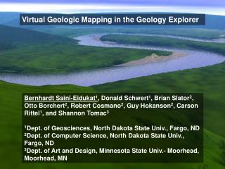
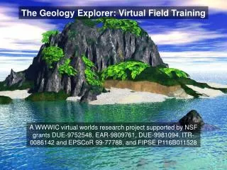
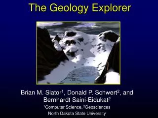
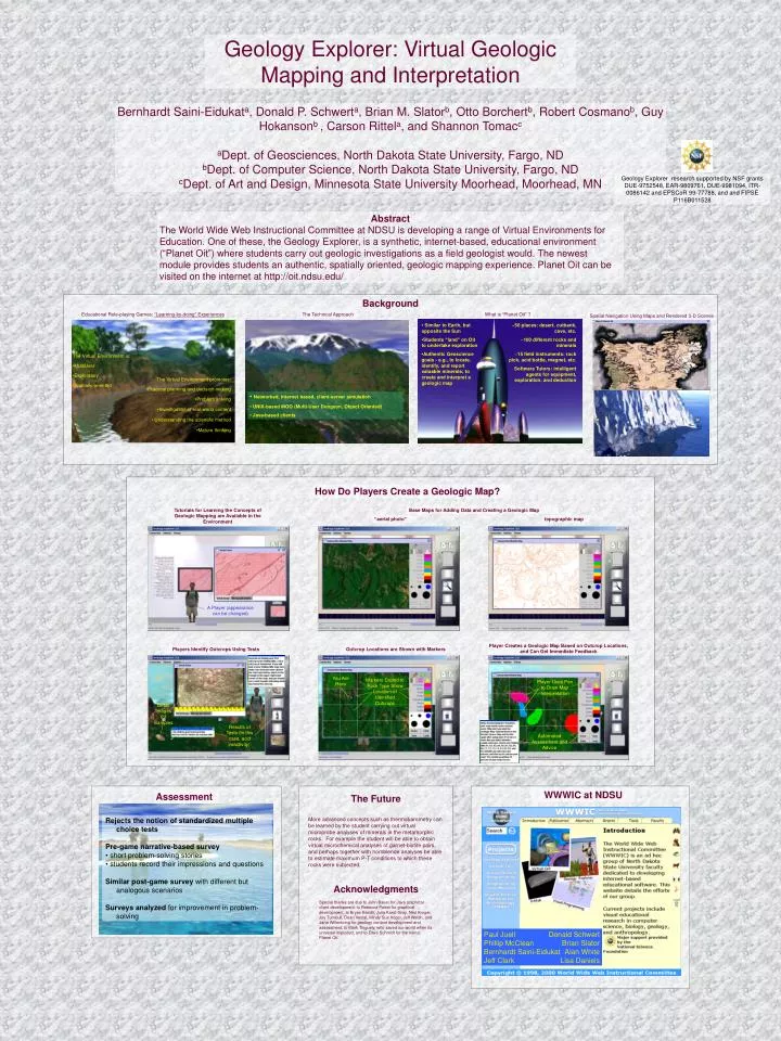
Spatial Navigation Using Maps and Rendered 3-D Scenes Educational Role-playing Games: “Learning-by-doing” Experiences The Technical Approach • The Virtual Environment is: • MultiUser • Exploratory • Spatially-oriented • The Virtual Environment promotes: • Practical planning and decision making • Problem solving • Investigation of real-world content • Understanding the scientific method • Mature thinking • Networked, internet based, client-server simulation • UNIX-based MOO (Multi-User Dungeon, Object Oriented) • Java-based clients Geology Explorer: Virtual Geologic Mapping and Interpretation Bernhardt Saini-Eidukata, Donald P. Schwerta, Brian M. Slatorb, Otto Borchertb, Robert Cosmanob, Guy Hokansonb , Carson Rittela, and Shannon Tomacc aDept. of Geosciences, North Dakota State University, Fargo, ND bDept. of Computer Science, North Dakota State University, Fargo, ND cDept. of Art and Design, Minnesota State University Moorhead, Moorhead, MN Geology Explorer research supported by NSF grants DUE-9752548, EAR-9809761, DUE-9981094, ITR-0086142 and EPSCoR 99-77788, and and FIPSE P116B011528 Abstract The World Wide Web Instructional Committee at NDSU is developing a range of Virtual Environments for Education. One of these, the Geology Explorer, is a synthetic, internet-based, educational environment (“Planet Oit”) where students carry out geologic investigations as a field geologist would. The newest module provides students an authentic, spatially oriented, geologic mapping experience. Planet Oit can be visited on the internet at http://oit.ndsu.edu/ Background What is “Planet Oit” ? • Similar to Earth, but opposite the Sun •Students “land” on Oit to undertake exploration •Authentic Geoscience goals - e.g., to locate, identify, and report valuable minerals; to create and interpret a geologic map ~50 places: desert, cutbank, cave, etc. ~100 different rocks and minerals ~15 field instruments: rock pick, acid bottle, magnet, etc. Software Tutors: intelligent agents for equipment, exploration, and deduction How Do Players Create a Geologic Map? Tutorials for Learning the Concepts of Geologic Mapping are Available in the Environment Base Maps for Adding Data and Creating a Geologic Map “aerial photo” topographic map A Player (appearance can be changed) Player Creates a Geologic Map Based on Outcrop Locations, and Can Get Immediate Feedback Players Identify Outcrops Using Tests Outcrop Locations are Shown with Markers You Are Here Markers Coded to Rock Type Show Location of Identified Outcrops Player Uses Pen to Draw Map Interpretation Detail Images for Samples Results of Tests (in this case, acid reactivity) Automated Assessment and Advice WWWIC at NDSU Assessment The Future More advanced concepts such as thermobarometry can be learned by the student carrying out virtual microprobe analyses of minerals in the metamorphic rocks. For example the student will be able to obtain virtual microchemical analyses of garnet-biotite pairs, and perhaps together with hornblende analyses be able to estimate maximum P-T conditions to which these rocks were subjected. Rejects the notion of standardized multiple choice tests Pre-game narrative-based survey • short problem-solving stories • students record their impressions and questions Similar post-game survey with different but analogous scenarios Surveys analyzed for improvement in problem-solving Acknowledgments Special thanks are due to John Bauer for Java graphical client development, to Rebecca Potter for graphical development, to Bryan Bandli, Julia Karst-Gray, Ned Kruger, Joy Turnbull, Dean Vestal, Mindy Sue Vogel, Jeff Walsh, and Jane Willenbring for geology content development and assessment, to Mark Tinguely, who saved our world when its universe imploded, and to Dave Schmidt for the name: Planet Oit. Paul Juell Donald Schwert Phillip McClean Brian Slator Bernhardt Saini-Eidukat Alan White Jeff Clark Lisa Daniels