Download
1 / 188
1.89k likes | 1.9k Views
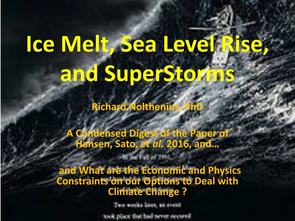
Ice Melt, Sea Level Rise, and SuperStorms. Richard Nolthenius , PhD A Condensed Digest of the Paper of Hansen, Sato, et al. 2016, and… and What are the Economic and Physics Constraints on our Options to Deal with Climate Change ?. A Note about this Presentation.

E N D
Ice Melt, Sea Level Rise, and SuperStorms Richard Nolthenius, PhD A Condensed Digest of the Paper of Hansen, Sato, et al. 2016, and… and What are the Economic and Physics Constraints on our Options to Deal with Climate Change ?
A Note about this Presentation • It’s designed to appeal to a broad, intelligent, and largely non-scientific audience. • I’ve focused on good science, but it also has some gallows humor to leaven the proceedings, and point out some outrageous claims as an example. • It also has a sprinkling of moral outrage – this subject is more than arcane academic material with little relevance to civilization’s future and life itself. It is as far from it as is possible to imagine. For some scientists, this is a jarring distance from their cultural paradigm. Especially astronomers (like me!). Get used to it; it’s our future. • We’ll all have to get used to talking both with meticulous accuracy and fidelity to evidence and rationality, and also the stark human meaning of it all, or else we’ll continue to be ignored. • I’m not here to put anyone to sleep till the bell rings! Strap in for the ride…
“We Ignore James Hansen at our peril”- Professor Michael Mann, Lead IPCC Scientist
Here’s the Paper Itself… • The full 52 page paper, in .pdf form • And here is Dr. James Hansen giving a 15 minute video summary of the paper • I will explain Hansen’s conclusions and the physical reasoning to support his conclusions, and weave in supporting evidence from other studies
Methods • CMIP climate model runs (CMIP= “Coupled Model Intercomparison Project) • And…Ocean modelling • Together with … paleo data from past interglacial periods, • Together with … the modern observed changes, and rates of change of ice sheets and climate over the past 100 years where data is more precise
+2C Global Warming Implications Summary • 1. “Cooling of the Southern Ocean, especially in the Western Hemisphere • 2. “Slowing of the Southern Ocean overturning circulation, warming of the ice shelves, and growing ice sheet mass loss” • 3. “Slowdown and eventual shutdown of the Atlantic overturning circulation with cooling of the North Atlantic region” • 4. “Increasingly powerful storms” • 5. “Non-linearly growing sea level rise, reaching several meters over a timescale of 50–150 years.” • Why?... Here briefly are some key reasons….
1. Surface mixing of the ocean is too efficient in the earlier models • This transports heat too efficiently out of the surface ocean into the deeper ocean, and causes a slower climate response by ~10-20 years compared to observational data.
2. Ice sheet dynamics are not included in IPCC models. • Not included in IPCC models: Transport of floating ice out of Arctic on both sides of Greenland • In Situ mechanisms which accelerate ice breakup, including calving dynamics, moulins, drainage to glacier/basement interface causing softening, increased glacier speed • Observed ice loss rate is rising exponentially; doubling every 10 years, vastly faster than IPCC models
3. The predicted large melt off Greenland and Antarctica COOLS the surface of the ocean with low density fresh water • This lowers Earth surface temperatures vs. no melt. Great, right? NO. • This lowers Earth’s ability to cool itself • This WORSENS Earth’s heat imbalance. The heat instead is trapped beneath the ocean surface where it can’t escape, but still is close to the surface and thus RAISES the melting of the ice shelves from beneath, worsening sea level rise • You haven’t let the heat radiate away to space, which is the only real solution. • Before discussing the resulting sea level rise, we discuss the more dramatic and previously unexpected implications
Implications: Weather Intensity Changes • Warmer Sea Surface Temperatures Mean… • more evaporation • stronger vertical air temperature gradient driving convection • This is one cause which drives stronger storms • Warmer Air Temperatures Mean… • --- Air can hold more water vapor, so rain is less frequent. • 7% higher saturation humidity per 1 degree C of temperature rise, predicted by the Clausius-Clapeyron equation, and confirmed by decades of observation (e.g. Held and Soden 2006).
Indeed, Global humidity is rising, doubling the warming due to CO2 alone, and aiding stronger storms
Warm Air Holds More Water Vapor • However, when saturation of the air does take place, the rarer resulting rains will be more forceful because of the higher amounts of water • Floods significantly more common, as higher air temps mean more precip falls as rain now instead of snow, which runs off rapidly rather than being stored for weeks or months as snow in the mountains. • We are transitioning from a time of more frequent, gentle rains which allow soaking of the soil and plant roots, to a time of rarer rains on parched dry land with less healthy plants, and soil, and severe erosion caused by stronger deluges when and where rain does occur
Extreme Precip Events Were Expected to Increase at the Same Rate, 7%, as Water Vapor, per Degree Celsius • This was the conclusion of Pall et al. 2006 • But climate models post-dicted that the increase would be greater, 8.3% per degree Celsius over land areas with weather stations since 1901… • In fact, though… actual observations since 1901 show an even greater increase, of 10% per degree Celsius of global temperature rise (Asadieh and Krakauer2015)
We are already seeing more extreme deluges than even those climate models predicted. HadEX2 (top) is a century’s data, vs. CMIP5 climate model runs (bottom) post-diction average, from Asadieh and Krakauer 2015
From Coumous and Rahmstorff (2012) : Higher ocean surface temperatures go with stronger tropical storms for the future
What about Tornados? These are over Land; We’re not sure if there will be more, or stronger. But, here is not where we want to go.
How Ice Melt Can Shut Down The Global Ocean Circulation • AMOC = Atlantic Meridional Overturning Circulation; a wonky description of the current which absorbs tropical heat, carries it by the Gulf Stream north, where it cools, gets saltier, denser, and falls to the bottom of the ocean, then heads south to rise again near the equator and get re-heated. • Atlantic most important than Pacific in the northern hemisphere because it has access to cold on either side of frozen Greenland, cooling the surface waters enough (given they’re salty) to punch down through the thermocline to reach the bottom of the ocean
AMOC Shutdown • Hansen shows that the advanced stages of polar melt can shut down the global thermohaline circulation, as too much surface cold fresh water prevents water from breaking through the thermocline as it currently does at two places near Greenland, and two places near Antarctica. Why? Fresh water is LESS dense than salt water! • This shuts off the transport of warm water to the sub polar areas, cooling their surface, while strongly heating stagnant surface tropical waters, driving storms of surprising intensity • This happened during the Eemian interglacial 120,000 years ago, as we’ll show from Hansen et al’spaper. • This situation can drive…
The Hansen et al. 2016 Study of Future Climate Predicts a New Era of Superstorms • Paleo data indicates remarkably powerful storms driven by the amplified temperature gradient in the Atlantic if the AMOC shuts down. • The developing “cold patch” off Greenland, where the AMOC descends, is, in the collective authors’ judgment, the beginning of this gradient (see later slides). • Sharp temperature gradient from hotter equatorial waters to cold Greenland meltwater. Heat engines are how mechanical work is generated from temperature differences. • Strong gradient -> strong “work” (storms)
Prediction: Ice Sheet Melt -> Cold Freshwater Pools Sitting on Surface Waters (low density), Off Greenland and Antarctica. Without ice dynamics, IPCC models fail to predict (top row) the cold (purple) surface fresh water that results from amplified Greenland melt
Could the Global Ocean Circulation Really Shut Down? • Yes. The IPCC AR4 thought it would weaken but not halt this century, but new observations (below) is suggesting a more rapid decline than their models expected. Yet again, IPCC under-estimation is evident. • It’s concerning that the current greenhouse forcing is more rapid (by “a factor of a million” - Prof. Michael Mann) than any prior climate forcing, including the Eemian interglacial, yet the Eemian Period did see global ocean circulation shut down, initiated with global temperatures barely above those we have now. • Indeed, the Atlantic Meridional Overturning Circulation (AMOC), which is the only portion of the global currents on which we now have good data as of 2015, has already weakened…
Observed Data Now Show: The Process Has Begun, Much Sooner than Expected… Note the cold patch (blue) below Greenland, due to Greenland meltwater
Past 1200 years time series of the temperature difference between the subpolar North Atlantic and the entire northern hemisphere, which can be interpreted as an indicator of the strength of the Atlantic circulation. From Rahmstorf et al. 2014, see here
The strength of the AMOC is declining, and predicted to continue (Rahmstorf et al. 2015)
The hotter tropical waters strongly amplify convective storms, further amplified by the stronger temperature gradient between cold offshore Greenland and the hot equator. Storm-tossed thousand ton boulders – Evidence?
Evidence Detailed in Support these Are Boulders, Moved to Current Location, not Erosion Remnants • 1. They rest on younger Pleistocene landscape aged at MIS 5e, yet composed of limestone sand of MIS 9 or MIS 11 age (older) • 2. Land snails beneath boulders correlate to MIS 5e (Eemian, the last interglacial), not boulder • 3. Amino acid raceimization confirm the age differences of boulders and substrate • 4. Bedding plane angles are far different between boulders and boulder/substrate, arguing against being erosion remnants in situ
Could The Boulders Be Erosional Remnants? Tsunami Deposited? • Could they have fallen from higher elevation? • No, the largest of the boulders are found even on the top of the ridge of the Island • What’s the evidence they were tossed up by mega-storms? • Run-up deposits 50ft high, across much of the Bahamas,and characteristic “chevron” patterns ~3 kilometers long, (compare to those you see today on sea shores, a few feet long) with stratigraphy impossible to produce by rain processes (next slide), and all aimed towards deep water (southwest), with no relation to the varying coastal inlets and peninsulas, and all parallel vs. oriented from a point source as would be expected from a massive slope-failure-origin caused tsunami originating in the Bahamas
Giant Waves created Chevron deposits 50 ft high and miles long, when washing back to sea
Run-up stratigraphy shows later run-ups at higher energy, upward climbing succession – highly improbable by sediment sloughing downhill
Thousand ton boulders tossed onto beaches, 50 ft high sand chevrons miles long… Some find the strength of the storms which could do this hard to believe, and wonder if maybe tsunami’s brought them up • The massive, parallel chevrons throughout the islands argue against a slope-failure tsunami originating in the Bahamas, which would instead show a radiating or converging pattern. • And earthquake-sourced tsunamis are associated with long, significant subduction zones • Is there a suitable subduction zone?
RN: The nearest subduction zone of any kind is a short and weak zone southeast of Cuba, SE of Bahamas – the wrong direction to explain the chevron deposits; Any events due to the subduction zone north of Colombia would be shielded from the Bahamas by Cuba and Haiti
Could a Landslide-Caused Mega-Tsunami Create the Bahamas Chevrons • If the source was far from the Bahamas, then at least it would be consistent with the uniform 65 degrees SW orientation of the chevrons, but then it would have to be a huge volume of earth falling into the ocean all at once. • A search showed no known mega-tsunami during the Eemian period • Some fear that a large part of the volcanic La Palma volcano in the Canary Islands could slough into the ocean all at once, which would generate a wave sufficient to explain these features. An early paper claimed this, and was good fodder for a scary, but not credible, episode of “Nova” • A good series of later papers and evidence from La Palma’s past events itself, make a strong case that these sloughs have happened in only small pieces which only collectively add up to the larger volumes. But you only generate a tsunami capable of ~100 ft+ waves in the Caribbean and America if you have a single large event all at once, and The evidence is the opposite (Hunt et al. 2013). No such single large episode is in the geologic La Palma Island record. • Mega-Tsunamis in history, and the American Geophysical Union scientists’ rebuttal to the La Palma Island mega-tsunami scare is here. No evidence of a La Palma megatsunami in the Eemian.
Sea Level Rise • “Two conclusions are especially germane. • First, subsurface ocean warming is an effective mechanism for destabilizing ice shelves and thus the ice sheets buttressed by the ice shelves. • Second, large rapid sea level rise can occur as a result of melting ice shelves.” – Hansen et al. p. 31
There is a tight correlation in paleo data, showing CO2 is the driver of Earth Climate, Ice Sheets, and Sea Level
Observed Sea Level During the Industrial Age, Rising at Accelerating Rate
Accelerating Losses of Ice. Greenland loss rate doubling time ~13 years, and about ~8 years for Antarctica, from GRACE and Mass Balance methods. Still poorly constrainted by brief data
Studies using many locations around the world, show sea level rise will be far worse than early IPCC Estimates, which did not include ice sheet dynamics or other amplifiers • Raymo et al.2012 studied just onelocation, the Bahamas, to show 20-40 ft sea level rise levels at today’s temperatures in the past interglacial. • A year later, Foster and Rohling (2013) published a work consolidating evidence from the past ~40 million years at many locations to determine sea level rise at thermal equilibrium (when climate has finally stabilized at a given new CO2 level) for various CO2 levels • They find that at CO2 of 400 ppm (8ppm lower than today’s level), sea level will rise at least 9m and most likely ~24m above present levels, due to complete melting of Greenland, and the West Antarctic Ice Sheet (WAIS), and part of the remainder of Antarctica as well. 24m = 80 feet. • 80 feet of sea level rise, will submerge the Earth’s greatest cities, and millions of square miles of continental area, including the prime farmland in delta regions worldwide (and California). Geology.com shows how such rising sea levels flood key areas, including Santa Cruz County. • Delaware was the first state to join the United States, and it will be the first to disappear underwater (bits of Florida will still remain when Delaware finally is gone). First in / First out. FIFO. Cruelly ironic.
Foster & Rohling 2013 - Paleo climate shows that 400 ppm CO2 leads to final sea level rise of ~24m (80 ft) above today’s, and conclude “Our results imply that to avoid significantly elevated sea level in the long term, atmospheric CO2 should be reduced to levels similar to those of preindustrial times.” (That’s 280 ppm, vs. today’s 408 ppm). 350.org’s goal of 350ppm is NOT ENOUGH, scientists now say we need to return to ~280ppm
Evidence The Southern Meridional Overturning Circulation (SMOC) is Now Also Weakening • The thermohaline circulation is global, and so it’s perhaps not surprising that the Southern hemisphere circulation is also affected. • The Weddell Sea portion of the SMOC has weakened by ~17% from 1984 to 2008 (Huhnet al. 2008) • This is likely due to the melting of Antarctic ice, adding fresh cap of cold water onto nearby sea, (and thin ice sheet as well), forcing warmer waters deeper where they cannot radiate energy, instead melting the underside of local ice shelves • And in 2014, we discovered….
Collapse of the West Antarctic Ice Sheet (WAIS) Has Now Begun • NY Times Article on new published research paper. • Warmer waters underneath the ice shelves at the terminus of the largest West Antarctic glacier has eaten away at the bottom of the ice mass, disconnecting the grounding line and begun the collapse of the ice sheet. It is now described as “unstoppable”. • Thomas Wagner, director of NASA’s Polar Ice Sheets program: “There’s nothing that can stop it now”. • While most of the cause is the warmer waters surrounding Antarctica due to greenhouse warming, exacerbated by the cap of cold meltwater, it is also being exacerbated by geothermal heating. A tectonic spreading zone underlies parts of West Antarctica (but no evidence this geothermal heating has been anything but constant over recent geologic time – Schroeder et al. 2014)
The West Antarctic Ice Sheet (WAIS) sits in a shallow ocean basin • The West Antarctic Ice Sheet is grounded in a shallow ocean basin, which it fills. If that ice melts enough to pull the bottom of the ice off the sea floor ridges, it is no longer anchored, can no longer resist being pushed by the attached landed glacial ice sheets experiencing gravity, and they accelerate and slide into the warmer ocean. • This is now the process we see happening with these new papers just published (Rignot et al. 2014) • This process was predicted back in 1978 by glaciologist John Mercer • From this alone, global sea level rise will almost certainly go up more than 10 feet going forward, the timing depends on our actions. And more in the Northern Hemisphere, due to gravity effects.
The gravitational attraction of the oceans towards Antarctic Ice will lessen as it melts, preferentially raising sea levels in the NORTHERN hemisphere. Worst is North America
Antarctic ice sheets elevation profile: Note WAIS sits on a shallow ocean basin, grounded until now by the ridge line under the Ross Ice Shelf
Satellite photo: Breakup of the West Antarctic Ice Sheet Has Begun ( May ‘14). Thwaites Glacier Terminus Here