Download
1 / 25
310 likes | 767 Views
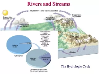
Rivers and Streams. Chapter 6.1 and 6.2. The Distribution of Earth’s Water. The Water Cycle. Water Cycle Processes. Evaporation – Liquid w ater changing into water vapor. Condensation – Water vapor turning into liquid water. Sublimation – Solid ice turning into water vapor.

E N D
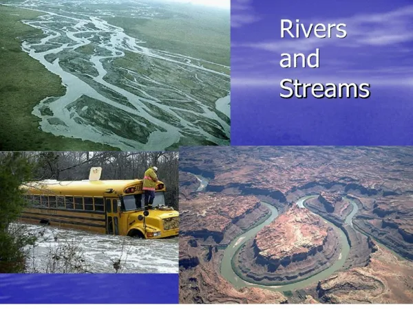
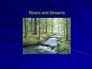
Rivers and Streams Chapter 6.1 and 6.2
Water Cycle Processes • Evaporation – Liquid water changing into water vapor. • Condensation – Water vapor turning into liquid water. • Sublimation – Solid ice turning into water vapor. • Deposition – Water vapor turning into solid ice. • Freezing/melting – Liquid water into solid ice and solid ice turning back into liquid water. • Infiltration – water seeping and penetrating into the soil to reach the aquifers (groundwater). • Transpiration – water in the ground moves through plant roots and leaves to evaporate from the plants.
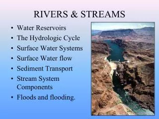
River and Stream Characteristics • Gradient – Gradient is how much a river or stream drops over a certain distance. Usually expressed as feet/per mile or meters/per kilometer. • Discharge – Discharge is how much water (volume) moves through the river in a certain amount of time. Usually expressed in cubic Feet/ per Second. • Channel Shape and Texture – The types of material, the depth of the channel and width of a channel all affect the character of a river or stream.
Stream Gradient • To calculate stream gradient, subtract the lower elevation from the upper elevation. • Divide the difference in elevation from the distance of the river. • 500 feet divided by 15 miles = 33.3 ft./mile
Stream Discharge • To find the discharge of a stream, you multiply the average depth by the average width of a stream. Then you take that number and multiply it by the velocity.
Points of Interest on a Stream • Headwaters or Source– A streams point of origin. Where it started. Sometimes from a lake or glacier. Often times streams start off as a small trickle of water that comes from a spring out of the ground. No matter where it starts, it is always at a higher elevation than anywhere else along the entire stream. • Ultimate Base Level– The end of all rivers. The lowest point to which a stream can go. SEA LEVEL. Sea level is the ultimate base level of every stream.
Points of Interest on a Stream • Temporary Base Levels– temporary base levels can be any place along a stream where the water backs up and loses energy to deposit its material. • A temporary base level could be a large lake, a man-made dam or a beaver dam. Anything that temporarily stops or obstructs the flow of water in the stream. • Tributaries – Side channels that run into the main channel. Tributaries increase the discharge of a stream. As a stream travels to the ocean, more and more tributaries flow into it to make it bigger.
How Rivers Change from the Headwaters to the Base Level • When rivers begin at their source, they have a high gradient and so the erosion is more severe. This causes a narrow v-shaped valleyto occur. • The force of gravity primarily cuts down. • As rivers get closer to their base level, they start to lose energy from gravity. Their gradient decreases dramatically. As a result the river starts to widen and the motion changes to a more side to side motion. • This forms a meandering riverin a wide floodplain.
How Rivers Change from the Headwaters to the Base Level • If a meander gets cut off from the main channel, a horseshoe-shaped lake called an oxbow can form. • The river keeps getting closer to base level. When this happens, the river loses more of its energy and begins to deposit sediment it has been carrying. • Sometimes the river becomes braided because it is choked with sediment. • At the very end of the river,the river will widen dramatically and form a pyramid or triangular shaped feature known as a delta.
Braided Rivers • Many Alaskan rivers are braided because of the high amount of silt produced from melting glaciers in the summertime.
River Deltas This is a Delta on the Kenai River Delta on the Nile River
Additional Features of Rivers • Gravel Bar or Point Bars– Usually the velocity of a stream is greatest on the outside bend of a river and least on the inside bend of a river. Where the velocity is the slowest, more deposition occurs. This is where gravel bars or point bars form. Where the velocity is the greatest, erosion and cut banks often form. • Natural Levees– When streams and rivers flood their banks, they deposit sediment along the side of the river. This accumulation of sediment forms natural levees that help contain rising flood waters.
Floods and Humans • Historically humans have always lived along rivers. Water is plentiful. The soils are rich in nutrients. The agriculture is more suitable along the floodplain. • The downside is that civilizations living on the floodplain are vulnerable to floods. • One way to prevent flood damage is by building artificial levees. However, if the floods overtop the levees (Hurricane Katrina), it can make the problem even worse than it would have been without them.
Floods and Humans • Building dams is another possible solutionto flooding. • The problem with dams is that the sediment backs up behind the dams causing flooding behind it. • Also, by removing the sediment in the stream or river, the river or stream increases its capacity to erode more sediment downstream. • Ultimately the best solution is to avoid living directly on the floodplain itself. Living on the floodplain has its benefits but it also has severe risks.
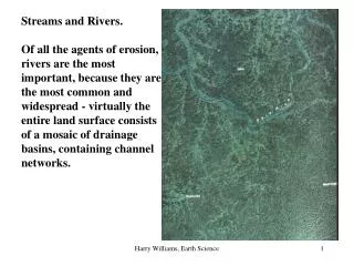
Drainage Basins • A Drainage Basin is the sum of all the area that contributes water to a major river or stream. • It includes all the tributaries, springs, rivers, streams etc. in a large area that drains into a major river.