Download
1 / 51
580 likes | 909 Views
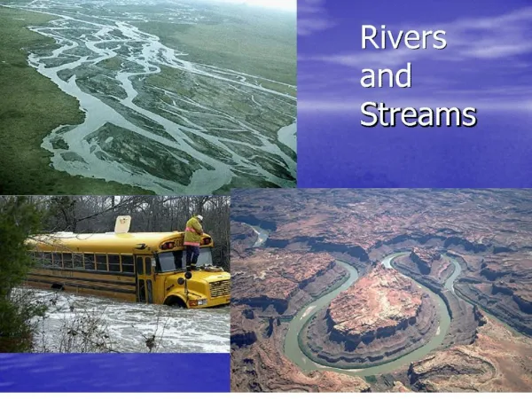
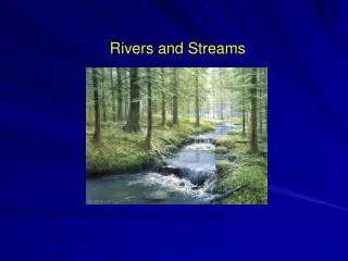
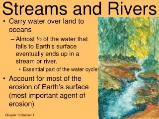
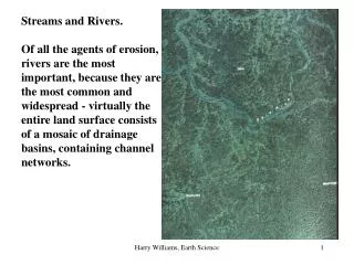
Streams and Rivers. Stream a body of water that carries rock particles and dissolved substances and flows down a slope along a defined path Channel a defined path of a stream Load the material that a stream carries Streams are vital geologic agents for various reasons

E N D
Stream • a body of water that carries rock particles and dissolved substances and flows down a slope along a defined path • Channel • a defined path of a stream • Load • the material that a stream carries • Streams are vital geologic agents for various reasons • They carry most of the water that goes from land to sea (Water Cycle) • They transport billions of tons of sediment to the ocean that will be form rock • They shape the surface of the continental crust
Most landscapes consist of stream valleys separated by higher ground and results from • Weathering • Mass wasting • Stream erosion
Erosion By Running Water • Erosion by running water occurs in two ways • Impacts as raindrops hit the ground • Sheets of water flowing over ground during heavy rains
Runoff • Runoff occurs in two ways • Overland flow • Movement of water in broad sheets • Streamflow • Flow of surface water in well-defined channels
Sheet erosion occurring when rainfall is greater than the capacity of the ground absorbing it • Raindrop splash erosion
Geometry of Steams • Discharge • quantity of water that passes a given point per unit of time • Varies both along the channel and through time • Floodplain • the part of any stream valley inundated with floods
Cross Section of a Stream • Typically rounded • Long profile • An imaginary line drawn along the surface of a stream from its source to its mouth • Velocity • Decreases toward the bed and channel wall • Velocity in long sinuous rivers is at or near the surface of mid-channel • As stream bends, the zone of highest velocity swings toward the outside of the channel
Channel Patterns • Straight channels • Rare except where landscapes is strongly influenced by joints or faults • Thalweg • Line connecting the deepest parts of the channel • Bar • Tends to accumulate on the side where the velocity is lower and thalweg is opposite • Meanders • Looplike bends that occur most commonly in channels having gentle gradients in fine-grained alluvium
Migration of Meanders • Accomplished by erosion on the outer bank of meander bends • Meander cutoffs • Form oxbow lakes as channel bypasses the loop due to encountering less erodible sediments • Braided channels • Form when water flows through two or more adjacent but interconnected channels separated by bars or islands • Stream is unable to transport all available load • As bar builds, it emerges an island stabilized by plants • Sediment may be reworked by laterally shifting channels
Dynamics of Streamflow • Factors influencing streamflow • Channel dimensions (m) • Gradient (m/km) • Average velocity (m/sec) • Discharge (m3/sec) • Load (m.t./m3)
Channels downstream • Traveling down a river from its head to its mouth the following occur • Discharge increases • Width and depth of channel increases • Velocity increases slightly • Gradient decreases
Base level • The limiting level below which a stream cannot erode the land • Ultimate base level • For most streams is the global ocean • One exception is where the floor of a tectonically downfaulted basin lies below sea level like Death Valley, California • Second exception is the basin of the Dead Sea • Local base level • Can be a lake or another stream
Artificial dams • Create a reservoir upstream (local base level) but will fill with sediment in several hundred years and will render themselves useless • A graded stream • One in which the slope has become so adjusted that the stream is just able to transport the sediment load available to it, but is highly unlikely
Large scale changes can cause a stream to adjust such as • Long-term changes in climate • Fluctuations of world sea level • Tectonic activity also cause streams to change course, become ponded, erode downward or build up their channels.
The Stream Load • Bed load • Moves by rolling or sliding or by saltation • Suspended load • Sediment carried in suspension such as clays and fine silts • This is the largest part of stream load • Dissolved load • Substances carried dissolved in water such as silica and CaCO3
Stream’s Ability to Carry Load • Determined by two factors: • Competence • The maximum size of particles it can carry • Capacity • Maximum load it can carry • Erosion occurs at its maximum during a flood • Maximum capacity and competence • Can erode and transport more sediment than it does during its normal flow
Deposition • Certain size particles will settle out at a critical settling velocity • As streamflow drops below critical settling velocity of a certain particle size, the sediment begins to settle out • This is a mechanism by which a stream separates particles according to size as velocity continues to drop. • This is called sorting. • Well-sorted material deposited by a stream is called alluvium
How Deltas Form • When a stream enters relatively still waters like an ocean or a lake, its velocity drops abruptly • Coarser sediment will settle out first to form the foreset beds. • these can be covered by thin horizontal beds the form during flood stage and are called topset beds. • The finer silts and clays will settle out some distance from the mouth into nearly horizontal layers called bottomset beds.
The main channel of the stream divides into distributaries which distribute water instead of contributing water to it like a tributary would • After numerous shifts, the delta grows into a rough triangular shape, but not always, depending on the shape of shoreline and variations in nature • Some rivers like the Mississippi River may have deltas extending over thousands of square kilometers • The Mississippi River delta is really a series of 7 coalescing subdeltas that has formed in the last 500 to 6000 years • These formed as the Mississippi River seeks a shorter route to the Gulf of Mexico
How Natural Levees Form • Natural levees are formed when successive floods deposit coarse sediment in long strips along the banks • As the water spreads out over the valley, a lesser amount of fine silt is deposited on the valley floor • This forms a gentle slope for the natural levee • Sometimes water can become trapped behind the natural levee and it cannot join the main stream forming a backswamp, a marshy area of standing water • A tributary that cannot join the main stream because of the natural levee is called a yazoo tributary. • The Yazoo River parallels the Mississippi for over 300 kilometers.
Artificial Levees • These are built along rivers to control flooding • The sediment that would otherwise have been deposited on the flood plain is dropped within the channel • Artificial levees need to be built up periodically after floods due to this deposition • However many levees are not and can fail causing massive flooding as the 1993 floods of the Midwest.
Stream Valleys • Stream valleys are divided into two general types: • Narrow V-shaped valleys • Wide valleys with flat floors • The sides of the valleys are shaped by a combination of the following • Weathering • Overland flow • Mass wasting
Narrow Valleys • Primary work of the stream is downcutting • Most prominent feature is rapids • Resistant rock cause rapids to form • Waterfalls are also prominent • Places where the stream profile makes a vertical drop
Wide Valleys • Stream has cut its channel closer to base level • Stream’s energy is directed side to side • Floodplains form as the valley floor is widened forming a wide valley • The river is confined to its channel except during flood stage when the floodplain is inundated • Two types of floodplains • Erosional floodplains that cut laterally (side to side) • Depositional floodplains which are due to a change in base level due to deposition of sediment
Meanders form when an obstacle causes the river to cut sideways causing the river to bend. • As the river meanders, point bars will form in the inside of the meander where the sand will accumulate where the velocity is slowest. This area is gently sloping • On the opposite side of the meander where the velocity is more rapid and erosion is stronger, river bluffs form and have a vertical drop
When meanders get close enough to meet, a cutoff forms and an oxbow lake will form as the meander is abandoned • Straightening a channel is done by creating artificial cutoffs as has been done to the Mississippi River by the Army Corps of Engineers to control flooding • The river will always have a tendency to meander and keeping the channel straight is very difficult because the Mississippi River will do what the Mississippi River wants!!!!
Drainage Patterns • Every stream has a drainage basin • The land area that contributes water to the stream • A divide is an imaginary line that separates two streams flowing in different directions • These can range in scale from a ridge separating two gullies on a hillside to a continental divide the splits the continent into two large river basins • The Great Continental Divide in the Rockies separates the drainage basin of the Colorado River to the Pacific from the Rio Grande River to the Gulf of Mexico
Drainage systems are networks of streams that together form distinctive patterns • Most commonly formed drainage pattern is the dendritic pattern • Looks treelike • Surface material is generally uniform in its resistance to erosion • Pattern is determined by the slope of the land
When streams diverge from a central area like spokes of a wheel the pattern is said to be radial • Typical of a volcanic cone or dome uplifts • When bedrock is criss-crossed by a series of joints or faults, it will form right angle bends forming a rectangular pattern • These structures are more easily eroded more easily than unbroken rock • The trellis pattern forms in areas that are underlain by alternate bands of resistant and less resistant rock causing it to look like a garden trellis with tributaries nearly parallel
Stages of River Development • There are four stages to river development: • Youth, maturity, old age, and rejuvenation
Youthful Stage • Downcutting • Steep gradient • Rapids and waterfalls • Straight course with no meanders • No floodplain formed • Clear water with very little sediment • V-shaped valley • Typical of mountainous areas where headwaters form from melting snow • More dissolved load than bedload or suspended load
Mature Stage • U-shaped valley • Gentler gradient • Lateral cutting • Development of a floodplain and natural levees • More bedload and suspended load carried by the stream due to lateral erosion of the banks • Meanders forming • Point bars and river bluffs forming • Tributaries may join main stream • More discharge of water and greater velocity
Old Age • Flat valley with stream no where near valley walls • Highly meandering • Oxbow lakes and meander scars (dried oxbow lakes) • Natural levees, backswamps, and yazoo tributaries • Reworks unconsolidated sediments constantly • Shifting can be very rapid
Rejuvenation • Uplift of land can cause an old river to begin downcutting again • Meanders remain and become deeper and are called entrenched meanders • May cut a new floodplain at a level below the old one as it adjusts to uplift • The remnants of the old floodplain often remain as flat surfaces called terraces.
The time required for a stream to reach any given stage depends on the following: • Erosive ability of the stream • The nature of the material through which the stream must cut • Stream’s height above stream level • Some streams may reach maturity in matter of a few hundred years • However, as in the case of the Colorado River, it has been in its youthful stage for 5 or 6 million years • Some streams may reach old age downstream while the headwaters are still in its youthful stage.
Groundwater • Water that has soaked into the ground • Underground rivers are extremely rare • Water is found between grains of soil and sediment, along faults and joints • It collects and moves through certain types of rocks • Of all the water on Earth, only 0.6 % occurs underground • The largest volume of fresh water occurs as ice second is groundwater • 94% of freshwater that is available to us that is not ice is groundwater
Why groundwater is important geologically: • Dissolves soluble rock allowing surface depressions to form as sinkholes • Creates subterranean caverns • Much of the water in rivers is not rainwater but groundwater • It is a form of storage of water during droughts
Movement of Groundwater • Much of the water that travels downward is trapped by molecular attraction to soil particles • Much of this moisture evaporates into the air • The other is used by plants • But water not held near the surface makes its way to the zone of saturation • The top of the zone of saturation is called the water table • The zone above the zone of saturation is called the zone of aeration where the spaces are filled with air through which water moves
Porosity • The amount of water that can be stored depends on the porosity of the material or its ability to hold water but with no movement • Vesicles (openings in lava from escaping gases), joints, faults, and cavities formed from solution can hold underground water • Permeability refers to the ability of the water to move through the openings in the material • If pores are so small such as in clays, the water cannot move through it, it is described as impermeable
Clays are calledaquicludesbecause they don’t allow water to move through them • Larger particles such as gravel or sand will allow water to move through them and these rocks are called aquifers • they can supply water to a number of homes, cities, wells and industries
Springs • Free-flowing water whose source is rainwater that has remained stored in the zone of saturation • When the water table intersects with the ground surface a spring occurs • A perched water table occurs when an aquiclude blocks rainwater from percolating downward to join the main water table and it becomes localized above it.
Types of Springs • Hot springs (water that is 5-6o C hotter than normal) • There are over 1000 hot springs in the U.S. alone • Temperatures increase 2o C for every 100 meters • If water circulates at great depths and rises to the surface, it rises as a hot spring • Geysers are intermittent hot springs or fountains of hot water ejected with great force at various intervals • (Old Faithful in Yellowstone National Park)
Geysers occur where there are extensive chambers within hot igneous rocks • As relatively cool groundwater enters these chambers, it is heated • Due to the pressure of the water, it is pushed upward with great force of the water expanding as it is heated • A Well is the most common method of removing groundwater by boring a hole in the rock to reach the zone of saturation • The main use of well water is for irrigation and agriculture • The water table may fluctuate with withdrawal throughout the year, especially during dry periods
Whenever water is withdrawn from a well, the water table around the well is lowered and is called drawdown • This causes a cone of depression next to the well, which can be negligible for most small domestic wells used by farmers. • But it can create problems for smaller wells when large amounts of water is used for irrigation, which can cause a wide cone of depression and cause smaller wells to go dry.
Artesian Wells • For artesian water to form, two conditions must exist: • Water must be confined to an aquifer that is inclined so that one end is exposed at the surface where it can receive water (recharge area) • Aquicludes must be found above and below the aquifer preventing the water from moving up or down • Two types of artesian wells • Nonflowing artesian well • Flowing artesian well • Hydrostatic pressure builds in the center of the aquifer and when a well is drilled to that depth, the water rushes forth without having to be pumped out.
Environmental Problems of Groundwater • It is a nonrenewable resource because it takes many years to recharge, especially if withdrawal exceeds recharge • Too many wells overdrawing water • Population growth • Land subsidence from too much water being withdrawn
Groundwater Contamination • Various sources of contamination include: • Sewage • Highway salt • Fertilizers • Pesticides • Industrial leaks from pipelines containing flammable, corrosive, explosive and toxic chemicals • Rainwater can carry these to the water table
Geologic Work of Groundwater • Dissolves rock with dissolved weak carbonic acid which forms from carbon dioxide dissolving in rainwater • Carbonic acid dissolves limestone formations causing caverns to form • There are over 17,000 caves in the U.S. alone. • Stalactites form in the ceiling of caves from dripping water saturated with calcium carbonate precipitating out of solution • Stalagmites form on the floor of caves where the calcium carbonate precipitates out of the water falling from the ceiling
Most caves and caverns form below the water table. • When there is uplift and the water table is lowered, the water drains out leaving the huge caverns for stalactites and stalagmites to form • A live cave is where there is water dripping. • A dead cave is completely dry and no more caverns deposits are forming