Download
1 / 1
10 likes | 13 Views
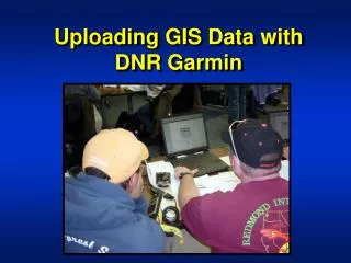
GIS (geographic information system), a specialized type of mapping technology that allows you to layer data from geographical points. Instead of looking at some of the important features on static maps. GIS mapping allows you to view customization of data layers in dynamic equipment.

E N D
Discovery of Data with GIS Services When you think of a map, it may seem to think of the map or the atlas used in your school days, but today's GIS maps are far beyond the previous years of static maps. GIS (geographic information system), a specialized type of mapping technology that allows you to layer data from geographical points. Instead of looking at some of the important features on static maps. GIS mapping allows you to view customization of data layers in dynamic equipment. GIS MAPPING SERVICES The GIS mapping services creates a much wider and complex GIS map from the given data, used with satellite imagery and fixed vector data so that each inch of the land is uniquely identified. We create, store, and manage the detailed GIS maps in respect of international standards so that you can confirm accurate solutions to address the difficult challenges of your project. Geographical suggestions are many useful benefits of services: As a geographic map company, we gather, organize, and analyze geographical data of the location of a particular geographical location and present them as dynamic maps. GIS MAPPING SOFTWARE:- GIS Mapping software helps you to analyze and represent geographical information maps and other graphic displays for analysis of geographical information. A GIS with these capabilities is an important tool for creating a decision support system for viewing spatial data or for use in its organization. For example, geographical information systems store information using local indices to make it possible to identify features of the map in one - way area. In addition to the above-mentioned capabilities, a mapping applies a relational database of business capacities, which is a key feature for GIS software. Attribute data can be freely linked and separated from geographical layers and tables. Relational data manipulation, spatial queries, polygonal overlays, and other location-based analysis is integrated with powerful and powerful earth resources. It is supported so that data can easily be transferred from the related tables to geographical databases. Besides, the binomial table on the map supports 32,767 feeds and 1 billion records and has an unlimited width of the character field.