Download
1 / 31
330 likes | 525 Views
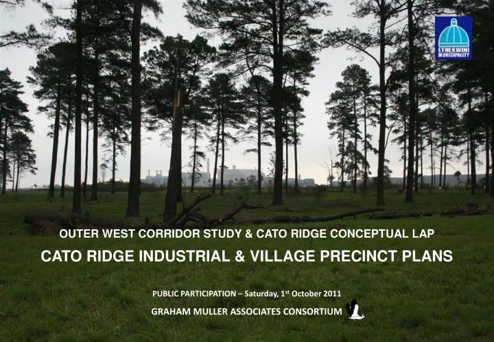
OUTER WEST CORRIDOR STUDY & CATO RIDGE CONCEPTUAL LAP CATO RIDGE INDUSTRIAL & VILLAGE PRECINCT PLANS PUBLIC PARTICIPATION – Saturday, 1 st October 2011 GRAHAM MULLER ASSOCIATES CONSORTIUM . INTRODUCTION. STRUCTURE OF PRESENTATION Introduction and Context Transport & Traffic

E N D
OUTER WEST CORRIDOR STUDY & CATO RIDGE CONCEPTUAL LAP CATO RIDGE INDUSTRIAL & VILLAGE PRECINCT PLANS PUBLIC PARTICIPATION – Saturday, 1st October 2011 GRAHAM MULLER ASSOCIATES CONSORTIUM
STRUCTURE OF PRESENTATION • Introduction and Context • Transport & Traffic • Bulk Infrastructure • Infrastructure Plan • Cato Ridge LAP & Industrial & Village Precinct Plans • INTRODUCTION
NATIONAL & PROVINCIAL CONTEXT • Need to create jobs and facilitate employment for neighbouring communities • Implications of growing cargo volumes and port expansion: • Back of Port area – serious pressures (new roads, railways and truck routes) and space (logistics); • “Overflow” out of South Durban Basin must be accommodated somewhere: • Both port related and non-port related businesses; • Proposed truck freight road through Umhlatuzana Valley planned to link with N3 somewhere near Cato Ridge; • Hence the possibility of establishing an inland inter-modal container terminal at Cato Ridge is under consideration.
REGIONAL CONTEXT • Cato Ridge and the Outer West Corridor are strategically located on the N3 national route between eThekwini Municipality and Mkhambathini Municipality and close to Pietermaritzburg. • Cato Ridge offers potential space for industry and logistics and benefits uniquely from its positioning astride both the N3 national route and the NATCOR railway line. • The area could respond to increasing demand for industrial land in eThekwini Municipality and serve to better integrate the economies of eThekwini, Mkhambathini and Msunduzi Municipalities
METROPOLITAN CONTEXT • High demand for industrial and commercial land in and around Durban for the foreseeable future; • Demand will increase dramatically when the next big wave of Transnet port expansion takes place in eThekwini Municipality (2020); • More industrial land will be demanded by container related companies needing extra space for empty containers, storage, packing and unpacking of containers (approx. 687 ha extra by 2038); • This would mean further displacement of industries traditionally located in the South Durban Basin and expanding container related activities seeking additional industrial land accessible to key transport routes.
METROPOLITAN CONTEXT • The Outer West Corridor offers significant opportunities for meeting anticipated future land demand for both industrial activates and logistics activities at: • Shongweni; • Bartlett Estate; • Hammarsdale; • Cato Ridge and Harrison Flats. • The study area includes part of the Umgeni River Catchment – the source of most of Durban’s potable water supply
NEIGHBOURING DEVELOPMENT CONTEXT • Western suburbs north of N3 accommodating middle to upper income accommodation are growing rapidly • Areas further north comprise largely traditional rural settlements located in severely fragmented topography, • The area exhibits substantial tourism and recreational potential, • Mpumalanga township south of the N3 requires expansion and upgrading, • Revitalisation and growth of the Hammarsdale industrial area is anticipated, • The Shongweni node around the N3 and M4 intersections is expected to be developed further • Revitalisation and growth of the Cato Ridge industrial area is already evident • Areas south of Shongweni and Mpumalanga consist of traditional rural settlements • Valuable agricultural activities exist along the N3 and are expected to remain in place • The area accommodates substantial and key environmental resources • Development constraints include the limited capacity of the Hillcrest waste water treatment works, the need for additional waste water treatment capacity at Cato Ridge and the need for a additional N3 interchange and poor accessibility to development land at Cato Ridge.
LIMITATIONS OF THE PLAN • This is a twenty year set of plans • The plans do not taken into account the impact of a possible truck freight route, as this is a recent development and the route is not finalised • The inter-modal hub remains a possibility as Transnet Freight Rail has not finally resolved whether a new rail line will be developed between Gauteng & the Port of Durban • INTRODUCTION
The study team assessed the suitability of three industrial areas additional to the planned industrial zonings in Cato Ridge • The additional areas were originally excluded due to environmental & social concerns, as well as roads & sewer infrastructure implications & costs. These areas are sub-optimal for industrial development. • Road & bulk infrastructure constraints in Cato Ridge restrict the maximum extent of industrial development possible, • Therefore if land owners wish to develop land in these additional industrial areas the landowners must accept full financial responsibility for: • The road, sewer, electricity & water infrastructure required to access and service these developments • The purchase and cancellation of industrial zoning rights in an equivalent area of land within the planned industrial zones in the study area Landfill Site Possible additional industrial areas Intermodal Hub & supporting logistics Natcor Railway • INTRODUCTION
NEIGHBOURING AREAS • Planning of Cato Ridge has also taken into account various proposals within the broader outer west corridor, notably: • a new town centre & associated residential commercial facilities at Shongweni; • a new town centre & civic infrastructure at Mpumalanga; • new light & service industry park at Bartlett Estate (near Hammarsdale). • The existence of a nearby service centre at Camperdown in a neighbouring municipality. • INTRODUCTION
PROJECT COMPOSITION Overarching Strategic Assessment Conceptual Cato Ridge LAP Outer West Corridor Study Industrial Precinct Plan Village Precinct Plan Infrastructure Plan
KEY ECONOMIC OPPORTUNITIES KEY ECONOMIC CONSTRAINTS • Employment creation and education opportunites for the nearby communities KwaXimba, Fredville & south across the valley at Mpumalanga; • Provision of land for development which, at a metropolitan scale, is required in the long term for • Large manufacturers; • Service & light industry; • Logistics & distribution. • The Cato Ridge area presents large areas of topographically suitable land, much of it currently zoned “industrial” and the only immediate opportunities to release significant amounts of industrial land with site sizes in excess of 5,000 m2; • The possibility to exploit the national road & rail routes that intersect in the area. • The study area serves as a gateway to the Valley of 1000 Hills, the Msini resort at Nagle Dam & hosts existing successful tourism & recreational businesses in the Craiglea area. • Inadequate existing road capacity to support meaningful development at Cato Ridge in the medium to long term; • Inadequate existing bulk infrastructure (particularly waste water treatment & electricity) to support any meaningful development in Cato Ridge; • Large land owners (historically speaking) not releasing their land for sale to 3rd party private developers; • Acute environmental concerns with respect to bio-diversity, critical habitats & water catchments that must be balanced against any form of development. • Need to preserve & support tourism and recreational service development which has the potential to employ large numbers of unskilled people from surrounding communities. • SOCIO-ECONOMIC CONSTRAINTS & OPPORTUNITIES
BIODIVERSITY ASSESSMENT • Objectives: • Ensure that habitats supporting biodiversity, particularly rare & endangered species, are identified; • Identify biodiversity corridors; • Ensure that riverine areas are identified in order to be protected - 30m buffer ; • Produce a biodiversity sensitivity map indicating areas of biodiversity significance. • Divided into the following habitat conditioning categories: • Good– natural habitats that contain valuable biodiversity features, including Red Listed species. • Degraded– natural habitats that have been disturbed by various impacts, such as over grazing, erosion, poor burning regimes, alien plant infestations, etc. • Transformed – areas that are already developed. ENVIRONMENTAL ANALYSIS
INFRASTRUCTURE CONSTRAINTS • Umgeni Catchment Watershed Ridge Line • Slopes steeper than 1 : 3 • Rivers and Flood Lines • Environmental Value • Sewer 1 – Requires pumping • Sewer 2 – Requires pumping and is also north of the ridge line • Sewer 3 – Gravity type 0 but north of ridge line Sewer 2 Sewer 3 Sewer 2 Sewer 1 Sewer 1 INFRASTRUCTURE PLAN
PROPOSED BULK INFRASTRUCTURE • Sewer Pump Stations • Sewer Gravity systems • Storm water systems and attenuation devises • Water networks INFRASTRUCTURE PLAN
PROPOSED ELECTRICAL INFRASTRUCTURE • Establish a 400/132kV Switching Station at Assmang (long term) • Establish a Trelawney & Harrison Flats 132/11kV 2x40MVA Switching Station • Establish a Nagle Dam 132kV 2x20MVA Switching Station • Construct a 132kV Kingbird line from the Abattoir to Nagle Dam • Construct a DC 132kV Kingbird line from Trelawney to Harrison Flats • Turn-in the existing 132kV Georgedale to Msunduzi lines INFRASTRUCTURE PLAN
ROAD INFRASTRUCTURE – PROPOSED AREAS Anticipated new road infrastructure and road improvements for the area are shown on the map. Traffic impact assessments will be undertaken at the development application stage where the detailed and specific improvements required will be assessed on a case by case basis. • TRANSPORT
ROAD INFRASTRUCTURE – PROPOSED AREAS Anticipated new road infrastructure and road improvements for the area are shown on the map. Traffic impact assessments will be undertaken at the development application stage where the detailed and specific improvements required will be assessed on a case by case basis. • TRANSPORT
ROAD INFRASTRUCTURE – PROPOSED AREAS Anticipated new road infrastructure and road improvements for the area are shown on the map. Traffic impact assessments will be undertaken at the development application stage where the detailed and specific improvements required will be assessed on a case by case basis. • TRANSPORT
ROAD INFRASTRUCTURE – PROPOSED AREAS Anticipated new road infrastructure and road improvements for the area are shown on the map. Traffic impact assessments will be undertaken at the development application stage where the detailed and specific improvements required will be assessed on a case by case basis. • TRANSPORT
ROAD INFRASTRUCTURE – PROPOSED AREAS Anticipated new road infrastructure and road improvements for the area are shown on the map. Traffic impact assessments will be undertaken at the development application stage where the detailed and specific improvements required will be assessed on a case by case basis. • TRANSPORT
GI GENERAL INDUSTRIAL SI SERVICE INDUSTRY LI LIGHT INDUSTRY T TOURISM R RESIDENTIAL RURAL R RURAL RESIDENTIAL MX MIXED USE RR RIVER RESERVE POS PUBLIC OPEN SPACE INST INSTITUTIONAL (BULKS) AGRI AGRICULTURE PFS FUEL SERVICE STATION CONS CONSERVATION PRIVOS PRIVATE OPEN SPACE RURAL R T GI2 RURAL R POS/CONS GI2 POS/CONS RURAL R MX3 MX3 INST RURAL R RR GI2 GI2 POS/CONS RR RR POS/CONS MX3 PFS GI2 POS/CONS MX1 GI2 SI2 GI2 Si1 Si1 LI4 GI2 SR900 SR900 LI4 LI4 LI4 GI2 SI1 CATO RIDDGE VILLAGE LI4 RR PFS AGRI 1 PRIVOS PFS LI4 AGRI 1 AGRI 1 INST LAND USE MANAGEMENT PLAN INDUSTRIAL PRECINCT • CATO RIDGE LOCAL AREA PLAN & PRECINCT PLANS
SR900 SPECIAL RESIDENTIAL SR200 MEDIUM DENSITY HOUSING MX1 MIXED USE 1 MX3 MIXED USE 3 PFS PETROL FILLING STATION E EDUCATION POS PUBLIC OPEN SPACE PRIV OS PRIVATE OPEN SPACE AOS ACTIVE OPEN SPACE A1 AGRICULTURE 1 RR RIVER RESERVE INST INSTITUTIONAL TS TRUCK STOP MX3 POS SR200 MX1 RR TS SR200 PFS SR900 SR900 MX1 SR900 E SR200 INST RR SR900 SR200 POS PRIV OS AOS SR900 E RR A1 A1 LAND USE MANAGEMENT PLAN VILLAGE PRECINCT • CATO RIDGE LOCAL AREA PLAN & PRECINCT PLANS
Thank you! Detailed plans will be available for scrutiny at the following venues from Tuesday 4th October 2011: Cato Ridge Library Hillcrest Municipal Offices KwaXimba Community Centre Michael Gwala Community Hall, Fredville
Comments emailed to: • graham@grahammuller.co.za • RamloutanA@durban.gov.za Copies of the documents are available at: • Cato Ridge Library • KwaXimba Community Hall • Michael Gwala Community Hall • Hillcrest Municipal Offices OR • ftp://ftp.durban.gov.za/arch/OutGoing/Framework Planning/ • Deadline: 23rd October 2011