Download
1 / 48
480 likes | 544 Views
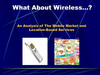
Location-Based Services An introduction to technological and market challenges. By Adam Battson & Zhong Zhao SIE510, UMaine, Orono Adam.battson@maine.edu Zzhao@spatial.maine.edu 10 February 2004 (A talk lasting ~40 minutes). Overview of Presentation. Intro.

E N D
Location-Based ServicesAn introduction to technological and market challenges By Adam Battson & Zhong Zhao SIE510, UMaine, Orono Adam.battson@maine.edu Zzhao@spatial.maine.edu 10 February 2004 (A talk lasting ~40 minutes)
Overview of Presentation Intro 1. Motivations for Location-Based Services 2. System Architectures (what’s the GIS bit do?) 3. Spatial Data Requirements & DBMS 4. Interoperability and Standards 5. Market Issues: Trends and challenges 6. Conclusions Some Demos (to keep you interested!) LBS Objectives Architecture Spatial Data Interoperability Market Issues Conclusions Adam Battson & Zhong Zhou, Feb 2004
References Intro “Location-Based Services : Technical and Business Issues” By Dao D., Rizos C & Wang J (2003), Univ. Sydney, Australia http://plan.geomatics.ucalgary.ca/papers/DiepDao.pdf “Assessing the Impact of Location-Based Services” By Bharat Rao & Louis Minakakis (2004) http://csdl.computer.org/comp/proceedings/hicss/2004/2056/03/205630078c.pdf “WhereWare” (Available electronically via Library) By Pfeiffer E. & Johnstone B., Technology Review(106/7), Sep2003 OpenGIS Location Services Specification www.OpenGIS.org LBS Objectives Architecture Spatial Data Interoperability Market Issues Conclusions
References Intro “Wireless Location Privacy Study” By Driscoll-Wolfe Marketing & Research Consulting (2001) http://www.driscoll-wolfe.com/wireless/w_locationbased.htm “Location Privacy Protection Act of 2001” By Sen. John Edwards (2001) http://www.techlawjournal.com/cong107/privacy/location/s1164is.asp “Wireless Privacy Protection Act of 2003” By Mr. FRELINGHUYSEN2003 http://www.theorator.com/bills108/hr71.html “Mobile systems: an overview” By Ericsson Radio Systems AB http://www.artes.uu.se/events/summer00/ericsson-mobiile-systems.pdf LBS Objectives Architecture Spatial Data Interoperability Market Issues Conclusions
What are LBS anyway?What they’re for… Intro LBS Objectives • A.K.A. “WhereWare” or “L-services” • The provision of targeted, relevant, timely and engaging mobile information exchange and assistance. • Government: FCC E-911 Assistance. Location 100m (67% time) ; 300m (95% time); UK $35bn Licenses. • Revenue: ‘Concierge Services’. Users’ locations, profiles leveraged as “inherent consumption contexts”, alerting them to unforeseen (spending) opportunities. • Efficiency: Business/work tracking people & assets. Architecture Spatial Data Interoperability Market Issues Conclusions
Comparison with other GIS domains Intro LBS Objectives • The technology, products and markets remain speculative and immature – not yet ‘an industry’. • GIS are components in demandingly complex, integrated systems of LBS h/ware and software. • Geog Info services ‘for the masses’: Potentially massive revenues and cultural impact. • Integration and Interoperability are vital issues. Architecture Spatial Data Interoperability Market Issues Conclusions
What are LBS anyway?3. Underlying technologies… Intro LBS Objectives • LBS are built upon integrated systems involving: • Wireless communications • Positioning technologies • Spatial databases and GIS • Non-spatial databases User Profiles, Services, Billing Architecture Spatial Data Interoperability Market Issues Conclusions
Mobile Comms SystemsData Architecture 1 Intro LBS Objectives HLR VLR Architecture Spatial Data Multiplexing Protocols SMS Interoperability IS-41 GSM GPRS (US) (Eur/Aus) Market Issues Internet(~60Kbps) Conclusions
Mobile Comms SystemsData Architecture 2 Intro LBS Objectives Architecture Spatial Data Interoperability Market Issues Conclusions
LBS System Architecture Intro LBS Objectives Architecture Spatial Data Interoperability Market Issues Conclusions
LBS Positioning Technologies Intro • GPS Uses 24 military satellites, +/-3ns clocks Good Reliable, accurate, resolution <10m Bad Slow start, urban signal attenuation, battery life • A-GPS Assisted GPS + WAN &/or Bluetooth Urban use, no slow start. Complex tracking & billing? Privacy? • Non-GPS Mobile network location methods ‘Cell of Origin’ (CoO) Simple, but imprecise & coarse-grained ‘Time of Arrival’ (ToA) Triangulation. Accurate to +/- >100m. ‘Angle of Arrival’ (AoA) Triangulation. Accurate to +/- >100m. • BSN Broadband Satellite Network. 280 satellites using I.P. (Internet Protocol). Complex. ‘Iridium’ used this and went bust! LBS Objectives Architecture Spatial Data Interoperability Market Issues Conclusions
LBS Positioning Technologies Intro LBS Objectives Architecture Spatial Data Interoperability Market Issues Conclusions
LBS Positioning Technologies Intro • GPS Uses 24 military satellites, +/-3ns clocks Good Reliable, accurate, resolution <10m Bad Slow start, urban signal attenuation, battery life • A-GPS Assisted GPS + WAN &/or Bluetooth Urban use, no slow start. Complex tracking & billing? Privacy? • Non-GPS Mobile network location methods ‘Cell of Origin’ (CoO) Simple, but imprecise & coarse-grained ‘Time of Arrival’ (ToA) Triangulation. Accurate to +/- >100m. ‘Angle of Arrival’ (AoA) Triangulation. Accurate to +/- >100m. • BSN Broadband Satellite Network. 280 satellites using I.P. (Internet Protocol). Complex. ‘Iridium’ used this and went bust! LBS Objectives Architecture Spatial Data Interoperability Market Issues Conclusions
LBS System Architecture Intro LBS Objectives Architecture Spatial Data Interoperability Market Issues Conclusions
Intro LBS Objectives Architecture Yubee.com Before Zhong, a Demo! Spatial Data Interoperability Market Issues Conclusions
Spatial DataRequirements & DBMS Intro LBS Objectives • One of the essential parts in location based services. • Ways to deal with spatial data • Geographic Information System – GIS • Database Management Systems - DBMS Architecture Spatial Data Interoperability Market Issues Conclusions
Spatial Data - GIS Intro LBS Objectives • Computer-based capability to manipulate spatial / geographic data. • Acquisition, compilation, storage, update, management, retrieval, presentation and analysis of data • Geo-referencing (coordinate information) • Format in vector or raster • Spatial objects have common characteristics location, form, attributes and relationship with other objects. Architecture Spatial Data Interoperability Market Issues Conclusions
Spatial Data - DBMS Intro LBS Objectives • Relational Database Management Systems – RDBMS • Easy to store simple data types, e.g. characters and numbers. • Difficult to deal with complex spatial objects. • Object Relational Database Management Systems – ORDBMS • Storage of complex data, e.g. objects. • Management of relationships between objects. • User-defined data types, user-defined functions Architecture Spatial Data Interoperability Market Issues Conclusions
Spatial Data – ADT, SQL Intro LBS Objectives • Abstract Data Types – ADT • Hidden data structure • A set of operations (interface) • Access only through the interface. Separation of data structures and operations • Programming language independent • Classes in object-oriented programming • Structured Query Language - SQL • Standard interactive and programming language • Used for database operations, spatial analyses Encapsulation Architecture Spatial Data Interoperability Market Issues Conclusions
Spatial Data – LBS Requirements Intro LBS Objectives • GIS • Not many complex spatial analyses • Basically geometric functions • Possibly different representation of results • DBMS • LBS quality depends on the nature, completeness and accuracy of the database content • Maps and related features Architecture Spatial Data Interoperability Market Issues Conclusions
Spatial Data – Commercial DBMS Intro LBS Objectives • Oracle 8 Spatial Catridge • Manipulation of geometric objects through ADT • LBS developers include AirFlash, AutoDesk, CellPoint, GeoTouch, IntelliWhere, Webraska and Xmarc. Architecture Spatial Data Interoperability Market Issues Conclusions
Interoperability and Standards Intro LBS Objectives • Positioning technologies • Mobile telecommunications • Location Interoperability Forum (LIF) • Open Mobile Alliance (OMA) • OGC Open Location Services (OpenLS) Architecture Spatial Data Interoperability Market Issues Conclusions
Mobile Telecommunications -History Intro LBS Objectives Architecture Spatial Data Interoperability Market Issues Conclusions
Mobile Telecommunications2G / 2.5G Systems Intro LBS Objectives • 2G Systems • GSM – Global System for Mobile Communications • TDMA/IS-136 – Time Division Multiple Access Also D-AMPS - Digital Advanced Mobile Phone System • CDMA/IS-95 (cdmaOne) - Code Division Multiple Access • PDC – Personal/Pacific Digital Cellular • 2.5G Systems • GPRS - General Packet Radio Services. Up to 171.2 Kbps. • EDGE - Enhanced Data Rates for GSM Evolution. Up to 384 Kbps. Also known as EGPRS – Enhanced GPRS • CDMA2000 1X. Up to 307Kbps Architecture Spatial Data Interoperability Market Issues Conclusions
Mobile Telecommunications2G / 2.5G Services Intro LBS Objectives • SMS – Short Message Service • Text messages consisting of words and numbers with limited size. • Mobile mapping in text format, e.g. turn-by-turn directions. • GPRS - General Packet Radio Services • Enhanced SMS • Internet Enabled • Higher Speed • Wireless/Mobile Internet • Incompatible Mobile systems • Handset restricted in interface, CPU power and memory; network with limited bandwidth, longer latency and lower reliability • Need of WAP – Wireless Application Protocol and WML – Wireless Markup Language – designed for limited-bandwidth Architecture Spatial Data Interoperability Market Issues Conclusions
Mobile TelecommunicationsWAP Architecture and Model Intro LBS Objectives Architecture Spatial Data Interoperability Market Issues Conclusions
Mobile Telecommunications3G Technology Intro LBS Objectives • Helps bring together the mobile communications and the wireless Internet industries • High-speed Internet access, data, video and CD-quality music • A single global standard not to be achieved soon. There will remain to be a multi-band and multi-mode world. • New handsets to support multiple technologies / frequencies Architecture Spatial Data Interoperability Market Issues Conclusions
Mobile Telecommunications3G Standard - IMT-2000 Intro LBS Objectives • A single family of compatible standards for 3G systems: • Used worldwide • Used for all mobile applications • Packet-switched (PS) + circuit-switched (CS) data transmission • Up to 2 Mbps of transmission rate • High spectrum efficiency • Most important proposals out of 17: • UMTS (W-CDMA) • CDMA20001xEV-DO, 1xEV-DV • TD–SCDMA - Time Division–Synchronous CDMA Architecture Spatial Data Interoperability Market Issues Conclusions
Mobile TelecommunicationsFuture - 4G Networks Intro LBS Objectives • Characteristics: • All IP-based network • High Speed – more than 100Mbps in stationary mode, an average of 20Mbps when travelling. • Access through a collection of radio interfaces (HIPERLAN, WLAN, Bluetooth, GPRS) • Global seamless roaming / handover across multiple wireless and mobile networks • Always connected to the best network • One bill with reduced total access cost • Architecture: • Personal Area Networking (e.g. Bluetooth) • Local high-speed access points on the network including wireless LAN technologies • Cellular Connectivity Architecture Spatial Data Interoperability Market Issues Conclusions
Location Interoperability Forum - LIF Intro LBS Objectives • Founded in October 2000 by Ericsson, Motorola and Nokia • Global interoperability between mobile positioning systems. • Common and ubiquitous location service solutions • Now a part of the Open Mobile Alliance (OMA) Architecture Spatial Data Interoperability Market Issues Conclusions
Open Mobile Alliance - OMA Intro LBS Objectives • Formed in June 2002 by nearly 200 companies. • Service interoperability across devices, geographies, service providers, operators, and networks • Consolidation of • WAP Forum • Location Interoperability Forum (LIF) • SyncML Initiative • MMS-IOP (Multimedia Messaging Interoperability Process) • Wireless Village • Mobile Gaming Interoperability Forum (MGIF) • Mobile Wireless Internet Forum (MWIF). Architecture Spatial Data Interoperability Market Issues Conclusions
Intro LBS Objectives Architecture Spatial Data Interoperability Market Issues Conclusions
OpenGIS Location Services – OpenLS: Core Services, Parts 1-5 Intro LBS Objectives • An open platform for location-based application services, also referred to as GeoMobility Server (GMS). • Primary objective To define access to the Core Services and Abstract Data Types (ADT) that comprise the GeoMobility Server. Architecture Spatial Data Interoperability Market Issues Conclusions
Intro LBS Objectives Architecture Spatial Data Interoperability Market Issues Conclusions
Intro LBS Objectives Architecture Spatial Data Interoperability Market Issues Conclusions
GeoMobility Server Intro LBS Objectives • Core Services and their OpenLS interfaces • OpenLS Information Model, consisting of ADTs • Possibly, a set of local applications build upon the Core Services and accessing them through OpenLS interfaces • Content such as map data, points of interest, routes, and so on used by the Core Services. Can also be hosted on other servers and accessed through the Internet • Possibly other supporting functions for personalization, context management, billing, logging, etc. Architecture Spatial Data Interoperability Market Issues Conclusions
OpenLS - Core Services Intro LBS Objectives Architecture Spatial Data Interoperability Market Issues Conclusions
OpenLS - Information Model Intro LBS Objectives • ADT - Abstract Data Types Position ADT Address ADT Location ADT Map ADT Point of Interest (POI) ADT Area of Interest (POI) ADT Route Summary ADT Route Geometry ADT Route Maneuvers ADT Route Directions ADT Architecture Spatial Data Interoperability Market Issues Conclusions
OpenLS - A Use Case Intro • A subscriber wants to access a list of restaurants nearby its location. He/she does not have any positioning capabilities on his/her device. The position is provided by network elements (GMLC/MPC). LBS Objectives Architecture Spatial Data Interoperability Market Issues Conclusions
Billing Intro LBS Objectives • Location based / sensitive billing • One of Location Based Services • User defined zones for preferential billing, e.g. flat rate calling in home zone and special rates in other areas. • Useful when used in conjunction with other mobile applications such as prepaid wireless service. • Other options: • Content based billing • Real time rating • Converged billing • Functionality related to interoperability Architecture Spatial Data Interoperability Market Issues Conclusions
Privacy - Problems Intro LBS Objectives • Customers may be known within 100m of their locations • Their “tracks” can be recorded and analyzed • Potential threats to personal security • Use of personal location information for commercial purposes and legal actions Architecture Spatial Data Interoperability Market Issues Conclusions
Privacy – Possible Solutions Intro • For LBS carriers: • Be aware of the importance of customers’ location privacy • Be able to distinguish customers who want LBS and those who do not • No forwarding of customer’s location information without authorization • Legal issues: • Location Privacy Protection Act of 2001 By Sen. John Edwards (2001) • Wireless Privacy Protection Act of 2003 By Mr. FRELINGHUYSEN (2003) LBS Objectives Architecture Spatial Data Interoperability Market Issues Conclusions
Interoperability - Summary Intro LBS Objectives • Global mobile telecommunications interoperability not to be achieved until the implementation of 4G technology. • Major companies integrate specification activities into the Open Mobile Alliance. • Open GIS Consortium promotes global interoperation of geoprocessing technology. • OGC OpenLS provides GeoMobility Server, an open platform for location-based application services. Architecture Spatial Data Interoperability Market Issues Conclusions
LBS Market Issues Intro • So far: Technology => how LBS deliver. • Now: Market Issues => why and what information consumers might pay for. • LBS Problems: Regulatory E911 ‘push’ Imprecise urban location Limited bandwidth, slow response Small screens, fiddly interfaces Complex interoperability vital Speculative markets Elusive ‘Killer App’ High costs & risk • Driscoll-Wolfe (Market Research ’02?) 20,000 homes Average 1 or 2 LBS-type queries likely per month LBS Objectives Architecture Spatial Data Interoperability Market Issues Conclusions
Predicted Markets Intro LBS Objectives • Numbers of Subscribers US:150K, 2002 42million, 2005 (Gartner 2003) Globally, by 2006, ~680million (Rao & Minakakis 2004) • RevenuesUS:$6million, 2002 $828million, 2005 (Gartner 2003) Europe: $32billion by 2005 (Strategis Group, 2000) • GIS by comparisonhttp://www.directionsmag.com/article.php?article_id=403 Architecture Spatial Data Interoperability Market Issues Conclusions
“Location, location, location!” Intro Context, context, context! LBS Objectives • Vendors need more than where customers are. They also need why they’re there & what their preferences are. • =>Additional complexity: Roaming profiles & histories! • Inaccuracies and irrelevant info will irritate users • Cultural factors affect local requirements • Innovative new business models vital (cf. ‘Click-Thru’) • “Business models must sufficiently address and enhance the customer experience, whilst carefully managing costs” • E.g. Workplace LBS “A quiet revolution” Demo!http://imgs.intergraph.com/freebies/demos.asp Architecture Spatial Data Interoperability Market Issues Conclusions
LBS Employment Intro LBS Objectives E.g. Current Vacancy: ‘Mapflow.com’, Dublinhttp://www.mapflow.com/html/joblisting.htm Architecture Spatial Data Something further afield? http://news.bbc.co.uk/1/hi/sci/tech/3473139.stm Interoperability Market Issues Conclusions
Summary Conclusions Intro • Location-Based Services remain immature, but barely. Driven by regulatory requirements, which must be now paid for. • GIS technologies are critical components of LBS. • Highly complex LBS architectures demand multiple system standards, to achieve vital interoperability. • LBS => ‘GIS for the masses’, with potentially enormous financial & cultural ramifications. • Risky & speculative markets present new opportunities for highly innovative business models. • ‘I.T.-savvy’ SIE Alumni may prosper in LBS! LBS Objectives Architecture Spatial Data Interoperability Market Issues Conclusions